
Inverness Highlands North is an unincorporated area and census-designated place (CDP) in Citrus County, Florida, United States. The population was 2,401 at the 2010 census, up from 1,470 in 2000.

Ferry Pass is a census-designated place (CDP) in Escambia County, Florida. It is a community in Pensacola, and is located north of Pensacola City Limits. As of the 2010 United States Census, the population was 28,921. The University of West Florida, located in Ferry Pass, is the only university located in the Pensacola Metropolitan Area.
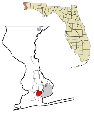
West Pensacola is a census-designated place (CDP) in Escambia County, Florida, United States. The population was 21,339 at the 2010 census. It is part of the Pensacola–Ferry Pass–Brent Metropolitan Statistical Area. The CDP area includes the community of Brownsville.

Spring Hill is a census-designated place (CDP) in Hernando County, Florida, United States. The population was 113,568 at the 2020 census, up from 98,621 at the 2010 census. Spring Hill belongs to Florida's Nature Coast region and is in the Tampa-St. Petersburg-Clearwater metro area. It is east of Hernando Beach, southwest of Brooksville, and north of Tampa.

Northdale is an unincorporated census-designated place in Hillsborough County, Florida, United States. Northdale was named by the combination of the words in North Dale Mabry, the main highway through the Northdale area. The population was 22,079 at the 2010 census.

Pebble Creek is a census-designated place (CDP) in Hillsborough County, Florida, United States. The population was 9,624 at the 2020 census, up from 7,622 at the 2010 census. Pebble Creek is located in the unincorporated portion of New Tampa, and is primarily a residential zone.

Town 'n' Country is a census-designated place (CDP) in Hillsborough County, Florida, United States. The population was 85,951 at the 2020 census.

University is an unincorporated census-designated place in Hillsborough County, Florida, United States. The population was 41,163 at the 2010 census, up from 30,736 at the 2000 census. The University of South Florida is located just southeast of the community, within the Tampa city limits. The community is also known as "University West", mainly due to its location in relation to the university. The community is often notoriously referred to by locals as "Suitcase City" due to the high rate of transients.

Leisure City is an unincorporated community and census-designated place (CDP) in Miami-Dade County, Florida, United States, that includes the smaller, older community of Modello in its northwestern section. The population was 26,324 at the 2020 census, up from 22,655 in 2010. It is most notable for the Coral Castle Museum, located in the Modello area.

Naranja is an unincorporated community and census-designated place (CDP) in Miami-Dade County, Florida, United States. Many orange groves were once located in this area, so the community name came from the Spanish word for orange, naranja, though the pronunciation among the local residents is "Na-Ran-Jah". Naranja was also a stop for the Florida East Coast Railroad that once ran through this area. The population was 13,509 at the 2020 census, up from 8,303 in 2010.

Princeton is a census-designated place (CDP) and unincorporated community in Miami-Dade County, Florida, United States. The population was 39,208 at the 2020 census, up from 22,038 at the 2010 census.

Richmond West is a census-designated place (CDP) in Miami-Dade County, Florida, United States. The population was 35,884 at the 2020 census, up from 31,973 at the 2010 census.

Trinity is a census-designated place (CDP) in Pasco County, Florida, United States. The population was 10,907 in 2010, according to the most recent census. The Trinity Community is named after Trinity College of Florida, a Bible college founded in 1932, when it relocated to the first occupied site in the communities developed by James Gills in the late 1980s. The main plaza is found near the high school, known as Mitchell Ranch Plaza. Trinity is located at the junction where Pasco, Hillsborough and Pinellas Counties meet. The community of Longleaf is located in Trinity and it is believed that the “Welcome Plank” originated in Longleaf.

East Lake is a census-designated place (CDP) in Pinellas County, Florida, United States. The population was 30,962 at the 2010 census. It was one of the last areas in the densely populated county to develop. It is often confused with East Lake in neighboring Hillsborough County.

Princeton North, also known as North Princeton, is an unincorporated community that is located in Princeton, in Mercer County, New Jersey, United States. As of the 2000 Census, the CDP population was 4,528. While the area was categorized as a census-designated place in the 2000 Census, the CDP status was eliminated by the United States Census Bureau as of the 2010 Census. The community is located in what was formerly Princeton Township.

Sun City Center is an unincorporated census-designated place (CDP) in southern Hillsborough County, Florida, United States. It is located south of Tampa and north of Sarasota on I-75. As of the 2020 census, the population was 30,952. The ZIP Code serving the community is 33573.
University is a census-designated place (CDP) and unincorporated community in Orange County, Florida, United States, east of Orlando. The community is centered around the University of Central Florida and includes a location on its south side known as University Park. The area is served by the zip codes 32816 and 32817. As of the 2010 census, the CDP had a population of 31,084. It is part of the Orlando–Kissimmee–Sanford, Florida Metropolitan Statistical Area.
Mango-Seffner was a Census-designated place in Hillsborough County, Florida during the 1980 United States Census, which consists of the communities of Mango and Seffner. The population in 1980 was 6,493. The census area split to form Mango and Seffner CDPs in 1990, when the population recorded were 8,700 & 5,371 respectively.
Tanglewood was a Census-designated place in Lee County, Florida during the 1980 United States Census. The population in 1980 was 8,229. The census area was partially annexed by neighboring Fort Myers while the remainder of the area was reassigned to the newly designated CDPs of Whiskey Creek & McGregor.
Bay Crest Park is an unincorporated community in Hillsborough County, Florida, United States.
