Related Research Articles

Clay County is a county in the U.S. state of South Dakota. As of the 2020 census, the population was 14,967. The county seat is Vermillion, which is also home to the University of South Dakota. The county is named for Henry Clay, American statesman, US Senator from Kentucky, and United States Secretary of State in the 19th century.

York County is a county in the U.S. state of Nebraska. As of the 2010 United States Census, the population was 13,665. Its county seat is York.
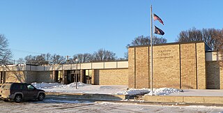
Stanton County is a county in the U.S. state of Nebraska. As of the 2010 United States Census, the population was 6,129. Its county seat is Stanton. The county was formed in 1856 and organized in 1867. It was first called Izard County until 1862, when it was renamed for Edwin M. Stanton, Secretary of War during the administration of President Abraham Lincoln.

Phelps County is a county in the U.S. state of Nebraska. As of the 2010 United States Census, the population was 9,188. Its county seat is Holdrege. The county was formed in 1873, and was named for William Phelps (1808–1889), a steamboat captain and early settler.

Lincoln County is a county located in the U.S. state of Nebraska. As of the 2020 census, the population was 34,676. Its county seat is North Platte. Despite the county's name, the state capital city of Lincoln is not in or near Lincoln County. The city of Lincoln is, instead, located more than 200 miles further to the east in Lancaster County.
Knox County is a county in the U.S. state of Nebraska. As of the 2020 United States Census, the population was 8,391. Its county seat is Center. Knox County was named for Continental and U.S. Army Major General Henry Knox.

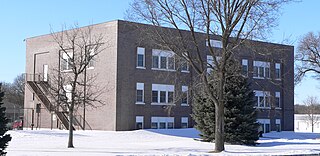
Pennington County is a county in the northwestern part of the U.S. state of Minnesota. As of the 2020 census, the population was 13,992. Its county seat is Thief River Falls.

Jetmore is a city in and the county seat of Hodgeman County, Kansas, United States. As of the 2020 census, the population of the city was 770.

Cromwell is a town in Seminole County, Oklahoma, United States. It is within the jurisdiction of the Muscogee (Creek) Nation. The population was 286 at the 2010 census, an 8 percent increase from the figure of 265 recorded in 2000. It was named for oilman Joe I. Cromwell, who platted the original town in 1923. The population soared to several thousand people in a few weeks, and lawlessness was rampant in the community. Retired legendary Old West lawman Bill Tilghman was hired as Town Marshal to restore order. Tilghman was shot to death the following year, the most notable event in Cromwell's history.

U.S. Highway 96 (US 96) is a north–south United States Numbered Highway that runs for about 117.11 miles (188.47 km) entirely in the U.S state of Texas. Its number is a violation of the standard numbering convention, as even-numbered two-digit highways are east–west routes by rule. As of 2004, the highway's southern terminus is in Port Arthur at an intersection with State Highway 87 (SH 87). Its northern terminus is in Tenaha at an intersection with US 59 /(Future I-369) and US 84.
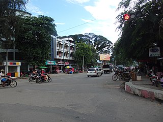
Myitkyina is the capital city of Kachin State in Myanmar (Burma), located 1,480 kilometers (920 mi) from Yangon, and 785 kilometers (488 mi) from Mandalay. In Burmese it means "near the big river", and Myitkyina is on the west bank of the Ayeyarwady River, just below 40 kilometers (25 mi) from Myit-son of its two headstreams. It is the northernmost river port and railway terminus in Myanmar. The city is served by Myitkyina Airport.

State Route 96, is an east–west, 21.79-mile-long (35.07 km) state highway in central part of the U.S. state of Arizona. It runs from Bagdad east to Yavapai County Road 15 near Hillside. The road was built in the late 1930s and logged as a state route from Bagdad to Hillside in 1962. The section from Bagdad to SR 97 was never officially part of the State Highway system, though the remainder of the highway was officially designated as such at the turn of the century.

Injangyang Township is a township of Myitkyina District in the Kachin State of Burma (Myanmar). The principal town and administrative center is Injangyang. The 2002 population estimate for the township was 23,370.

Puerto Rico Highway 183 (PR-183) is a main highway which begins in the downtown/business area of Caguas, near Puerto Rico Highway 1 and ends in Puerto Rico Highway 198 in Las Piedras. Measuring near 25 kilometers, it is real rural parallel road of Puerto Rico Highway 30, though it goes significantly south of the latter and the only municipality it does not go through which PR-30 does in Humacao.
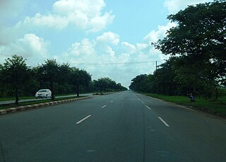
National Highway 1 (NR1), literally "The Road to Mandalay ") is an important south–north flowing highway of central Burma and the busiest road in the country. It connects Yangon to Meiktila where it joins the National Highway 4 going east and then NR1 continues north to Mandalay.

National Highway 3 (NR3) is one of the most important highways of central-eastern Burma. It connects Mandalay to Muse on the border with China.
The Ministry of Energy is the national Ministry of Energy of Mauritania, located in Nouakchott. It is located on the corner of Avenue Gamal Abdel Nasser and the Nouadhibou Highway, near the Grand National Hospital of Mauritania.
The fortification is located in Băile Homorod, Romania, and it has as defense: ditch, berm and rampart.
References
- 1 2 Google Maps (Map). Google.
- ↑ Bing Maps (Map). Microsoft and Harris Corporation Earthstar Geographics LLC.
| | This Burmese road, street or road transport-related article is a stub. You can help Wikipedia by expanding it. |