Caerphilly is a county borough in southern Wales, straddling the ancient county boundary between Glamorgan and Monmouthshire. It is governed by Caerphilly County Borough Council.

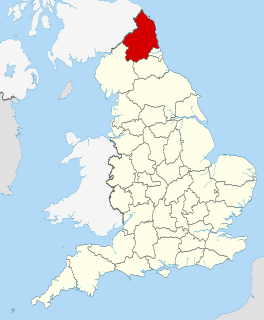
Ellington is a small village on the coast of Northumberland, England. Ellington is 4 miles (6 km) from Ashington, 6 miles (10 km) from Morpeth and 20 miles (32 km) north of Newcastle upon Tyne.

Ruabon is a village and community in the county borough of Wrexham in Wales. The name "Rhiwabon" comes from "Rhiw Fabon", "Rhiw" being the Welsh word for "slope" or "hillside" and "Fabon" being a mutation from St Mabon, the original church name, of earlier, Celtic origin. An older English spelling, Rhuabon, can sometimes be seen.

Brandon is a village in County Durham, England. It is situated a short distance to the southwest of Durham. Brandon was originally one of the seven townships within the ancient parish of Brancepeth. It grew from a sparsely populated agricultural area into a populous mining district after the establishment of collieries and later coke and fireclay works. Until the 19th century Brandon village, formerly known as East Brandon, was one of the larger settlements in Brancepeth Parish.
Murton is a village in County Durham, England. Lying six miles (9.7 km) east of the city of Durham and seven miles (11 km) south of Sunderland, it has a population of 4,534, increasing to 7,676 at the 2011 Census.

See also Thornley in Weardale.

Wylam is a village in the county of Northumberland. It is located about 10 miles (16 km) west of Newcastle upon Tyne.
Birchgrove is a large village and community in the City and County of Swansea, Wales. It does not have a community council. The village is situated some 4.5 miles north-east of Swansea city centre, between the flood plain of the River Tawe and Mynydd Drumau. Birchgrove also borders Neath Port Talbot. The community of Birchgrove, which includes the village of Birchgrove itself, Lon-las, and parts of Glais, had a population in 2008 of 5,807.
Pegswood is a mining village and civil parish in Northumberland, England, and the site of the former Pegswood Colliery. Pegswood is two miles (3 km) east of Morpeth and three miles (5 km) west of Ashington, with a population of around 3260. Pegswood is on a small hill above the valley in which Morpeth is situated, close to the River Wansbeck and to the river Brocks Burn.

The South Wales Coalfield is a large region of south Wales that is rich in coal deposits, especially the South Wales Valleys. It supported a large part, but not all, of the coal industry in Wales.
The Blyth and Tyne Railway was a railway company in Northumberland, England. It was incorporated in 1853 to unify several private railways and waggonways that were concerned with bringing coal from the Northumberland coalfield to Blyth and to the River Tyne. Over the years it expanded its network to include Ashington, Morpeth and Tynemouth. As coal output increased the company became very prosperous in hauling the mineral to quays for export, and in addition a residential passenger service based on Newcastle built up.
The Kent Coalfield was a coalfield located in the eastern part of the English county of Kent. The Coalfields Trust defines the Kent Coalfield as the wards of Barnham Downs and Marshside in the Canterbury district, and the wards of Aylesham, Eastry, Eythorne & Shepherdswell, Middle Deal & Sholden, Mill Hill and North Deal in the Dover district.
Tinsley Park Collieries were a group of coal mines situated in the Tinsley / Darnall area to the east of the City of Sheffield, South Yorkshire, England.

Mining in Wales provided a significant source of income to the economy of Wales throughout the nineteenth century and early twentieth century. It was key to the Industrial Revolution.
The Elsecar Collieries were the coal mines sunk in and around Elsecar, a small village to the south of Barnsley in what is now South Yorkshire, but was traditionally in the West Riding of Yorkshire.
The South Yorkshire Coalfield is so named from its position within Yorkshire. It covers most of South Yorkshire, West Yorkshire and a small part of North Yorkshire. The exposed coalfield outcrops in the Pennine foothills and dips under Permian rocks in the east. Its most famous coal seam is the Barnsley Bed. Coal has been mined from shallow seams and outcrops since medieval times and possibly earlier.

Gelli is a village in the Rhondda Fawr valley, in the county borough of Rhondda Cynon Taff, Wales, situated on the southern bank of the Rhondda Fawr River. Gelli is a former coal mining village which is a district of the community of Ystrad.

Scremerston is a village in Northumberland, England. The village lies on the North Sea coast about 3 miles (5 km) south of Berwick-upon-Tweed and adjacent to the A1, providing access to Newcastle upon Tyne to the south, and to Edinburgh to the north.
The Brampton railway was a mineral railway built in 1798 to bring coal from workings on Tindale Fell to staiths at Brampton. It was a development of short sections of earlier wooden railways.
Fletcher, Burrows and Company was a coal mining company that owned collieries and cotton mills in Atherton, Greater Manchester, England. Gibfield, Howe Bridge and Chanters collieries exploited the coal mines (seams) of the middle coal measures in the Manchester Coalfield. The Fletchers built company housing at Hindsford and a model village at Howe Bridge which included pit head baths and a social club for its workers. The company became part of Manchester Collieries in 1929. The collieries were nationalised in 1947 becoming part of the National Coal Board.