Naryan-Mar is a sea and river port town and the administrative center of the Nenets Autonomous Okrug, Russia. The town is situated on the right bank of the Pechora River, 110 kilometers (68 mi) upstream from the river's mouth, on the Barents Sea. Naryan-Mar lies north of the Arctic Circle. Population: 21,658 (2010 Census); 18,611 (2002 Census); 20,182 (1989 Census); 17,000 (1973). About half of the population of Nenetsia lives in the city.

Amderma is a rural locality in Zapolyarny District of Nenets Autonomous Okrug, Russia, located on the coast of Kara Sea, near the Vaygach Island, 490 kilometers (300 mi) from Naryan-Mar, the administrative center of the autonomous okrug. Population: 541 (2010 Census); 647 (2002 Census).

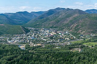
Sinegorye is an urban locality in Yagodninsky District of Magadan Oblast, Russia, located on the Kolyma River, 8 kilometers (5.0 mi) from Kolyma Hydroelectric Station. Population: 2,821 (2010 Census); 4,071 (2002 Census); 11,645 (1989 Census).

Bykovo is an urban locality in Ramensky District of Moscow Oblast, located 34 kilometers (21 mi) southeast of Moscow. Population: 10,391 (2010 Census); 9,235 (2002 Census); 10,395 (1989 Census).

Sokol is an urban locality in Magadan Oblast, Russia, located 49 kilometers (30 mi) north of Magadan on the Kolyma Highway section connecting Magadan and Ust-Nera, and is also on the proposed rail link connecting the Amur Yakutsk Mainline with Magadan. Population: 4,685 (2010 Census); 4,715 (2002 Census); 8,011 (1989 Census).

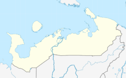
Zapolyarny District is an administrative and municipal district (raion), the only one in Nenets Autonomous Okrug, Russia. It encompasses all of the territory of the autonomous okrug, with the exception of the territory of the town of okrug significance of Naryan-Mar, the only other top-level administrative division of the autonomous okrug. The area of the district is approximately 170,000 square kilometers (66,000 sq mi). Its administrative center is the urban locality of Iskateley. Population: 20,432. The population of Iskateley accounts for 33.7% of the district's total population.
Omsukchan is an urban locality and the administrative center of Omsukchansky District of Magadan Oblast, Russia, located 576 kilometers (358 mi) north of Magadan. Population: 3,493 (2021 Census); 4,157 (2010 Census); 4,529 (2002 Census); 9,873 (1989 Census).
Mama is an urban locality and the administrative center of Mamsko-Chuysky District of Irkutsk Oblast, Russia. Population: 3,630 (2010 Census); 4,352 (2002 Census); 6,918 (1989 Census).

Zhigalovo is an urban locality and the administrative center of Zhigalovsky District of Irkutsk Oblast, Russia. Population: 5,369 (2010 Census); 5,412 (2002 Census); 5,663 (1989 Census).
Nerl is an urban-type settlement (township) in Russia, Ivanovo Oblast, Teykovsky District, the administrative center of Nerlian urban settlement. Population: 2,016 (2021 Census); 2,052 (2010 Census); 2,373 (2002 Census); 3,194 (1989 Census).

Dukat is an urban locality in the Omsukchansky District of Magadan Oblast, Russia, located 595 kilometers (370 mi) north of Magadan. Population: 1,351 (2010 Census); 1,287 (2002 Census); 6,945 (1989 Census).

Iskateley is an urban locality and the administrative center of Zapolyarny District of Nenets Autonomous Okrug, Russia. It is located on the right bank of the Pechora River, 6 kilometres (3.7 mi) from the center of the city of Naryan-Mar.
Priargunsk is an urban locality and the administrative center of Priargunsky District in Zabaykalsky Krai, Russia. Population: 7,388 (2010 Census); 8,260 (2002 Census); 7,954 (1989 Census).
Shelopugino is a rural locality and the administrative center of Shelopuginsky District of Zabaykalsky Krai, Russia. Population: 3,274 (2010 Census); 3,571 (2002 Census); 4,199 (1989 Census).
Medvenka is an urban locality in Medvensky District of Kursk Oblast, Russia. Population: 4,498 (2021 Census); 4,398 (2010 Census); 4,595 (2002 Census); 4,446 (1989 Census).

Balakhninsky is an urban locality in Bodaybinsky District of Irkutsk Oblast, Russia. Population: 1,300 (2010 Census); 1,720 (2002 Census); 2,124 (1989 Census).
Oma is a settlement in Zapolyarny District, Nenets Autonomous Okrug, Russia. It had a population of 763 in 2010, a decrease from its population of 795 in 2002.

Ust-Kara is a village on the eastern border of Zapolyarny District, Nenets Autonomous Okrug, Russia. It had a population of 574 as of 2010, a decrease from its population of 677 in 2002.
Nelmin-Nos is a village in Zapolyarny District, Nenets Autonomous Okrug, Russia. It had a population of 916 as of 2010, a decrease from its population of 970 in 2002.