Netherby (ship)

Last updated

StateLibQld 1 67703 Netherby (ship).jpg
Drawing of the Netherby
History
Civil Ensign of the United Kingdom.svg  United Kingdom
NameNetherby
Owner James Baines & Co.
Port of registry Liverpool, United Kingdom
BuilderRobert Thompson Jnr, County Durham, Sunderland, United Kingdom
Launched1858
FateWrecked 14 July 1866
General characteristics
Class and type Packet ship
Tons burthen944 tons
Length176 ft 0 in (53.64 m)
Beam22 ft 0 in (6.71 m)
Depth of hold33 ft 0 in (10.06 m)
PropulsionSails
Sail plan Full-rigged ship

Netherby was a full-rigged sailing ship of the Black Ball Line that ran aground and sank off the coast of King Island an island in Bass Strait between Tasmania and the Australian mainland on 14 July 1866 while sailing from London to Brisbane.

Contents

Remarkably, all of the 413 passengers and 49 crew were saved, firstly from drowning in the rough waters of Bass Strait and then from starvation on the mainly uninhabited island.

The ship and voyage

Netherby was a 944-ton vessel of dimensions 176 ft × 33 ft × 22 ft, built in Sunderland in 1858. [1] The vessel was under charter to the Queensland Government to carry emigrants from the United Kingdom to the then-British colony. Queensland, recently separated from its parent colony New South Wales, saw a need to quickly increase its population and so set in place a "land order" system of assisted emigration. [2] Netherby was the 77th vessel to sail under this system for the Queensland government. [1]

Sailing from East India Docks in London, Netherby sailed to Plymouth to take on its final group of emigrants before setting sail for Queensland. The ship's master for the voyage was Captain Owen Owens. The ship was supposed to take a route to the south of Tasmania but Owens decided to pass through Bass Strait instead. The ship had encountered extremely rough weather earlier in the voyage that had seen the steerage passengers confined below decks for 14 consecutive days. In taking the passage through Bass Strait, Owens hoped to avoid further rough weather and ease the burden on the passengers.

Owens' problems started when low cloud obscured the sun from view and thus he was unable to plot his position using celestial navigation techniques.

After Netherby was wrecked, all the 413 passengers and 49 crew were able to reach King Island safely, but there they were without shelter and with very limited provisions. The second officer, John Parry, led a small party of crew and passengers to procure assistance from the lighthouse on the island, but there were insufficient supplies there for the number of survivors. Parry and three others took the 23-foot whaleboat at the lighthouse and, despite high winds and rough seas, managed to reach the Australian mainland between Point Roadknight and Barwon Heads, where they met a party of surveyors who immediately assisted them. Parry then took a horse and rode the 26 miles to Geelong, from where he raised the alarm by telegram to Melbourne on 21 July.

The Victorian Government immediately summoned Captain William Henry Norman to load supplies of food, blankets, tents and medicine onto HMVS Victoria and then proceed at full speed to King Island to rescue the survivors; John Parry (who had travelled to Melbourne by train from Geelong) joined the ship to help locate the survivors. Another ship, Pharos, had also independently sailed from Williamstown to render assistance to the survivors. On Monday 23 July, Norman located the wreck of Netherby and, after discussions with the Netherby's Captain Owens took 230 passengers on board the Victoria (as many as was possible), while off-loading supplies for those remaining on the island. Then Pharos arrived and took on board the remaining 60 survivors near the wreck site, the other 117 survivors having left the wreck site heading to the lighthouse. Having taken the rescued people to Melbourne, Victoria and Pharos returned to the lighthouse at King Island, where they rescued the remaining survivors and replaced the lost whaleboat at the lighthouse. The survivors were taken by train and then by cab (a free service by the cabmen) to be accommodated in the Immigration Depot and Exhibition Building (not the present Royal Exhibition Building). Little of the luggage of the survivors was recovered, and most were in a wretched state after their ordeal; the Victorian public donated clothing and funds to assist the survivors, many of whom decided to settle in Victoria rather than undertake another sea voyage to Queensland. [3] [4] [5] [6]

The remaining passengers, bound for Brisbane, continued their journey on board City of Melbourne, arriving on 6 August 1866.

Related Research Articles

<span class="mw-page-title-main">Bass Strait</span> Sea strait between the Australian mainland and Tasmania

Bass Strait is a strait separating the island state of Tasmania from the Australian mainland. The strait provides the most direct waterway between the Great Australian Bight and the Tasman Sea, and is also the only maritime route into the economically prominent Port Phillip Bay.

King Island is an island in Bass Strait, belonging to the Australian state of Tasmania. It is the largest of four islands known as the New Year Group and the second-largest island in Bass Strait. The island's population at the 2021 census was 1,617 people, up from 1,585 in 2016. The local government area of the island is the King Island Council.

<i>Cataraqui</i> (ship) British emigrant ship wrecked in 1845

Cataraqui was a British barque which sank off the south-west coast of King Island in Bass Strait on 4 August 1845. The sinking was Australia's worst–ever maritime civil disaster incident, claiming the lives of 400 people.

<span class="mw-page-title-main">Bass Strait Triangle</span> Waters separating Victoria and Tasmania

The Bass Strait Triangle is the waters that separate the states of Victoria and Tasmania, including Bass Strait, in south-eastern Australia. The term Bass Strait Triangle appears to have been first used following the disappearance of Frederick Valentich in 1978 although the region had a bad reputation long before that.
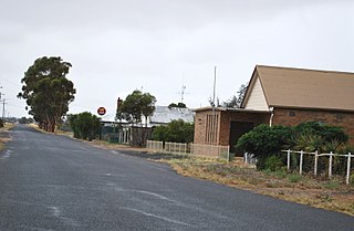
<span class="mw-page-title-main">Netherby, Victoria</span> Town in Victoria, Australia

Netherby is a town in western Victoria, in Australia. The town is approximately 406 kilometres (252 mi) north west from Melbourne.

Sir Charles Hardy Islands is in the reef of the same name adjacent to Pollard Channel & Blackwood Channel about 40 km east of Cape Grenville off Cape York Peninsula.

<span class="mw-page-title-main">Booby Island (Queensland)</span> Island in Queensland, Australia

Booby Island is located 45 km (28 mi) northwest of Muttee Heads at the tip of Cape York Peninsula in Queensland, Australia. This island is in the Torres Strait, 32 km (20 mi) west of Thursday Island and 23 km (14 mi) west of Prince of Wales Island. Booby Island is also known as Ngiangu by the Kaurareg people of the western Torres Strait, its traditional owners, named for the giant Ngiangu who was forced from a neighbouring island It has been called Booby Island by a number of European explorers, including Captain Cook, for the presence of the booby birds.
<i>Sydney Cove</i> (1796 ship)

Sydney Cove was the Bengal country ship Begum Shaw that new owners purchased in 1796 to carry goods to Sydney Cove, and renamed for her destination. She was wrecked in 1797 on Preservation Island off Tasmania while on her way from Calcutta to Port Jackson. She was among the first ships wrecked on the east coast of Australia.

Neva was a three-masted barque launched in 1813. She made two voyages transporting convicts to Australia. On her second voyage carrying convicts she wrecked in Bass Strait on 13 May 1835. Her loss was one of the worst shipwrecks in Australian history; 224 people died.

Cape Otway is a cape and a bounded locality of the Colac Otway Shire in southern Victoria, Australia on the Great Ocean Road; much of the area is enclosed in the Great Otway National Park. The cape marks the boundary between the Southern Ocean on the west and Bass Strait on the east.

<span class="mw-page-title-main">Wingan Inlet</span>

Wingan Inlet is an inlet within the Croajingolong National Park, in the East Gippsland region of Victoria, Australia.

<span class="mw-page-title-main">Currie, Tasmania</span> Town in Tasmania, Australia

Currie is a rural residential locality in the local government area (LGA) of King Island in the North-west and west LGA region of Tasmania. The 2021 census recorded a population of 659. It is the largest township on, and is the administrative centre of, King Island, at the western entrance to Bass Strait.

The following lists events that happened during 1866 in Australia.

SS <i>City of Launceston</i> Steamship operated by the Launceston and Melbourne Steam Navigation Company

SS City of Launceston was a 368 GRT steamship operated by the Launceston and Melbourne Steam Navigation Company from 1863, which had an early role in colonial steam shipping as the forerunner of the modern Bass Strait ferry service between Tasmania and Victoria. It was sunk in Port Phillip Bay after a collision with another ship on 19 November 1865.
SS <i>Gothenburg</i> British steamship wrecked on the Great Barrier Reef

SS Gothenburg was an iron-hulled sail- and steamship that was built in England in 1854 and sailed between England and Sweden until 1862. She then moved to Australia, where she operated across the Tasman Sea to and from New Zealand until 1873, when she was rebuilt. After her rebuild, she operated in the Australian coastal trade.

HMVS <i>Victoria</i> (1855)

HMVS Victoria was a 580-ton combined steam/sail sloop-of-war built in England in the 1850s for the colony of Victoria, Australia.

<span class="mw-page-title-main">William Henry Norman</span>

William Henry Norman (1812–1869) was a sea captain in Australia. As commander of HMVS Victoria, he engaged in the First Taranaki War in New Zealand and the search for explorers Burke and Wills.

MV <i>Blythe Star</i> Ship that sank in 1973 near Tasmania

The vessel MV Blythe Star was a coastal freighter which foundered off south-western Tasmania in October 1973. The crew of 10 successfully took to a small inflatable liferaft but drifted undiscovered. A search for the ship and its crew led to the largest maritime search operation conducted in Australia to that time.

<i>Charles Eaton</i> (1833 ship)

Charles Eaton was a barque, launched in 1833 for use as a merchant ship. Whilst under the command of Captain Fowle, she was wrecked in 1834 among the Torres Strait Islands, off the northern coast of Queensland, Australia, and her passengers and crew attacked and nearly all killed by Torres Strait Islanders on Mer Island. A cabin boy and small child survived and lived with the islanders until being rescued by Captain Lewis and crew on Isabella in June 1836, who also found skulls of some of the murdered people on a nearby island and took them back to Sydney for burial.

References

Notes

  1. 1 2 "Melbourne Argus news". The Netherby Shipwreck Story. Archived from the original on 12 July 2011. Retrieved 21 July 2010.
  2. "Queensland's history". Queensland Government. Archived from the original on 20 August 2010. Retrieved 21 July 2010.
  3. "WRECK OF THE SHIP NETHERBY". Bendigo Advertiser . Vol. XIII, no. 3480. Victoria, Australia. 23 July 1866. p. 2. Retrieved 4 September 2016 via National Library of Australia.
  4. "THE WRECK OF THE NETHERBY". The Age . No. 3, 661. Victoria, Australia. 25 July 1866. p. 5. Retrieved 4 September 2016 via National Library of Australia.
  5. "WRECK OF THE NETHERBY ON KING'S ISLANDS". The Border Watch . Vol. 6, no. 288. South Australia. 1 August 1866. p. 3. Retrieved 4 September 2016 via National Library of Australia.
  6. "THE WRECK OF THE NETHERBY". The Cornwall Chronicle . Vol. XXXI, no. 3316. Tasmania, Australia. 4 August 1866. p. 2. Retrieved 4 September 2016 via National Library of Australia.