
Puducherry, also known as Pondicherry, is a union territory of India, consisting of four small geographically unconnected districts. It was formed out of four territories of former French India, namely Pondichéry, Karikal (Karaikal), Mahé and Yanaon, excluding Chandannagar (Chandernagore), and it is named after the largest district, Puducherry, which was also the capital of French India. Historically known as Pondicherry, the territory changed its official name to Puducherry on 1 October 2006.

Karaikal is a Town of the Indian Union Territory of Puducherry. It is the administrative headquarters of the Karaikal District and the second most populated Town in the Union Territory after Pondicherry. Located on the Coromandel Coast of Bay of Bengal in South India, it is a coastal enclave and is surrounded by the state of Tamil Nadu in the southern region of Indian peninsula.

Yanam is a town located in the Yanam district in Puducherry. It has a population of 35,000 and is entirely surrounded by Andhra Pradesh. It was formerly a French colony for nearly 200 years, and, though united with India in 1954, is still sometimes known as "French Yanam". It possesses a blend of French culture and the Telugu culture, nicknamed Frelugu. During French rule, the Tuesday market at Yanam was popular among the Telugu people in the Madras Presidency, who visited Yanam to buy foreign and smuggled goods during Yanam People's Festival held in January. After implementation of the Child Marriage Restraint Act, 1929 in British India, Telugu people often traveled to Yanam to conduct child marriages, which remained legal under the French administration.

Madukkarai is a suburb of Coimbatore city in the Indian state of Tamil Nadu. It is the gateway to Coimbatore city from Kerala State and is located around 12 km from the Kerala border. The Coimbatore International Airport is about 27 km from here. It is the administrative centre for Madukkarai taluk.
Ariyankuppam is a Town, Commune, Sub-Taluk, and Assembly Constituency in the Union Territory of Puducherry, India. The streets in Ariyankuppam are straight and in grid form, similar to Puducherry boulevard.

The Puducherry district, also known by its former name Pondicherry district, is one of the four districts of the union territory of Puducherry in South India. The district occupies an area of 290 square kilometres (110 sq mi), spread over 12 non-contiguous enclaves lying on or near the Bay of Bengal within a compact area in the state of Tamil Nadu. According to the 2011 census, the district has a population of 950,289.

The Pondicherry Municipal Council is the municipality of Pondicherry, India. Pondicherry has had a French system of municipal administration since 1880 and till the last poll held in 1968. Recently, in 2006 again municipal elections were held.

V. Venkatasubba Reddiar was the second Chief Minister of the Union Territory of Pondicherry (Puducherry). He was born in a wealthy agricultural family at Madukkarai, Pondicherry. His parents are Vaithilingam Reddiar and Vemalammal. His father Vaithilingam Reddiar was the Mayor of Nettapakkam commune during French rule. His son V. Vaithilingam also served as the Chief Minister of Pondicherry.

Thavalakuppam is a panchayat village in Ariyankuppam Commune in the Union Territory of Puducherry, India. It is also a revenue village under Ariyankuppam Firka.

Kakkayanthope is a village in Ariyankuppam Commune in the Union Territory of Puducherry, India.
Bahour is a town, Commune, Taluk and Assembly Constituency in the Union Territory of Puducherry, India. It consists of four non-contiguous areas, including three of the nine true enclaves of Puducherry. It is home to the second largest and perhaps the oldest irrigation lake in the region- the Bahour Eri. The lake has been in existence since the Chola period. Bahour also has reports of lignite deposits but it is not exploited due to its close proximity to the sea and the likelihood of seeping seawater, adulterating the ground water. It is a major access point for villages south of Puducherry and forms the southern border to the Union territory. The city is also known as the ‘rice bowl of Puducherry’ since the area is suitable for Paddy (rice) cultivation.
Mannadipattu is a Village, Commune and Assembly Constituency in the Union Territory of Puducherry, India. It consists of 3 enclaves out of the 11 enclaves of Puducherry. Also, Sellipattu, located on the main enclave, is a part of Mannadipattu Commune. Mannadipattu, along with Nettapakkam Commune, forms the western border to the Union Territory.
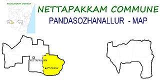
Pandasozhanallur is a panchayat village in Nettapakkam Commune in the Union Territory of Puducherry, India. It is also a revenue village under Nettapakkam firka. Pandasozhanallur is also known as PS Nallur.
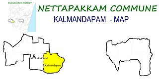
Kalmandapam is a panchayat village in Nettapakkam Commune in the Union Territory of Puducherry, India.
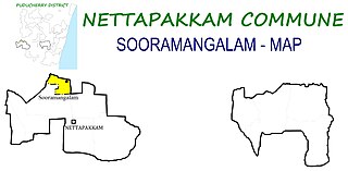
Sooramangalam is a panchayat village in Nettapakkam Commune in the Union Territory of Puducherry, India.
Maducarai (மடுகரை) is a panchayat village in Nettapakkam Commune in the Union Territory of Puducherry, India. It is also a revenue village under Nettapakkam firka. Muducarai consists of two village panchayats namely Maducarai(East) and Maducarai(West).

Karikalampakkam is a panchayat village in Nettapakkam Commune in the Union Territory of Puducherry, India. It is also a revenue village under Nettapakkam firka. If splitting the Name of Karikalampakkam and translating into English it will give the reason of village name by how it came. Kari - Dark; akalam - Non Leaving; pakkam - the place or location. So when the Pondicherry under French rule, this place identified by the other village people by noticing the full darkness; occupying entire area of the village even at day time, because this village covered fully by big trees and it won't allow the light passing inside.
Karaiyamputhur is a village in Bahour Commune of Bahour taluk in the Union Territory of Puducherry, India. It is one of the 11 Enclaves of Puducherry. Karaiyamputhur serves as a gateway to Puducherry - Panruti route. It lies on the southwesternmost tip of Puducherry district.
Manamedu is a village in Bahour Commune of Bahour taluk in the Union Territory of Puducherry, India. It is one of the 11 Enclaves of Puducherry. Manmedu serves as a gateway to Pondicherry - Nellikuppam route. It lies on the banks of Pennaiyar River
Seliamedu is a village, sub-taluk in Bahour Commune of Bahour taluk in the Union Territory of Puducherry, India. It lies on north side in the Bahour Enclave of Puducherry district.


