Neuhütten | ||
---|---|---|
| ||
Coordinates: 49°38′40″N7°00′59″E / 49.64435°N 7.01643°E Coordinates: 49°38′40″N7°00′59″E / 49.64435°N 7.01643°E | ||
Country | Germany | |
State | Rhineland-Palatinate | |
District | Trier-Saarburg | |
Municipal assoc. | Hermeskeil | |
Government | ||
• Mayor | Peter Kretz | |
Area | ||
• Total | 10.50 km2 (4.05 sq mi) | |
Elevation | 540 m (1,770 ft) | |
Population (2015-12-31) [1] | ||
• Total | 768 | |
• Density | 73/km2 (190/sq mi) | |
Time zone | CET/CEST (UTC+1/+2) | |
Postal codes | 54422 | |
Dialling codes | 06503 | |
Vehicle registration | TR |
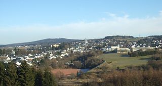
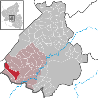
Neuhütten is a municipality in the Trier-Saarburg district, in Rhineland-Palatinate, Germany.
Trier-Saarburg is a district in the west of Rhineland-Palatinate, Germany. Neighboring districts are Bitburg-Prüm, Bernkastel-Wittlich, Birkenfeld, Sankt Wendel (Saarland), and Merzig-Wadern (Saarland). To the west it borders Luxembourg. The district-free city Trier is completely surrounded by the district.
Rhineland-Palatinate is a state of Germany.
Germany, officially the Federal Republic of Germany, is a country in Central and Western Europe, lying between the Baltic and North Seas to the north, and the Alps, Lake Constance and the High Rhine to the south. It borders Denmark to the north, Poland and the Czech Republic to the east, Austria and Switzerland to the south, France to the southwest, and Luxembourg, Belgium and the Netherlands to the west.
Neuhütten is a very active village with many cultural activities. Although the village counts only around 808 inhabitants, you can find about 13 clubs and associations.
The following clubs are active in Neuhütten (Hochwald):
Association/Club | Short description |
---|---|
AWO OV Züsch/Neuhütten | charitable society |
FC Züsch/Neuhütten | soccer sports club |
FÖV f. Kindergarten & Grundschule | education |
Heimatverein Neuhütten | cultural club |
Jugendclub Neuhütten | teenage club |
Hüttenzauber Turngruppe | gym club |
KUKI Kultur- und Karnevalsinitiative | carnival and cultural club |
MGV "Germania" Neuhütten | men's sing club |
MV Harmonie | music club |
Ski-Club Dollberg | ski club |
TC Könnigsbachtal | tennis club |
Kegelsportclub | skittles club |
. Frauengemeinschaft Züsch/Neuhütten | catholic women club |
Places of Interest:
Since 2015 is Neuhütten officially placed in the "Hochwald Nationalpark", therefore the surroundings and the forest is a very beautiful and peaceful place to be. Further the ski cottage, which is opened whenever there is snow, is a nice location to visit as well as the old Forsthaus "Altes Forsthaus" with its horse ranch.
Recently there has been a news team at the Dollberg Neuhütten. You can watch the video at: http://www.ardmediathek.de/
Celebrities:
Klaus Mörsdorf 1909–1989), catholic theologian and canonist
Next exits to the highway:
Otzenhausen approx. 6 km
Hermeskeil approx. 10 km
Distance to bigger cities > 100.000 inhabitants:
Trier: approx. 44 km
Saarbrücken: approx. 56 km
Luxembourg: approx. 85 km
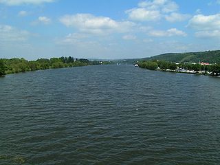
Konz is a city in the Trier-Saarburg district, in Rhineland-Palatinate, Germany. It is situated at the confluence of the rivers Saar and Moselle, approx. 8 km southwest of Trier.
Wüstenrot is a municipality in the Mainhardt Forest with about 6,800 inhabitants, more than half of them in small incorporated villages. The village is the birthplace of the Wüstenrot Bausparkasse.
Hermeskeil is a city in the Trier-Saarburg district, in Rhineland-Palatinate, Germany. It is situated in the Hunsrück, approx. 25 km southeast of Trier. Its population is about 5,900.
Schweich is a city in the Trier-Saarburg district, in Rhineland-Palatinate, Germany. It is situated on the river Moselle, approx. 10 km (6.2 mi) northeast of Trier.
Kell am See is a municipality in the Trier-Saarburg district, in Rhineland-Palatinate, Germany. It is situated in the Hunsrück, approx. 20 km southeast of Trier.
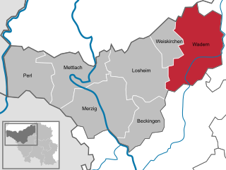
Wadern is a municipality in the federal state Saarland which is situated in the southwest of Germany. It's part of the district Merzig-Wadern. Wadern consists of 14 villages with approximately 16.000 inhabitants. With 143 inhabitants per km2 it is sparsely populated, but, with an area of 111 km2, Wadern is the third largest municipality in Saarland after Saarbrücken and St. Wendel. The town is divided into 14 urban districts and altogether 24 villages belong to the commune. The town is part of the Moselle Franconian language area.
Gebhardshain is a municipality in the district of Altenkirchen, in Rhineland-Palatinate, Germany. It is situated in the Westerwald, approx. 20 km south-west of Siegen. Gebhardshain was the seat of the former Verbandsgemeinde Gebhardshain.
The climatic spa (Luftkurort) of Thalfang is an Ortsgemeinde – a municipality belonging to a Verbandsgemeinde, a kind of collective municipality – in the Bernkastel-Wittlich district in Rhineland-Palatinate, Germany. It is the seat of the Verbandsgemeinde of Thalfang am Erbeskopf.
Stadland is a municipality in the district of Wesermarsch, in Lower Saxony, Germany. It is situated on the left bank of the Weser, approx. 32 km northeast of Oldenburg, and 42 km northwest of Bremen. On the west side Stadland bordered to the Jade Bight. Its seat is in the village Rodenkirchen, which is also part of this municipality as the villages Schwei, Seefeld and Kleinensiel. There are also many little Bauernschaften (hamlets) in Stadland.
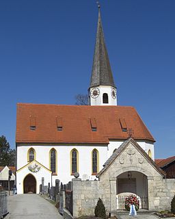
Otterfing is a municipality in the district of Miesbach in Bavaria in Germany.
Achtelsbach is an Ortsgemeinde – a municipality belonging to a Verbandsgemeinde, a kind of collective municipality – in the Birkenfeld district in Rhineland-Palatinate, Germany. It belongs to the Verbandsgemeinde of Birkenfeld, whose seat is in the like-named town.
Berschweiler bei Baumholder is an Ortsgemeinde – a municipality belonging to a Verbandsgemeinde, a kind of collective municipality – in the Birkenfeld district in Rhineland-Palatinate, Germany. It belongs to the Verbandsgemeinde of Baumholder, whose seat is in the like-named town. Berschweiler bei Baumholder is one of two municipalities in the district with the name Berschweiler. The two are distinguished from each other by their geographical “tags”; the other one is called Berschweiler bei Kirn.
Börfink is an Ortsgemeinde – a municipality belonging to a Verbandsgemeinde, a kind of collective municipality – in the Birkenfeld district in Rhineland-Palatinate, Germany. It belongs to the Verbandsgemeinde of Birkenfeld, whose seat is in the like-named town.
Brücken is an Ortsgemeinde – a municipality belonging to a Verbandsgemeinde, a kind of collective municipality – in the Birkenfeld district in Rhineland-Palatinate, Germany. It belongs to the Verbandsgemeinde of Birkenfeld, whose seat is in the like-named town.
Rinzenberg is an Ortsgemeinde – a municipality belonging to a Verbandsgemeinde, a kind of collective municipality – in the Birkenfeld district in Rhineland-Palatinate, Germany. It belongs to the Verbandsgemeinde of Birkenfeld, whose seat is in the like-named town.
Meckenbach is an Ortsgemeinde – a municipality belonging to a Verbandsgemeinde, a kind of collective municipality – in the Birkenfeld district in Rhineland-Palatinate, Germany. It belongs to the Verbandsgemeinde of Birkenfeld, whose seat is in the like-named town.
Züsch is a municipality located in Trier-Saarburg county, in the state of Rhineland-Palatinate, Germany. Züsch is located 40 km from Trier, Germany's oldest city. The Frankfurt-Hahn airport is 40 km away.
Sülm is a municipality in the district of Bitburg-Prüm, in Rhineland-Palatinate, western Germany.
Sessenbach is an Ortsgemeinde – a community belonging to a Verbandsgemeinde – in the Westerwaldkreis in Rhineland-Palatinate, Germany.
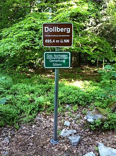
The Dollberg is a mountain in the Dollberge range in central Germany and the highest point in the state of Saarland. It is 695.4 m above sea level (NHN) and lies within the Schwarzwalder Hochwald on the boundary between the counties of Trier-Saarburg (Rhineland-Palatinate) and St. Wendel (Saarland).
This Trier-Saarburg location article is a stub. You can help Wikipedia by expanding it. |