Oberbillig | |
|---|---|
 Coat of arms | |
Location of Oberbillig within Trier-Saarburg district 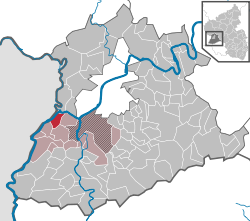 | |
 Oberbillig  Oberbillig | |
| Coordinates: 49°42′39.73″N6°30′16.19″E / 49.7110361°N 6.5044972°E | |
| Country | Germany |
| State | Rhineland-Palatinate |
| District | Trier-Saarburg |
| Municipal assoc. | Konz |
| Government | |
| • Mayor (2019–24) | Andreas Beiling [1] (CDU) |
| Area | |
• Total | 5.36 km2 (2.07 sq mi) |
| Elevation | 148 m (486 ft) |
| Population (2023-12-31) [2] | |
• Total | 985 |
| • Density | 180/km2 (480/sq mi) |
| Time zone | UTC+01:00 (CET) |
| • Summer (DST) | UTC+02:00 (CEST) |
| Postal codes | 54331 |
| Dialling codes | 06501 |
| Vehicle registration | TR |
| Website | www.oberbillig.de |

Oberbillig is a municipality in the Trier-Saarburg district, in Rhineland-Palatinate, Germany.
Contents
The municipality is situated on the Moselle river, a situation reflected in the design of its coat of arms.
There is a car ferry across the Moselle that connects Oberbillig in Germany to the city of Wasserbillig in Luxemburg.
