New Hampshire Route 1A is an 18.32-mile (29.48 km) long state highway located in southeast New Hampshire. The route runs along the Atlantic coastline from the Massachusetts border north to Rye, then turns toward downtown Portsmouth. The southern terminus is at the Massachusetts state line in Seabrook where it continues south as Massachusetts Route 1A. The northern terminus is at a junction with U.S. Route 1 in downtown Portsmouth. For the length of the road's run along the shore, its local name is Ocean Boulevard. In the northern part of Rye, it is known as Pioneer Road, and in Portsmouth, it is known as Miller Avenue and Sagamore Avenue.

New Hampshire Route 3A is a designation held by two separate state highways in New Hampshire. The two segments, although not directly connected, are linked by U.S. Route 3, from which they derive their route number.

New Hampshire Route 111 is a 50.027-mile-long (80.511 km) east–west highway in Hillsborough and Rockingham counties in southeastern New Hampshire. The road runs from the Massachusetts border at Hollis to North Hampton on the Atlantic shore.

New Hampshire Route 130 is a 12.739-mile-long (20.501 km) secondary east–west state highway in New Hampshire. The road runs between Brookline and Nashua, passing through the town of Hollis in the middle.
New Hampshire Route 13 is a 43.38-mile (69.81 km) long north–south state highway in the state of New Hampshire, United States. The highway runs from Brookline to Concord.

New Hampshire Route 31 is a 56.148-mile-long (90.361 km) north–south state highway in southern New Hampshire. It runs from Mason on the Massachusetts border, where, as Greenville Road, the road becomes Massachusetts Route 31. It passes through Greenville, Wilton, Lyndeborough, Greenfield, Bennington, Antrim, Hillsborough, Windsor, and Washington, reaching its northern terminus of Goshen at New Hampshire Route 10.
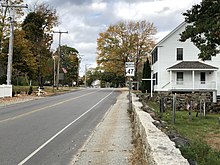
New Hampshire Route 41 is a 5.033-mile-long (8.100 km) north–south state highway in east-central New Hampshire. It is the main road connecting Silver Lake with Ossipee. The highway skirts the western edge of the lake named Silver Lake and provides access to local roads at the lakeside.

New Hampshire Route 45 is a 5.981-mile-long (9.625 km) north–south state highway in southern New Hampshire. It runs from Greenville to Temple.

New Hampshire Route 77 is a 17.874-mile-long (28.765 km) nominally east-west highway in Hillsborough and Merrimack counties in southern New Hampshire. It runs from New Boston to Dunbarton. Though labeled as east-west, the road has a north-south alignment for half of its length.

New Hampshire Route 102 is a 23.956-mile-long (38.553 km) state highway in Rockingham and Hillsborough counties in the southern part of the U.S. state of New Hampshire. NH 102 runs southwest to northeast between Hudson and Raymond, but is signed as an east–west route.

New Hampshire Route 119 is a state highway in the U.S. state of New Hampshire. The highway begins in Hinsdale at the Connecticut River, across which the highway continues into Brattleboro, Vermont, as Vermont Route 119 for 0.080 miles (0.129 km) to its terminus at U.S. Route 5 and VT 142. NH 119 heads east 39.908 miles (64.226 km) to the Massachusetts state line in New Ipswich, where the highway continues as Massachusetts Route 119. The state highway is the main east–west highway of southern Cheshire County, where it connects the towns of Hinsdale, Winchester, Richmond, Fitzwilliam, and Rindge.

New Hampshire Route 122 is a 12.614-mile-long (20.300 km) north–south highway in Hillsborough County in southeastern New Hampshire, United States. The highway runs from Amherst south to Hollis on the Massachusetts border.

New Hampshire Route 123 is a 63.055-mile-long (101.477 km) secondary north–south state highway in southwestern New Hampshire. The southern terminus of the route is at the Massachusetts state line in Mason where, as Mason Road, the road continues as an unnumbered local road in the town of Townsend. The northern terminus, as signed, is at the Connecticut River, where the highway continues west for 0.313 miles (0.504 km) to U.S. Route 5 in Westminster, Vermont, as Vermont Route 123. Route logs, however, place the terminus at New Hampshire Route 12 in Walpole.

New Hampshire Route 124 is a 28.083-mile-long (45.195 km) east–west highway in southern New Hampshire, United States. It runs from Marlborough to the Massachusetts border.

New Hampshire Route 149 is a 13.756-mile-long (22.138 km) secondary east–west state highway in Hillsborough County in the southern part of the U.S. state of New Hampshire. The road runs between the towns of Weare and Hillsborough.

New Hampshire Route 137 is a 16.583-mile-long (26.688 km) secondary north–south state highway in southern New Hampshire. The road runs between Jaffrey and Hancock.

New Hampshire Route 136 is a 17.459-mile-long (28.098 km) east–west state highway in Hillsborough County in southern New Hampshire. The road connects New Boston and Peterborough.

New Hampshire Route 152 is a 15.449-mile-long (24.863 km) east–west highway in Rockingham and Strafford counties in southeastern New Hampshire. It runs from an intersection with U.S. Route 4 near the Northwood/Nottingham town line east to an intersection with New Hampshire Route 108 in Newmarket.

New Hampshire Route 153 is a 50.566-mile-long (81.378 km) secondary north–south highway in Strafford and Carroll counties in eastern New Hampshire. The southern terminus is in Farmington at New Hampshire Route 11. The northern terminus is in Conway village at New Hampshire Route 16 and New Hampshire Route 113.

New Hampshire Route 9 is a 109.910-mile-long (176.883 km) state highway located in southern New Hampshire. It runs across the state from west to east and is a multi-state route with Vermont and Maine, part of 1920s-era New England Interstate Route 9.