
The United States Numbered Highway System is an integrated network of roads and highways numbered within a nationwide grid in the contiguous United States. As the designation and numbering of these highways were coordinated among the states, they are sometimes called Federal Highways, but the roadways were built and have always been maintained by state or local governments since their initial designation in 1926.

U.S. Route 66 or U.S. Highway 66 was one of the original highways in the United States Numbered Highway System. It was established on November 11, 1926, with road signs erected the following year. The highway, which became one of the most famous roads in the United States, ran from Chicago, Illinois, through Missouri, Kansas, Oklahoma, Texas, New Mexico, and Arizona before terminating in Santa Monica in Los Angeles County, California, covering a total of 2,448 miles (3,940 km).

Derry is a town in Rockingham County, New Hampshire, United States. The population was 34,317 at the 2020 census. Although it is a town and not a city, Derry is the most populous community in Rockingham County and the 4th most populous in the state. The town's nickname, "Spacetown", derives from the fact that Derry is the birthplace of Alan Shepard, the first astronaut from the United States in space. Derry was also for a time the home of the poet Robert Frost and his family.

U.S. Route 3 (US 3) is a United States Numbered Highway running 277.90 miles (447.24 km) from Cambridge, Massachusetts, through New Hampshire, to the Canada–United States border near Third Connecticut Lake, where it connects to Quebec Route 257.

U.S. Route 4 (US 4) is a 253-mile-long (407 km) United States Numbered Highway that runs from East Greenbush, New York, in the west to Portsmouth, New Hampshire, in the east, traversing Vermont.

Interstate 205 (I-205) is an east–west auxiliary Interstate Highway in the San Joaquin Valley in Northern California. It runs from I-5 west to I-580. Along with those highways, I-205 forms the north side of a triangle around the city of Tracy. The route provides access from the San Francisco Bay Area to the northern San Joaquin Valley.

The New Hampshire Highway System is the public roads system of the U.S. state of New Hampshire containing approximately 17,029 miles (27,406 km) maintained by the New Hampshire Department of Transportation (NHDOT). All public roads in the state are called "highways", thus there is no technical distinction between a "road" or a "highway" in New Hampshire.

Interstate 95 (I-95) is an Interstate Highway on the east coast of the United States, connecting Florida to Maine. Within the state of New Hampshire, it serves the Seacoast Region and is a toll road named the Blue Star Turnpike or New Hampshire Turnpike. The 16-mile (26 km) turnpike is maintained by the New Hampshire Department of Transportation (NHDOT) Bureau of Turnpikes and has a single toll plaza near Hampton.

U.S. Route 2 (US 2) is a part of the United States Numbered Highway System that is split into two segments. Its eastern segment runs from Rouses Point, New York, to Houlton, Maine. In Vermont, US 2 extends 150.518 miles (242.235 km) from the New York state line in Alburgh to the New Hampshire state line in Guildhall. West of Vermont, US 2 continues into New York for another 0.87 miles (1.40 km) to an intersection with US 11 in Rouses Point. US 2 passes through the cities of Burlington and Montpelier as it traverses the state. The highway parallels Interstate 89 (I-89) between these two cities. The Burlington to Montpelier route was first laid out as a toll road in the early 19th century. It was later incorporated into the transcontinental auto trail known as the Theodore Roosevelt International Highway in 1919 before being designated as part of US 2 in 1926.

U.S. Route 1 Bypass is a 4.3-mile-long (6.9 km) bypass of U.S. Route 1 in Portsmouth, New Hampshire and Kittery, Maine. Most of its north section, northeast of the Portsmouth Traffic Circle where it meets the Blue Star Turnpike and Spaulding Turnpike, is built to rudimentary freeway standards, with no cross traffic but driveway access. The southern portion is similarly constructed, although there are two four-way intersections with traffic lights just south of the circle and a third at its south end, just before intersecting with US 1.

U.S. Route 60 (US 60) is a major U.S. Highway in the American state of Kentucky. In the early days of the U.S. Highway System, US 60 was originally to be numbered as US 62. Following extensive lobbying and complaints filed by Kentucky governor William J. Fields to the American Association of State Highway Officials, the route was re-designated as US 60 before the system was finalized. In Kentucky, US 60 parallels the Ohio River. US 60 enters Kentucky from Cairo, Illinois, traveling northeast to Louisville, then takes a direct eastward route to rejoin the Ohio River in downtown Ashland, Kentucky. Both US 60 and US 23 run concurrently from Ashland to Catlettsburg where US 60 turns east and enters Kenova, West Virginia. US 60 is the longest route in Kentucky, running 495 miles (797 km) across the width of the state, passing through 22 of Kentucky's counties and through the cities of Paducah, Henderson, Owensboro, Louisville, the state capital of Frankfort, and Lexington.
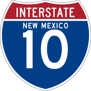
Interstate 10 (I-10) in the US state of New Mexico is a 164.264-mile route of the Interstate Highway System. I-10 traverses southern New Mexico through Hidalgo, Grant, Luna, and Doña Ana counties. The Interstate travels east–west from the Arizona state line to the interchange with I-25 in Las Cruces, and then travels north–south to the Texas state line. US Route 80 (US 80) was replaced by I-10 in the state.

U.S. Route 1 (US 1) in the U.S. state of Maine is a major north–south section of the United States Numbered Highway System, serving the eastern part of the state. It parallels the Atlantic Ocean from New Hampshire north through Portland, Brunswick, and Belfast to Calais, and then the St. Croix River and the rest of the Canada–United States border via Houlton to Fort Kent. The portion along the ocean, known as the Coastal Route, provides a scenic alternate to Interstate 95 (I-95).
U.S. Route 2 (US 2) is a part of the United States Numbered Highway System that is split into two segments, one between Washington and Michigan and the other between New York and Maine. In New Hampshire, US 2 runs 35.437 miles (57.030 km) from the Vermont state line at the Connecticut River in Lancaster east to the Maine state line in Shelburne. US 2 is the main highway through the White Mountains across southern Coös County, where it also passes through Jefferson, Randolph, and Gorham. US 2 is the main connection between the Coös county seat of Lancaster, where the highway intersects US 3, and the county's largest city, Berlin, via its connection with New Hampshire Route 16 (NH 16) in Gorham.

U.S. Route 27 (US 27) in Kentucky runs 201.120 miles (323.671 km) from the Tennessee border to the Ohio border at Cincinnati. It crosses into the state in the Lake Cumberland area, passing near or through many small towns, including Somerset, Stanford, and Nicholasville. The road then passes straight through the heart of Lexington, including past the University of Kentucky (UK) and Transylvania University. North of Lexington, it passes through Cynthiana and Falmouth before entering Campbell County and passing through many Northern Kentucky suburbs before ending at the Ohio state line on the Taylor–Southgate Bridge in Cincinnati.

U.S. Route 127 (US 127) in Kentucky runs 207.7 miles (334.3 km) from the Tennessee state line in rural Clinton County to the Ohio state line in Cincinnati. The southern portion of the route is mostly rural, winding through various small towns along the way. It later runs through the state capital of Frankfort before continuing north, eventually passing through several Cincinnati suburbs in Northern Kentucky, joining US 42 near Warsaw and US 25 in Florence before crossing the Ohio River via the Clay Wade Bailey Bridge.

U.S. Route 202 Business is a 10-mile (16 km) business route of US 202 in Montgomery and Bucks counties in the U.S. state of Pennsylvania, running between Montgomeryville and Doylestown. The route heads northeast from US 202 in Upper Gwynedd Township along five-lane Dekalb Pike through residential and commercial areas. In Montgomeryville, the route turns north to run concurrent with Pennsylvania Route 309 on five-lane Bethlehem Pike past several businesses. US 202 Bus. splits from PA 309 by turning northeast onto two-lane Doylestown Road. The route crosses into Bucks County and becomes Butler Avenue, passing through Chalfont and New Britain and curving east. West of Doylestown, the business route ends at an interchange with PA 611 in Doylestown Township.


