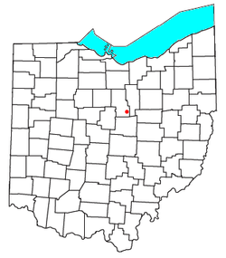
This area of present day Ohio was first inhabited by tribes such as the Wyandots, Iroquois, Shawnee, and Delawares. These groups grew crops such as corn, beans, squash, and other crops to complement a diet of hunted meat.[1] The tribes generally inhabited fixed villages with traditional long houses in small groups that responded to the topography and natural resources available in a certain area. Native American Tribes were expelled during the Indian removal following the Treaty of Greenville. Newville was then founded by John Frederick Herring and was platted in December 1823. It is situated upon section three, Worthington Township. Abraham Nye was one of the first settlers there, and was instrumental in inducing Mr. Herring to lay out the town. Newville lies in a small valley at the confluence of Slater's Run with the Clearfork of the Mohican River, nearly surrounded by tree-covered hills.
A photo of Newville from 1937
In 1811–12, John Frederick Herring built the second grist mill in Richland County. This mill was situate on the Clearfork, four miles west of Bellville, in what is now Perry township. Peter Weirick was employed to do the carpenter work, and while he was erecting the building, Mr. Herring drove to Baltimore with a six-horse team to procure burrs, wheels and gearings for the mill. After operating this mill for several years, Mr. Herring sold the same to Francis Baughman in 1815. In 1833, Mr. Baughman disposed of this property to John Hanawalt, who operated the same for about fifty years, and the mill is known in history as “Hanawalt’s.” This mill stood where the Lexington and Fredericktown road crosses the Clearfork.
After selling the mill west of Bellville, Mr. Herring entered another millsite, also on the Clearfork, fifteen miles down the stream, where he erected his second grist mill, and a few years later laid out the town of Newville.
The first settlers in Newville and vicinity were John Frederick Herring, Abraham Nye, Michael Hogan, Daniel Carpenter, George Armentrout and Luther Richard. Abraham Nye was the first tavern keeper, Daniel Stoner the first blacksmith and Michael Hogan the first merchant. Newville was named after Newville, Pennsylvania, the native place of the founder of the town.
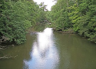
At the time Newville was laid out, the volume of water in the Clearfork of the Mohican was larger than it is now, and the pioneers were wont to found towns along streams of water, for mill-power and other purposes. Great things and a bright future were predicted for the town, but the hopes entertained for its future greatness were never realized in the scramble for new counties back in the “forties.”
The early settlers of the Newville country came, mostly, along the old Wyandot trail, following up the Mohican and its Clearfork to Newville. Some of the later arrivals came along the Portage road - a military road cut through by a portion of General Harrison’s army in 1812. This road runs diagonally across Worthington township from the northeast to southwest. This was probably the first road in the township, and although it has been changed in certain places to conform to local conditions, it is still a public highway.[2]
People
Samuel J. Kirkwood was one of the first school-teachers of the village. Mr. Kirkwood read law, became prosecuting attorney of Richland county, and after the close of his term, removed to Iowa, became governor of that state; was later a senator in the congress of the United States and closed his official career as a member of the Garfield cabinet.
Joseph Musgrave, once a Newville merchant, was a state senator from the Ashland district in 1856–57.
The late Major George F. Carpenter, lawyer and banker, was a son of the Daniel Carpenter, the promoter of the early business interests of Newville. Major Carpenter was one of the charter members of the Richland County Historical society and its first vice president.
Daniel Carpenter, father of W. B. Carpenter, of Mansfield, was one of the principal promoters of the business and industrial interests of Newville. He had a store of general merchandise and founded and operated a tannery and an ashery. To further the business interests of the town, Daniel Carpenter founded an “ashery,” and manufactured another exportable commodity - pearl ash. His teams traversed the country for miles around, buying ashes of the farmers, thus adding to their income.
Among the early industries, was pennyroyal distilleries, dotted here and there over the pennyroyal regions of Ohio. Pennyroyal grew in profusion in the southern part of the country in the earliest days. It is a deciduous, herbaceous plant, aromatic, with a pungent taste. The pennyroyal after being gathered, was allowed to wilt until it would pack well, and was then tramped down carefully in a steam chest until it was full. The oil is in small globules on the under side of the leaf. When set free by steam, it passed into a condenser, into which a small stream of cold water was conducted. After being condensed, it was poured into an oil vat, nearly filled with water. The oil being lighter than the water, ran into the vessel and passed out into a receiver. Pennyroyal oil is used for its medicinal properties, and was thought by the pioneers to be valuable as a carminative remedy. The last pennyroyal distillery in this part of the county was Fisher’s at Palmyra, five miles south of Bellville. At the Fisher distillery, essence of peppermint was also distilled.
In the 1940s, the U.S. Corps of Engineers built a dam on the Mohican river, that would under some circumstances, cause the town to be flooded, and it was ordered abandoned. Some of the foundations and buildings are still standing in the forest just west of the lake.
Related Research Articles
Richland County is a county located in the U.S. state of Ohio. As of the 2020 census, the population was 124,936. Its county seat is Mansfield. The county was created in 1808 and later organized in 1813. It is named for the fertile soil found there.
Bellville is a village in Richland County in the U.S. state of Ohio. It is part of the Mansfield, Ohio Metropolitan Statistical Area. The population was 1,963 at the 2020 census.
Butler is a village in Richland County in the U.S. state of Ohio. It is part of the Mansfield, Ohio Metropolitan Statistical Area. The population was 941 at the 2020 census.
Lexington is a village along the Clear Fork River in Troy Township and Washington Township in Richland County in the U.S. state of Ohio. It is part of the Mansfield, Ohio Metropolitan Statistical Area. The population was 4,848 at the 2020 census.
Lucas is a village in southeastern Richland County, Ohio, United States. Lucas is part of the Mansfield, Ohio Metropolitan Statistical Area. The population was 589 at the 2020 census.
Winchester is a ghost town in Worthington Township, Richland County, Ohio, United States, along the Clear Fork River. It was established south of Newville.
New Haven Township is one of the nineteen townships of Huron County, Ohio, United States. As of the 2020 census the population of the township was 2,409.
Green Township is one of the fifteen townships of Ashland County, Ohio, United States. The population was 3,676 at the 2020 census.
Hanover Township is one of the fifteen townships of Ashland County, Ohio, United States. The population was 2,467 at the 2020 census.
Vermillion Township is one of the fifteen townships of Ashland County, Ohio, United States. The population was 2,558 at the 2020 census.
The Black Fork is a principal tributary of the Mohican River, 58.4 miles (94.0 km) long, in north-central Ohio in the United States. Via the Mohican, Walhonding, Muskingum and Ohio Rivers, it is part of the watershed of the Mississippi River, draining an area of 351 square miles (910 km2). According to the Geographic Names Information System, it has also been known historically as "Armstrongs Creek" and "Black Fork Creek".
The Clear Fork is a principal tributary of the Mohican River, 36.6 miles (58.9 km) long, in north central Ohio in the United States. Via the Mohican, Walhonding, Muskingum and Ohio Rivers, it is part of the watershed of the Mississippi River, draining an area of 219 square miles (570 km2). According to the Geographic Names Information System, it has also been known historically as "Clear Creek" and as "Clear Fork Mohecan Creek".
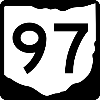
State Route 97 (SR 97) is a 34.57-mile (55.64 km) state route that runs between Galion and south of Loudonville in the US state of Ohio. Most of the route is a rural two-lane highway and passes through woodland, farmland and residential areas. For some of its path, SR 97 runs near the Clear Fork Mohican River. The highway was first signed in 1923 on a section of the current alignment. The route has been extended a few times; the first in 1926 extending the route to SR 3. The first section of road was paved in 1938. Another extension happened in 1939 with the route heading west to Galion. The final section paved was completed in the mid-1950s.
State Route 546 is a north–south state highway in the northern portion of the U.S. state of Ohio. The southern terminus of SR 546 is at a T-intersection with SR 13 nearly two and a half miles (4.0 km) north of Fredericktown. Its northern terminus is at a signalized intersection with the U.S. Route 42 (US 42)/SR 97 concurrency in Lexington.
New Haven is an unincorporated community and census-designated place (CDP) in central New Haven Township, Huron County, Ohio, United States. As of the 2020 census the population was 356. It has a post office with the ZIP code 44850. It lies at the intersection of U.S. Route 224 with State Routes 61 and 598.
The Mansfield–Ashland–Bucyrus, OH Combined Statistical Area is a CSA in the U.S. state of Ohio, as defined by the United States Census Bureau. It consists of the Mansfield Metropolitan Statistical Area ; and the Bucyrus–Galion Micropolitan Statistical Area, and, since 2020, the Ashland Micropolitan Statistical Area. As of the 2020 Census, the CSA had a population of 219,408.
Lenape settlements are villages and other sites founded by Lenape people, a Native American tribe from the Northeastern Woodlands. Many of these sites are located in Ohio and Pennsylvania.
Moshers Mill is a ghost town in Gilead Township, Morrow County, in the U.S. state of Ohio.
Mohicanville is an unincorporated community in Ashland County, in the U.S. state of Ohio.
This page is based on this Wikipedia article Text is available under the CC BY-SA 4.0 license; additional terms may apply. Images, videos and audio are available under their respective licenses.