Olivesburg, Ohio

Last updated

Olivesburg, Ohio
OHMap-doton-Olivesburg.png
Location of Olivesburg, Ohio
Coordinates: 40°53′09″N82°25′44″W / 40.88583°N 82.42889°W / 40.88583; -82.42889
Country United States
State Ohio
County Richland
Township Weller
Elevation
[1]
1,073 ft (327 m)
Time zone UTC-5 (Eastern (EST))
  Summer (DST) UTC-4 (EDT)
GNIS feature ID1065203 [1]

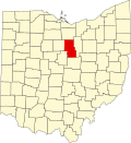
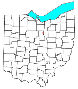
Olivesburg is an unincorporated community in northeastern Weller Township, Richland County, Ohio, United States. It is part of the Mansfield Metropolitan Statistical Area. The town is on the bank of the Whetstone Creek, about two miles north of its junction with the Blackfork of the Mohican River. The community is served by the Ashland (44805) post office. [2]

Contents

Today, the town consists of little more than a general store. It has an advertising sign posted for Olivesburg Dynamite, indicating the town once had a manufacturer of explosives. [3] The store serves today as a convenience store selling to tourists visiting the Amish country of Ohio; they offer a t-shirt claiming Olivesburg is the Road Apple Capital. [4]

Population of Olivesburg is officially posted on a state highway sign on as 813, though it would be hard to confirm since the same sign has been there since the early 1970s. [5]

Schools

The Olivesburg area is served by the Crestview Local School District located at 1545 State Route 96 in Richland County just a few miles west of Olivesburg. The independent school district boasts recently built Crestview High School, Crestview Middle School (located in the old high school) and recently built Crestview Elementary (which consolidated aging Savannah Elementary and Union Elementary schools) all located on the same campus. [6]

History

Olivesburg General Store Est.1840 Olivesburg.jpg
Olivesburg General Store Est.1840

Olivesburg was laid out by Benjamin Montgomery in 1816, and was named for his daughter, Olive. [7] By 1821 Benjamin Montgomery's tavern had been joined by Abel Montgomery's blacksmith shop, John Gun's tailor shop, Thomas Beach's cabinet shop, and Joseph Burget's tannery. [7]

The Olivesburgh post office was established in 1828 [8] and the Oliveburg General Store claims to have been founded in 1840, [9]

The 1873 county plat [10] shows the town to be the principal village of Weller Township, and refers to it as Olivesburgh in the text, Olivesburg in the map. Any confusion about the spelling of the name was resolved 1890 by the United States Board on Geographic Names, [11] which required that all burghs change their name to "burg" instead.

The Olivesburgh Post Office opened on February 6, 1828, changing its name to Olivesburg Post Office on August 8, 1893. [8] The post office was closed on September 14, 1907, with mail handled by the Ashland Post Office. [8]

Related Research Articles

<span class="mw-page-title-main">Richland County, Ohio</span> County in Ohio, United States

Richland County is a county located in the U.S. state of Ohio. As of the 2020 census, the population was 124,936. Its county seat is Mansfield. The county was created in 1808 and later organized in 1813. It is named for the fertile soil found there.

<span class="mw-page-title-main">Ashland, Kentucky</span> City in Kentucky, United States

Ashland is a home rule-class city in Boyd County, Kentucky, United States. The largest city in Boyd County, Ashland is located upon a southern bank of the Ohio River at the state border with Ohio and near West Virginia. The population was 21,625 at the 2020 census. Ashland is a principal city of the Huntington–Ashland metropolitan area, referred to locally as the "Tri-State area", home to 376,155 residents as of 2020. Ashland serves as an important economic and medical center for northeastern Kentucky.

<span class="mw-page-title-main">Galion, Ohio</span> City in Ohio, United States

Galion is a city in Crawford, Morrow, and Richland counties in the U.S. state of Ohio. The population was 10,453 at the 2020 census. Galion is the second-largest city in Crawford County after Bucyrus.

<span class="mw-page-title-main">Bellville, Ohio</span> Village in Ohio, United States

Bellville is a village in Richland County in the U.S. state of Ohio. It is part of the Mansfield, Ohio Metropolitan Statistical Area. The population was 1,963 at the 2020 census.

<span class="mw-page-title-main">Butler, Ohio</span> Village in Ohio, United States

Butler is a village in Richland County in the U.S. state of Ohio. It is part of the Mansfield, Ohio Metropolitan Statistical Area. The population was 941 at the 2020 census.

<span class="mw-page-title-main">Lexington, Ohio</span> Village in Ohio, United States

Lexington is a village along the Clear Fork River in Troy Township and Washington Township in Richland County in the U.S. state of Ohio. It is part of the Mansfield, Ohio Metropolitan Statistical Area. The population was 4,848 at the 2020 census.

<span class="mw-page-title-main">Lucas, Ohio</span> Village in Ohio, United States

Lucas is a village in southeastern Richland County, Ohio, United States. Lucas is part of the Mansfield, Ohio Metropolitan Statistical Area. The population was 589 at the 2020 census.

<span class="mw-page-title-main">Mansfield, Ohio</span> City in Ohio, United States

Mansfield is a city in and the county seat of Richland County, Ohio, United States. Located midway between Columbus and Cleveland via Interstate 71, it is part of Northeast Ohio region in the western foothills of the Allegheny Plateau. The 2020 Census showed that the city had a total population of 47,534, making it the 21st-largest city in Ohio. It lies approximately 65 miles (105 km) southwest of Cleveland, 45 miles (72 km) southwest of Akron and 65 miles (105 km) northeast of Columbus.

<span class="mw-page-title-main">Ontario, Ohio</span> City in Ohio, United States

Ontario is a city in Richland County in the U.S. state of Ohio. It was founded in 1834 on the western edge of the Allegheny Plateau, just west of the city of Mansfield. After being incorporated in 1958, Ontario became a heavy manufacturing center because of the Erie Railroad line, and its proximity to Mansfield. However, its status in that regard began to decline in the late 20th century, when much of the Erie Railroad that once ran through the city was abandoned; and shifts in the manufacturing industry led to the relocation or repositioning of many factories. The city's industry has since diversified into the service economy, including education, finance and healthcare. The city is also a major regional retail hub serving the entire North-Central Ohio area, with a shopping population of over 150,000.

<span class="mw-page-title-main">Mifflin Township, Richland County, Ohio</span> Township in Ohio, United States

Mifflin Township is one of the eighteen townships of Richland County, Ohio, United States. It is a part of the Mansfield Metropolitan Statistical Area. The 2020 census found 6,106 people in the township.

Crestview High School is a public high school in Weller Township, just west of Ashland, Ohio, United States. It is the only high school in the Crestview Local School District. The high school enrolled 416 students as of the 2006-2007 academic year.

<span class="mw-page-title-main">Black Fork Mohican River</span> River in the United States

The Black Fork is a principal tributary of the Mohican River, 58.4 miles (94.0 km) long, in north-central Ohio in the United States. Via the Mohican, Walhonding, Muskingum and Ohio Rivers, it is part of the watershed of the Mississippi River, draining an area of 351 square miles (910 km2). According to the Geographic Names Information System, it has also been known historically as "Armstrongs Creek" and "Black Fork Creek".

Crestview Local School District is a public school district serving students in the northeastern part of Richland County just north of the city of Mansfield and the northwestern part of Ashland County just northwest of the city of Ashland in the U.S. state of Ohio. Municipalities and townships that are included in the school district in Richland County are northern parts of the city of Mansfield, most of Franklin Township, all of Weller Township, all of Butler Township, and southern parts of Blooming Grove Township. Municipalities and townships that are included in the school district in Ashland County are the villages of Savannah and Bailey Lakes, most of Clear Creek Township, and northwestern parts of Orange Township. The school district enrolls 1,256 students as of the 2007–2008 academic year.

<span class="mw-page-title-main">Bannock, Ohio</span> Unincorporated community in Ohio, United States

Bannock is a census-designated place in northwestern Richland Township, Belmont County, Ohio, United States, along Wheeling Creek. As of the 2020 census it had a population of 159. It has a post office with the ZIP code 43972. It lies along State Route 331.

The Mansfield–Ashland–Bucyrus, OH Combined Statistical Area is a CSA in the U.S. state of Ohio, as defined by the United States Census Bureau. It consists of the Mansfield Metropolitan Statistical Area ; and the Bucyrus–Galion Micropolitan Statistical Area, and, since 2020, the Ashland Micropolitan Statistical Area. As of the 2020 Census, the CSA had a population of 219,408.

<span class="mw-page-title-main">Ohio Cardinal Conference</span>

The Ohio Cardinal Conference, which began play in 2003, is an OHSAA athletic league whose members are from Ashland, Holmes, Richland, and Wayne counties in Ohio. The conference name stems from the local legacy of the Cardinal Conference.

The Mansfield Metropolitan Statistical Area, as defined by the United States Census Bureau, is an area consisting of one county – Richland – in north central Ohio, anchored by the city of Mansfield. As of the 2020 census, the MSA had a population of 124,936. The MSA forms the eastern half of the Mansfield–Ashland–Bucyrus, OH CSA.

<span class="mw-page-title-main">Firelands Conference</span>

The Firelands Conference is an Ohio High School Athletic Association (OHSAA) athletic league located in north-central Ohio. The league was formed in the 1960–61 school year and is named for the Firelands area of the old Western Reserve, where most of the member schools reside. High schools in this conference are located in Ashland, Huron, and Richland counties. Some of the schools' district boundaries extend into the neighboring counties of Crawford, Erie, and Lorain. Most of the founding schools came from the defunct Huron-Erie League.

<span class="mw-page-title-main">Shawn Grate</span> American serial killer on death row

Shawn Michael Grate is an American serial killer and rapist who was sentenced to death for the murders of five young women in and around northern Ohio from 2006 to 2016. Grate was convicted on two counts of aggravated murder on May 7, 2018, in Ashland County, pleaded guilty to two additional murders on March 1, 2019, in Richland County, and pleaded guilty to an additional murder on September 11, 2019, in Marion County.

Lincoln Heights is an unincorporated area and census-designated place (CDP) in Richland County, Ohio, United States. It was first listed as a CDP prior to the 2020 census.

References

  1. 1 2 U.S. Geological Survey Geographic Names Information System: Olivesburg, Ohio
  2. Zip Code Lookup
  3. History retrieved September 8, 2006 from http://www.olivesburg.com
  4. Feature retrieved September 8, 2006 from http://www.olivesburg.com
  5. the sign is posted on State Route 545 coming from Mansfield and also entering the town from State Route 96.
  6. "About CHS - Crestview Local School District". Archived from the original on October 29, 2010. Retrieved May 13, 2010.
  7. 1 2 Olivesburg history retrieved September 8, 2006 from http://www.rootsweb.com/~ohrichla/Hist-Olivesburg1903.htm
  8. 1 2 3 U.S. Geological Survey Geographic Names Information System: Olivesburg retrieved September 8, 2006
  9. General Store retrieved September 8, 2006 from http://www.olivesburg.com
  10. Atlas Map of Richland County, Ohio. Compiled, Drawn & Published from Personal Graminations & Surveys by A.T. Andreas. Chicago, Ill., 1873, p. 36-37. retrieved September 8, 2006 from http://www.rootsweb.com/~ohrichla/1873PlatBook/Weller.htm
  11. United States Board on Geographic Names Policy of the Board retrieved September 8, 2006 from http://www.carnegielibrary.org/exhibit/hname6.html Archived 2007-09-27 at the Wayback Machine