
Alberschwende is a municipality and a village in the district of Bregenz in the Austrian state of Vorarlberg.

Admont is a town in the Austrian state of Styria. It is historically most notable for Admont Abbey, a monastery founded in 1074.

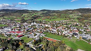
Weiz is a town in the eastern part of the Austrian state of Styria.

Satteins is a town in the Austrian state of Vorarlberg.
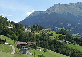
Bartholomäberg is a municipality and a village in the district of Bludenz in the Austrian state of Vorarlberg.

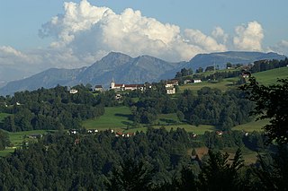
Oberdrauburg is a market town in the district of Spittal an der Drau at the western rim of the Austrian state of Carinthia.

Lassee is a town in the district of Gänserndorf in the Austrian state of Lower Austria.

Artstetten-Pöbring is a town in the district of Melk in the Austrian state of Lower Austria.
Pöggstall is a town in the district of Melk in the Austrian state of Lower Austria.

Herzogenburg is a town in the district of Sankt Pölten-Land in the Austrian state of Lower Austria.

Blons is a municipality in the district of Bludenz in Austrian state of Vorarlberg.

Bludesch is a municipality in the district of Bludenz in the Austrian state of Vorarlberg.

Sankt Gallenkirch is a municipality in the district of Bludenz in the Austrian state of Vorarlberg.

Silbertal is a municipality in the district of Bludenz in the Austrian state of Vorarlberg.
Sonntag is a municipality in the district of Bludenz in the Austrian state of Vorarlberg.
Buch is a municipality in the district of Bregenz in the Austrian state of Vorarlberg.

Höchst is a municipality in the district of Bregenz in the Austrian state of Vorarlberg.

Koblach is a municipality in the district of Feldkirch in the Austrian state of Vorarlberg.
Altschwendt is a municipality in the district of Schärding in the Austrian state of Upper Austria.

Bad Gleichenberg is a municipality in the district of Südoststeiermark in the Austrian state of Styria.


