Sillian

Last updated
Sillian
Sillian in Osttirol.jpg
Wappen at sillian.png
Sillian.png
Location within Lienz district
Austria Tyrol location map.svg
Red pog.svg
Sillian
Location within Austria
Austria adm location map.svg
Red pog.svg
Sillian
Sillian (Austria)
Coordinates: 46°45′10″N12°25′16″E / 46.75278°N 12.42111°E / 46.75278; 12.42111 Coordinates: 46°45′10″N12°25′16″E / 46.75278°N 12.42111°E / 46.75278; 12.42111
Country Austria
State Tyrol
District Lienz
Government
   Mayor Franz Schneider (ÖVP)
Area
[1]
  Total36.26 km2 (14.00 sq mi)
Elevation
1,103 m (3,619 ft)
Population
 (2018-01-01) [2]
  Total2,051
  Density57/km2 (150/sq mi)
Time zone UTC+1 (CET)
  Summer (DST) UTC+2 (CEST)
Postal code
9920
Area code 04842
Vehicle registration LZ
Website www.marktgemeinde-sillian.at

Sillian is a market town in the district of Lienz, in the Austrian state of Tyrol.

Contents

Geography

The municipality, at a height of about 1,100 m (3,600 ft), is the main settlement in the East Tyrolean Hochpustertal , the eastern part of the Puster Valley, stretching from Lienz up to the border with South Tyrol, Italy in the west. The settlement is situated north of the upper Drava river, on the sunny slopes of the Villgraten Mountains. In the south, the valley stretches to the Lienz Dolomites and the Carnic Alps.

Climate

The weather in Sillian is extremely changeable due to its location, and it can quickly change from warm and balmy to sub-zero.

Climate data for Sillian (1971–2000)
MonthJanFebMarAprMayJunJulAugSepOctNovDecYear
Record high °C (°F)11.5
(52.7)
17.0
(62.6)
21.0
(69.8)
23.0
(73.4)
27.8
(82.0)
30.0
(86.0)
33.5
(92.3)
31.0
(87.8)
29.0
(84.2)
25.4
(77.7)
17.4
(63.3)
13.0
(55.4)
33.5
(92.3)
Average high °C (°F)0.7
(33.3)
3.4
(38.1)
7.8
(46.0)
11.6
(52.9)
16.7
(62.1)
19.8
(67.6)
22.5
(72.5)
22.8
(73.0)
18.1
(64.6)
12.7
(54.9)
5.7
(42.3)
0.8
(33.4)
11.8
(53.2)
Daily mean °C (°F)−4.8
(23.4)
−3.0
(26.6)
1.0
(33.8)
4.9
(40.8)
10.0
(50.0)
13.2
(55.8)
15.6
(60.1)
14.8
(58.6)
11.0
(51.8)
5.8
(42.4)
−0.1
(31.8)
−4.3
(24.3)
5.3
(41.5)
Average low °C (°F)−8.7
(16.3)
−7.4
(18.7)
−3.7
(25.3)
−0.3
(31.5)
4.2
(39.6)
7.4
(45.3)
9.6
(49.3)
9.3
(48.7)
5.8
(42.4)
1.3
(34.3)
−3.8
(25.2)
−7.8
(18.0)
0.5
(32.9)
Record low °C (°F)−26.0
(−14.8)
−21.0
(−5.8)
−23.5
(−10.3)
−11.0
(12.2)
−14.0
(6.8)
−1.5
(29.3)
1.5
(34.7)
0.0
(32.0)
−5.2
(22.6)
−10.2
(13.6)
−22.0
(−7.6)
−20.0
(−4.0)
−26.0
(−14.8)
Average precipitation mm (inches)42.3
(1.67)
37.9
(1.49)
58.3
(2.30)
68.5
(2.70)
95.2
(3.75)
116.0
(4.57)
130.6
(5.14)
105.9
(4.17)
90.2
(3.55)
91.2
(3.59)
66.1
(2.60)
48.2
(1.90)
950.3
(37.41)
Average snowfall cm (inches)30.6
(12.0)
39.5
(15.6)
28.5
(11.2)
14.8
(5.8)
1.3
(0.5)
0.0
(0.0)
0.0
(0.0)
0.0
(0.0)
0.0
(0.0)
3.4
(1.3)
29.3
(11.5)
32.8
(12.9)
180.2
(70.9)
Average precipitation days (≥ 1.0 mm)5.65.16.48.311.913.612.812.08.57.56.66.1104.4
Average relative humidity (%) (at 14:00)64.450.143.641.244.246.044.848.049.154.259.571.851.4
Source: Central Institute for Meteorology and Geodynamics [3]

History

The area belonged to the estates granted by Duke Tassilo III of Bavaria to Innichen Abbey in 769. First mentioned about 1000, the estates of Silano were held by the Meinhardiner counts of Gorizia from the 13th century onwards. The parish church was consecrated in 1326. Count Leonhard of Gorizia vested the citizens with market privileges in 1469. Upon the extinction of the line in 1500, Sillian was seized by the House of Habsburg king Maximilian I and incorporated into the County of Tyrol.

Up to World War I, Sillian was a garrison town of the Austro-Hungarian Army. By the 1919 Treaty of Saint Germain, it became a border town close to the South Tyrolean lands of the Italian kingdom.

Population

Historical population
YearPop.±%
18691,417    
18801,258−11.2%
18901,202−4.5%
19001,224+1.8%
19101,240+1.3%
19231,249+0.7%
19341,396+11.8%
19391,425+2.1%
19511,671+17.3%
19611,948+16.6%
19711,988+2.1%
19812,004+0.8%
19911,997−0.3%
20012,082+4.3%
20112,073−0.4%

Notable people

Young Richard Strauss from 1872 onwards spent several summers at Sillian; he is purported to have played the church organ as well as the hotel piano of the Schwarzer Adler (Black Eagle) inn, and even to have composed here.[ citation needed ]

Economy

Sillian's economy mainly relies on wood processing and tourism. There are 1200 guest beds of all categories available.

Related Research Articles

Tyrol (state) State of Austria

Tyrol is a state (Land) in western Austria. It comprises the Austrian part of the historical Princely County of Tyrol. It is a constituent part of the present-day Euroregion Tyrol–South Tyrol–Trentino. The capital of Tyrol is Innsbruck.

Landeck Place in Tyrol, Austria

Landeck is a city in the Austrian state of Tyrol, the capital of the district of Landeck.

Spittal an der Drau Place in Carinthia, Austria

Spittal an der Drau is a town in the western part of the Austrian federal state of Carinthia. It is the administrative centre of Spittal an der Drau District, Austria's second largest district (Bezirk) by area.

Lienz Place in Tyrol, Austria

Lienz is a medieval town in the Austrian state of Tyrol. It is the administrative centre of the Lienz district, which covers all of East Tyrol. The municipality also includes the cadastral subdivision of Patriasdorf.

Krimml Place in Salzburg, Austria

Krimml is a municipality in Zell am See District, in the federal state of Salzburg, Austria, in the Pinzgau region.

Lofer Place in Salzburg, Austria

Lofer is a market town in the district of Zell am See in the Austrian state of Salzburg.

County of Tyrol Estate of the Holy Roman Empire (1140-1806); county of Austria (1806-1919)

The (Princely) County of Tyrol was an estate of the Holy Roman Empire established about 1140. After 1253, it was ruled by the House of Gorizia and from 1363 by the House of Habsburg. In 1804, the county of Tyrol, unified with the secularised prince-bishoprics of Trent and Brixen, became a crown land of the Austrian Empire. From 1867, it was a Cisleithanian crown land of Austria-Hungary.

County of Gorizia

The County of Gorizia, from 1365 Princely County of Gorizia, was a State of the Holy Roman Empire. Originally mediate Vogts of the Patriarchs of Aquileia, the Counts of Gorizia (Meinhardiner) ruled over several fiefs in the area of Lienz and in the Friuli region of northeastern Italy with their residence at Gorizia (Görz).

Dellach Place in Carinthia, Austria

Dellach is a municipality in the district of Hermagor, in the Austrian state of Carinthia.

Lesachtal Place in Carinthia, Austria

Lesachtal is a municipality in Hermagor District, in the Austrian state of Carinthia. It comprises the western part of the eponymous valley formed by the upper Gail River, and stretches from the Carinthian border with East Tyrol down to Kötschach-Mauthen in the east.

Greifenburg Place in Carinthia, Austria

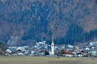
Greifenburg is a market town in the district of Spittal an der Drau in the Austrian state of Carinthia.

Lurnfeld Place in Carinthia, Austria

Lurnfeld is a market town in the district of Spittal an der Drau in the Austrian state of Carinthia. The municipality consists of the two Katastralgemeinden: Möllbrücke and Pusarnitz, comprising several small villages.

Mallnitz Place in Carinthia, Austria

Mallnitz is a municipality in the Spittal an der Drau District in Carinthia, Austria.

Oberdrauburg Place in Carinthia, Austria

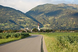
Oberdrauburg is a market town in the district of Spittal an der Drau at the western rim of the Austrian state of Carinthia.

Sachsenburg Place in Carinthia, Austria

Sachsenburg is a market town in the district of Spittal an der Drau in Carinthia, Austria.

Anras Place in Tyrol, Austria

Anras is a municipality in the district of Lienz in the Austrian state of Tyrol.

Tristach Place in Tyrol, Austria

Tristach is a municipality in the district of Lienz in the Austrian state of Tyrol.

Obertilliach Place in Tyrol, Austria

Obertilliach is a municipality in the district of Lienz, in the Austrian state of Tyrol.

Matrei in Osttirol Place in Tyrol, Austria

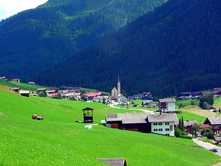
Matrei in Osttirol is a market town in the Lienz District in the Austrian state of Tyrol. It is situated about 29 km (18 mi) north of Lienz within the Hohe Tauern mountain range of the Central Eastern Alps. Its municipal area comprises parts of the Granatspitze Group and the Venediger Group, with the Großvenediger peak as its highest point. The population largely depends on tourism, seasonal agriculture and forestry.

Stams Place in Tyrol, Austria

Stams is a municipality in Imst District, in the Austrian state of Tyrol. It is chiefly known for Cistercian Stams Abbey, founded in 1273 by Count Meinhard II of Gorizia-Tyrol and his wife.

References

  1. "Dauersiedlungsraum der Gemeinden Politischen Bezirke und Bundesländer - Gebietsstand 1.1.2018". Statistics Austria. Retrieved 10 March 2019.
  2. "Einwohnerzahl 1.1.2018 nach Gemeinden mit Status, Gebietsstand 1.1.2018". Statistics Austria. Retrieved 9 March 2019.
  3. "Klimadaten von Österreich 1971–2000 – Tirol-Sillian" (in German). Central Institute for Meteorology and Geodynamics. Archived from the original on 12 October 2019. Retrieved 28 October 2019.