Anras

Last updated
Anras
Schloss Anras.jpg
Anras Castle with St Stephen's Church
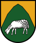
Wappen at anras.png
Anras.png
Location within Lienz district
Austria adm location map.svg
Red pog.svg
Anras
Location within Austria
Coordinates: 46°46′26″N12°33′39″E / 46.77389°N 12.56083°E / 46.77389; 12.56083 Coordinates: 46°46′26″N12°33′39″E / 46.77389°N 12.56083°E / 46.77389; 12.56083
Country Austria
State Tyrol
District Lienz
Government
   Mayor Anton Oberhofer
Area
[1]
  Total62.07 km2 (23.97 sq mi)
Elevation
1,261 m (4,137 ft)
Population
 (2018-01-01) [2]
  Total1,233
  Density20/km2 (51/sq mi)
Time zone UTC+1 (CET)
  Summer (DST) UTC+2 (CEST)
Postal code
9912
Area code 04846
Vehicle registration LZ
Website www.anras.at

Anras is a municipality in the district of Lienz in the Austrian state of Tyrol.
Contents

Geography

The settlement is situated in the East Tyrolean part of the Puster Valley, stretching along the upper Drava river between the Villgraten Mountains (Defereggen) in the north to the foothills of the Lienz Dolomites, the westernmost peaks of the Gailtal Alps. The farmsteads lie mostly on the sunny terraces or on the valley floor north of the Drava.

The municipal area comprises the cadastral communities of Anras proper, Asch-Winkl, and Ried.

History

From about 1200, Anras Castle was built as a summer residence of the Bishops of Brixen. In 1236, Emperor Frederick II granted them the surrounding Puster Valley estates up to the Lienz suburbs where they bordered the lands of the rivaling Counts of Gorizia.

In 1754, the castle was rebuilt in a Baroque style and served as the seat of the local administration. The territories were held by the Brixen prince-bishops until the secularisation of 1803. Today, the fertile soils of Anras are known as the East Tyrolean breadbasket.

Related Research Articles

<span class="mw-page-title-main">Brixen im Thale</span> Place in Tyrol, Austria

Brixen im Thale is a municipality situated at the highest point of the Brixental valley in the Austrian state of Tyrol. Every year on the Feast of Corpus Christi, the village celebrates the traditional Antlassritt. It is also the birthplace of Matthäus Hetzenauer, an Austrian sniper in the 3rd Mountain Division on the Eastern Front of the World War II, who was credited with 345 kills.

<span class="mw-page-title-main">Malta, Austria</span> Place in Carinthia, Austria

Malta is a municipality and a village in the district of Spittal an der Drau, in the Austrian state of Carinthia.

The Bezirk Lienz is an administrative district (Bezirk) in Tyrol, Austria. It is the only district in East Tyrol. The district borders the Pinzgau (Salzburg) in the north, the districts Spittal an der Drau and Hermagor in the east, Veneto (Italy) in the south, and South Tyrol (Italy) in the west.

<span class="mw-page-title-main">Lienz</span> Place in Tyrol, Austria

Lienz is a medieval town in the Austrian state of Tyrol. It is the administrative centre of the Lienz district, which covers all of East Tyrol. The municipality also includes the cadastral subdivision of Patriasdorf.

<span class="mw-page-title-main">Puster Valley</span> District in Italy

The Puster Valley is one of the largest longitudinal valleys in the Alps that runs in an east-west direction between Lienz in East Tyrol, Austria, and Mühlbach near Brixen in South Tyrol, Italy. The South Tyrolean municipalities of the Puster Valley constitute the Puster Valley district.

<span class="mw-page-title-main">House of Gorizia</span> Noble family in the Holy Roman Empire

The Counts of Gorizia, also known as the Meinhardiner, were a comital, princely and ducal dynasty in the Holy Roman Empire. Named after Gorizia Castle in Gorizia, they were originally "advocates" (Vogts) in the Patriarchate of Aquileia who ruled the County of Gorizia (Görz) from the early 12th century until the year 1500. Staunch supporters of the Emperors against the papacy, they reached the height of their power in the aftermath of the battle of Marchfeld between the 1280s and 1310s, when they controlled most of contemporary Slovenia, western and south-western Austria and north-eastern Italy mostly as (princely) Counts of Gorizia and Tyrol, Landgraves of Savinja and Dukes of Carinthia and Carniola. After 1335, they began a steady decline until their territories shrunk back to the original County of Gorizia by the mid 1370s. Their remaining lands were inherited by the Habsburg ruler Maximilian I.

<span class="mw-page-title-main">Lesachtal</span> Place in Carinthia, Austria

Lesachtal is a municipality in Hermagor District, in the Austrian state of Carinthia. It comprises the western part of the eponymous valley formed by the upper Gail River, and stretches from the Carinthian border with East Tyrol down to Kötschach-Mauthen in the east.

<span class="mw-page-title-main">Berg im Drautal</span> Place in Carinthia, Austria

Berg im Drautal is a village and municipality in the district of Spittal an der Drau in the Austrian state of Carinthia.

Lendorf is a municipality in the district of Spittal an der Drau in the Austrian state of Carinthia.

<span class="mw-page-title-main">Lurnfeld</span> Place in Carinthia, Austria

Lurnfeld is a market town in the district of Spittal an der Drau in the Austrian state of Carinthia. The municipality consists of the two Katastralgemeinden: Möllbrücke and Pusarnitz, comprising several small villages.

<span class="mw-page-title-main">Oberdrauburg</span> Place in Carinthia, Austria

Oberdrauburg is a market town in the district of Spittal an der Drau at the western rim of the Austrian state of Carinthia.

<span class="mw-page-title-main">Sachsenburg</span> Place in Carinthia, Austria

Sachsenburg is a market town in the district of Spittal an der Drau in Carinthia, Austria.

<span class="mw-page-title-main">Paternion</span> Place in Carinthia, Austria

Paternion is a market town in the district of Villach-Land in the Austrian state of Carinthia. It is located within the Drava valley about 18 kilometres (11 mi) in the north-west of the city of Villach.

<span class="mw-page-title-main">Sillian</span> Place in Tyrol, Austria

Sillian is a market town in the district of Lienz, in the Austrian state of Tyrol.

<span class="mw-page-title-main">Tristach</span> Place in Tyrol, Austria

Tristach is a municipality in the district of Lienz in the Austrian state of Tyrol.

<span class="mw-page-title-main">Kartitsch</span> Place in Tyrol, Austria

Kartitsch is a municipality in the district of Lienz in the Austrian state of Tyrol.

<span class="mw-page-title-main">Obertilliach</span> Place in Tyrol, Austria

Obertilliach is a municipality in the district of Lienz, in the Austrian state of Tyrol.

<span class="mw-page-title-main">Matrei in Osttirol</span> Place in Tyrol, Austria

Matrei in Osttirol is a market town in the Lienz District in the Austrian state of Tyrol. It is situated about 29 km (18 mi) north of Lienz within the Hohe Tauern mountain range of the Central Eastern Alps. Its municipal area comprises parts of the Granatspitze Group and the Venediger Group, with the Großvenediger peak as its highest point. The population largely depends on tourism, seasonal agriculture and forestry.

<span class="mw-page-title-main">Drava Valley Railway</span>

The Drava Valley Railway is an east–west railway running along the Drava. It runs from Maribor to Innichen, where it merges into the Puster Valley Railway to Franzensfeste (Fortezza). It starts in northern Slovenia, crosses Carinthia and East Tyrol and ends in South Tyrol. The Klagenfurt–Bleiburg section has been rebuilt as part of the Koralm Railway, which follows the Jaun Valley Railway (Jauntalbahn) from Bleiburg. Like the rest of the line in Slovenia, this section of the line has one track and is unelectrified.

<span class="mw-page-title-main">Puster Valley Railway</span> Railway line in South Tyrol, Italy

The Puster Valley Railway is a standard gauge, single-track railway line in the Puster Valley between Franzensfeste and Innichen, South Tyrol, Italy. The line branches off the Brenner Railway in Franzensfeste and runs via Bruneck and Toblach to Innichen, where it continues as the Drava Valley Railway (Drautalbahn).

References

  1. "Dauersiedlungsraum der Gemeinden Politischen Bezirke und Bundesländer - Gebietsstand 1.1.2018". Statistics Austria. Retrieved 10 March 2019.
  2. "Einwohnerzahl 1.1.2018 nach Gemeinden mit Status, Gebietsstand 1.1.2018". Statistics Austria. Retrieved 9 March 2019.