Nongtalang

Last updated

Nongtalang
Nongtelang
Town
India Meghalaya location map.svg
Red pog.svg
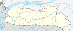
Nongtalang
Location in Meghalaya, India
India location map.svg
Red pog.svg
Nongtalang
Nongtalang (India)
Coordinates: 25°12′33″N92°04′01″E / 25.209300°N 92.066846°E / 25.209300; 92.066846
Country Flag of India.svg  India
State Meghalaya
District West Jaintia Hills
Population
  Total5,595
Languages
  Official War, Khasi & English
Time zone UTC+5:30 (IST)
PIN
793 109

Nongtalang is a predominantly rural town with a population of around 5,595 people approx located in West Jaintia Hills district, Meghalaya, India. It is about 42 kilometers from the district headquarters of Jowai and 98 kilometers from the state capital of Shillong. Nongtalang is well connected by roadways to both cities.

Contents

View of Nongtalang Town from above IMAG3737.jpg
View of Nongtalang Town from above

The town is home to a number of educational institutions and Health care Centre like Nongtalang Community Health Center (CHC). [1] The Nongtalang College, a private college run by the village Council (Village Durbar of Nongtalang), is one of the oldest and most prestigious colleges in Meghalaya.

Nongtalang is a popular tourist destination, especially for its natural beauty. The town is surrounded by hills and forests, and there are a number of waterfalls and the Rbang Amkhlew Living Root Bridge. [2]

The people of Nongtalang are mostly War-Jaintias, a tribal group native to Meghalaya. The town is known for its rich culture and heritage. They also have a unique language and religion.

Nongtalang is a peaceful and quiet town with a lot to offer visitors. It is a great place to relax and enjoy the beauty of nature.

Connectivity

Nongtalang is well connected by roadways to Shillong and Jowai. Shillong is 98 km away and Jowai is 42 km away. [3]

View of Nongtalang Khlachympa at Nongtalang Town from above. IMAG3739.jpg
View of Nongtalang Khlachympa at Nongtalang Town from above.

Communication services

Fixed telephone lines are not available in this small town. Internet services are available only through wireless broadband. It is only two cellular providers available i.e. Bharti Airtel 5G & Jio 5G.

Institutions in Nongtalang

Colleges and Institution providing higher studies
Nongtalang College Nongtalang College.jpg
Nongtalang College

Prominent schools and higher secondary institutions

Localities in Nongtalang

Places of interest

Related Research Articles

<span class="mw-page-title-main">Meghalaya</span> State in northeastern India

Meghalaya is a state in northeast India. Meghalaya was formed on 21 January 1972 by carving out two districts from the state of Assam: (a) the United Khasi Hills and Jaintia Hills and (b) the Garo Hills. The population of Meghalaya as of 2014 is estimated to be 3,211,474. Meghalaya covers an area of approximately 22,429 square kilometres, with a length-to-breadth ratio of about 3:1.

<span class="mw-page-title-main">Shillong</span> City and state capital of Meghalaya, India

Shillong is a hill station and the capital of Meghalaya, a state in northeastern India. It is the headquarters of the East Khasi Hills district. Shillong is the 330th most populous city in India with a population of 143,229 according to the 2011 census. It is said that the rolling hills around the town reminded the British of Scotland. Hence, they would also refer to it as the "Scotland of the East".

<span class="mw-page-title-main">East Khasi Hills district</span> District of Meghalaya in India

East Khasi Hills is an administrative district in the state of Meghalaya in India. The district headquarters are located at Shillong. The district occupies an area of 2752 km² and has a population of 825,922. As of 2011, it is the most populous district of Meghalaya's 12 districts.

<span class="mw-page-title-main">Khasi Hills</span> Region in Meghalaya, India

The Khasi Hills are a low mountain formation on the Shillong Plateau in the Meghalaya state of India. The Khasi Hills are part of the Garo-Khasi-Jaintia range and connect with the Purvanchal Range and larger Patkai Range further east. The Khasi Hills, and the whole Garo-Khasi-Jaintia range, are in the Meghalaya subtropical forests ecoregion.

<span class="mw-page-title-main">Jowai</span> Town in Meghalaya, India

Jowai is the headquarters of the West Jaintia Hills district of the state of Meghalaya, India, and is home to the Pnar, a sub-tribe of the Khasi people. It is located on a plateau surrounded on three sides by the Myntdu river bordering Bangladesh to the south. Due to its high altitude of 1365 m above sea level, Jowai experiences warm summers with cool to chilly winters.

Shri Hoping Stone Lyngdoh was an Indian politician who was the president of the Hill State People's Democratic Party (HSPDP), one of three official political parties of the state of Meghalaya in India. He was the son of late Hajur Shon; was born at Nonglait Village, West Khasi Hills District on March 15, 1929; he studied at St. Anthony's College, Shillong.

<span class="mw-page-title-main">Jaintiapur Upazila</span> Upazila in Sylhet, Bangladesh

Jaintiapur is an upazila of Sylhet District in the Division of Sylhet, Bangladesh.

Evelyn Norah "Rani" Shullai is an educationalist and a pioneer of Girl Guiding in India. She has received numerous awards including the Silver Star from the Indian government and the Silver Elephant from the Bharat Scouts and Guides. Shullai is the second Padma Shri recipient in Meghalaya, given in 1977.

The Roman Catholic Diocese of Jowai is a diocese located in the town of Jowai in the Ecclesiastical province of Shillong in India. In a land area of 3,819 square kilometers, the diocesan territory covers the districts of East and West Jaintia Hills in Meghalaya.

<span class="mw-page-title-main">Khasi Hills Autonomous District Council</span>

Khasi Hills Autonomous District Council (KHADC) is an autonomous district council in the state of Meghalaya in India. It covers West Khasi Hills district, Eastern West Khasi Hills district, East Khasi Hills district and Ri Bhoi district. It is one of the three autonomous district councils within Meghalaya, and one of twenty-five autonomous regions of India. Between its foundation on 27 June 1952 and 14 June 1973 it was known as the United Khasi-Jaintia Hills District Council. The total area of the Khasi Hills Autonomous District Council is 11,718 km2 having a population of 1,578,375 as of 2011.

<span class="mw-page-title-main">Dawki</span> Town in Meghalaya, India

Dawki or Dauki is a town in West Jaintia Hills district, Meghalaya, India.

George Gilbert Swell was a college professor, an Indian politician, an ambassador to several countries, a former Deputy Speaker of the Lok Sabha and its member from Shillong in Meghalaya. Over a span of more than 35 years, he represented India at high levels nationally and internationally. Though arising from a modest and rural background in far Northeast India, Swell quickly rose to prominence in every field he entered.

Martin Luther Christian University is a private university in Shillong, Meghalaya, India. The university is named after Martin Luther (1483–1546), the father of reformation. MLCU was established in July 2005; it is the first Christian university in India after more than two centuries of Christian education in the country that does not focus on theological training. The creation and functioning of the university is in accordance with the University Grants Commission Act, 1956, under Section 2(f).

<span class="mw-page-title-main">Northeast Adventist University</span>

North East Adventist University is a Seventh-day Adventist institution of higher learning seven (7) km from Jowai, India. It is a part of the Seventh-day Adventist education system, the world's second largest Christian school system. This institution was affiliated to the North Eastern Hill University (NEHU) from 1999 till 2019. It was upgraded to University on 29 April 2019 under the Northeast Adventist University Act, 2015.

North East India Christian Council (NEICC) is a Protestant ecumenical council of North East India, affiliated to the National Council of Churches in India as one of the regional councils in the year 1939.

<span class="mw-page-title-main">West Jaintia Hills district</span> District of Meghalaya in India

West Jaintia Hills is an administrative District in the state of Meghalaya in India. The united district was created on 22 February 1972 and occupied an area of 3819 km2. It had a population of 272,185. The district is part of the Meghalaya subtropical forests eco-region. With the bifurcation of the erstwhile Jaintia Hills District into East and West Jaintia Hills Districts, West Jaintia Hills District came into existence on 31 July 2012 with its headquarters at Jowai. Jowai is the host of all the heads of important governmental offices and establishments, educational institutions, hospitals, banking institutions, etc.

Saipung is a village in East Jaintia Hills district, Meghalaya, India. It is the headquarters of the Saipung Sub-Division. The population was 1,431 as per the 2011 Indian census. Located about 136 km from the state's capital Shillong, Saipung is inhabited by the Biate people.

<span class="mw-page-title-main">Hinduism in Meghalaya</span> Hinduism in the Indian state

Hinduism is a minority religion in the Meghalaya state of India constituting 12% of the state's population. The Nartiang Durga Temple in Meghalaya is one of the 51 Shakti peethas on Earth and is considered by Hindus of Meghalaya as the permanent abode of Goddess Durga. Hinduism is a popular religion practice by Rabhas, Hajongs, Kochs, Rajbongshis, Mikirs, Bengalis, Nepalis, Biharis etc.

<span class="mw-page-title-main">Eastern West Khasi Hills district</span> District in Meghalaya, India

Eastern West Khasi Hills is a district in the Indian state of Meghalaya, located approximately 25 kilometres (16 mi) west of the state capital of Shillong. It was created in 2021, after bifurcation of existing West Khasi Hills district. The territories which make up the district recorded a total population of 131,451 in the 2011 census. The district headquarters is the town of Mairang.

References

  1. Nongtalang Community Health Center
  2. Rbang Amkhlew Living Root Bridge
  3. "45.0 Km | Distance from Jowai to Nongtalang | CityMeter.net".
  4. Nongtalang College
  5. Nongtalang College Website
  6. "Colleges in Meghalaya: Department of Education, Government of Meghalaya".
  7. The Gazette of Meghalaya
  8. "Archived copy" (PDF). Archived from the original (PDF) on 7 May 2018. Retrieved 6 May 2018.{{cite web}}: CS1 maint: archived copy as title (link)
  9. MBOSE - Meghalaya Board of School Education