Nonio | ||
---|---|---|
Comune | ||
Comune di Nonio | ||
| ||
Coordinates: 45°50′N8°22′E / 45.833°N 8.367°E Coordinates: 45°50′N8°22′E / 45.833°N 8.367°E | ||
Country | Italy | |
Region | Piedmont | |
Province | Province of Verbano-Cusio-Ossola (VB) | |
Government | ||
• Mayor | Pierugo Pirall | |
Area | ||
• Total | 9.8 km2 (3.8 sq mi) | |
Elevation | 476 m (1,562 ft) | |
Population (30 November 2017) [1] | ||
• Total | 855 | |
• Density | 87/km2 (230/sq mi) | |
Demonym(s) | Noniesi | |
Time zone | CET (UTC+1) | |
• Summer (DST) | CEST (UTC+2) | |
Postal code | 28010 | |
Dialing code | 0323 | |
Website | Official website |
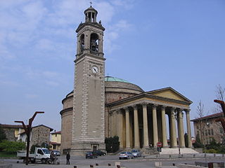
Nonio is a comune (municipality) in the Province of Verbano-Cusio-Ossola in the Italian region Piedmont, located about 100 kilometres (62 mi) northeast of Turin and about 15 kilometres (9 mi) southwest of Verbania.
The comune is a basic administrative division in Italy, roughly equivalent to a township or municipality.
Verbano-Cusio-Ossola is the northernmost province in the Italian region of Piedmont. It was created in 1992 through the fusion of three geographical regions which had previously been part of the Province of Novara. The area flanking the western shore of Verbano forms the eastern part of the province; Cusio and its environs form the southern part; while the north and west of the province consists of the Ossola, a region of Alpine mountains and valleys. The ISO code for the province is VB.
Italy, officially the Italian Republic, is a country in Southern Europe. Located in the middle of the Mediterranean Sea, Italy shares open land borders with France, Switzerland, Austria, Slovenia and the enclaved microstates San Marino and Vatican City, as well as a maritime border with Croatia. Italy covers an area of 301,340 km2 (116,350 sq mi) and has a largely temperate seasonal and Mediterranean climate. With around 61 million inhabitants, it is the fourth-most populous EU member state and the most populous country in Southern Europe.
Nonio borders the following municipalities: Cesara, Omegna, Pella, Pettenasco, Quarna Sotto, Varallo.
Cesara is a comune (municipality) in the Province of Verbano-Cusio-Ossola in the Italian region Piedmont, located about 100 kilometres (62 mi) northeast of Turin and about 15 kilometres (9 mi) southwest of Verbania. As of 31 December 2004, it had a population of 617 and an area of 11.3 square kilometres (4.4 sq mi).
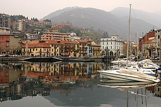
Omegna is a comune (municipality) in the Province of Verbano-Cusio-Ossola in the Italian region Piedmont, located about 100 kilometres (62 mi) northeast of Turin and about 13 kilometres (8 mi) southwest of Verbania at the northernmost point of Lago d’Orta and traversed by the Nigoglia, the lake's sole outflow.
Pella is a comune (municipality) in the Province of Novara in the Italian region Piedmont, located about 100 kilometres (62 mi) northeast of Turin and about 45 kilometres (28 mi) northwest of Novara on the Lake Orta. It borders the municipalities of Cesara, Madonna del Sasso, Nonio, Orta San Giulio, Pettenasco, and San Maurizio d'Opaglio.
Alto is a comune (municipality) in the Province of Cuneo in the Italian region Piedmont, located about 110 kilometres (68 mi) south of Turin and about 45 kilometres (28 mi) southeast of Cuneo.
Bernezzo is a comune (municipality) in the Province of Cuneo in the Italian region Piedmont, located about 80 kilometres (50 mi) southwest of Turin and about 9 kilometres (6 mi) west of Cuneo.
Brondello is a comune (municipality) in the Province of Cuneo in the Italian region Piedmont, located about 60 kilometres (37 mi) southwest of Turin and about 25 kilometres (16 mi) northwest of Cuneo. As of 31 December 2004, it had a population of 349 and an area of 9.9 square kilometres (3.8 sq mi). Brondello borders the following municipalities: Isasca, Martiniana Po, Pagno, Revello, and Venasca.
Frassino is a comune (municipality) in the Province of Cuneo in the Italian region Piedmont, located about 60 kilometres (37 mi) southwest of Turin and about 30 kilometres (19 mi) northwest of Cuneo.
Nucetto is a comune (municipality) in the Province of Cuneo in the Italian region Piedmont, located about 90 kilometres (56 mi) southeast of Turin and about 40 kilometres (25 mi) east of Cuneo. As of 31 December 2004, it had a population of 451 and an area of 7.6 square kilometres (2.9 sq mi).
Rittana is a comune (municipality) in the Province of Cuneo in the Italian region Piedmont, located about 80 kilometres (50 mi) southwest of Turin and about 13 kilometres (8 mi) southwest of Cuneo.
Roaschia is a comune (municipality) in the Province of Cuneo in the Italian region Piedmont, located about 90 kilometres (56 mi) south of Turin and about 15 kilometres (9 mi) southwest of Cuneo.
Robilante is a comune (municipality) in the Province of Cuneo in the Italian region Piedmont, located about 90 kilometres (56 mi) south of Turin and about 10 kilometres (6 mi) southwest of Cuneo. As of 31 December 2004, it had a population of 2,362 and an area of 24.9 square kilometres (9.6 sq mi).
Sanfrè is a comune (municipality) in the Province of Cuneo in the Italian region Piedmont, located about 35 kilometres (22 mi) south of Turin and about 45 kilometres (28 mi) northeast of Cuneo. As of 31 December 2004, it had a population of 2,602 and an area of 15.4 square kilometres (5.9 sq mi).
Valloriate is a comune (municipality) in the Province of Cuneo in the Italian region Piedmont, located about 90 kilometres (56 mi) southwest of Turin and about 15 kilometres (9 mi) southwest of Cuneo.
Venasca is a comune (municipality) in the Province of Cuneo in the Italian region Piedmont, located about 60 kilometres (37 mi) southwest of Turin and about 25 kilometres (16 mi) northwest of Cuneo. As of 31 December 2004, it had a population of 1,563 and an area of 20.4 square kilometres (7.9 sq mi).
Vernante is a comune (municipality) in the Province of Cuneo in the Italian region Piedmont, located about 90 kilometres (56 mi) south of Turin and about 15 kilometres (9 mi) south of Cuneo. As of 31 December 2004, it had a population of 1,307 and an area of 62.0 square kilometres (23.9 sq mi).
Rezzago is a comune (municipality) in the Province of Como in the Italian region Lombardy, located about 45 kilometres (28 mi) north of Milan and about 14 kilometres (9 mi) northeast of Como. As of 30 November 2012, it had a population of 317 and an area of 3.8 square kilometres (1.5 sq mi).
Antegnate is a comune (municipality) in the Province of Bergamo in the Italian region of Lombardy, located about 50 kilometres (31 mi) east of Milan and about 25 kilometres (16 mi) southeast of Bergamo.
Ghisalba is a comune (municipality) in the Province of Bergamo in the Italian region of Lombardy, located about 50 kilometres (31 mi) northeast of Milan and about 13 kilometres (8 mi) southeast of Bergamo. As of 31 December 2010, it had a population of 5,967 and an area of 10.2 square kilometres (3.9 sq mi).
Lenna is a comune (municipality) in the Province of Bergamo in the Italian region of Lombardy, located about 70 kilometres (43 mi) northeast of Milan and about 30 kilometres (19 mi) north of Bergamo. As of 31 December 2004, it had a population of 676 and an area of 12.9 square kilometres (5.0 sq mi).
Garlasco is a comune (municipality) in the Province of Pavia in the Italian region Lombardy, located about 35 kilometres (22 mi) southwest of Milan and about 20 kilometres (12 mi) west of Pavia. As of 31 December 2004, it had a population of 9,343 and an area of 39.0 square kilometres (15.1 sq mi).
Quarna Sotto is a comune (municipality) in the Province of Verbano-Cusio-Ossola in the Italian region Piedmont, located about 100 kilometres (62 mi) northeast of Turin and about 15 kilometres (9 mi) southwest of Verbania.
This article on a location in the Province of Verbano-Cusio-Ossola is a stub. You can help Wikipedia by expanding it. |