
Lavagno is a comune (municipality) in the Province of Verona in the Italian region Veneto, located about 90 kilometres (56 mi) west of Venice and about 12 kilometres (7 mi) east of Verona.

Mezzane di Sotto is a comune (municipality) in the Province of Verona in the Italian region Veneto, located about 90 kilometres (56 mi) west of Venice and about 13 kilometres (8 mi) northeast of Verona. As of 31 December 2004, it had a population of 1,949 and an area of 19.6 square kilometres (7.6 sq mi).

Tregnago is a comune (municipality) in the Province of Verona in the Italian region Veneto, located about 90 kilometres (56 mi) west of Venice and about 15 kilometres (9 mi) northeast of Verona.
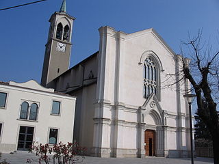
Ambivere is a comune (municipality) in the Province of Bergamo in the Italian region of Lombardy, located about 40 kilometres (25 mi) northeast of Milan and about 9 kilometres (6 mi) west of Bergamo. As of 31 December 2004, it had a population of 2,265 and an area of 3.2 square kilometres (1.2 sq mi).

Boltiere is a comune (municipality) in the Province of Bergamo in the Italian region of Lombardy, located about 35 kilometres (22 mi) northeast of Milan and about 13 kilometres (8 mi) southwest of Bergamo. As of 31 December 2004, it had a population of 4,695 and an area of 4.1 square kilometres (1.6 sq mi).

Cenate Sotto is a comune (municipality) in the Province of Bergamo in the Italian region of Lombardy, located about 60 kilometres (37 mi) northeast of Milan and about 12 kilometres (7 mi) east of Bergamo. As of 31 December 2004, it had a population of 2,947 and an area of 4.5 square kilometres (1.7 sq mi).

Filago is a comune (municipality) in the Province of Bergamo in the Italian region of Lombardy, located about 35 kilometres (22 mi) northeast of Milan and about 12 kilometres (7 mi) southwest of Bergamo.

Levate is a comune (municipality) in the Province of Bergamo in the Italian region of Lombardy, located about 40 kilometres (25 mi) northeast of Milan and about 8 kilometres (5 mi) southwest of Bergamo.

Madone is a comune (municipality) in the Province of Bergamo in the Italian region of Lombardy, located about 35 kilometres (22 mi) northeast of Milan and about 11 kilometres (7 mi) southwest of Bergamo. As of 31 December 2004, it had a population of 3,501 and an area of 3.0 square kilometres (1.2 sq mi).
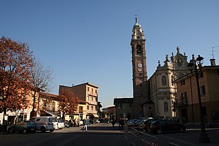
Osio Sotto is a comune (municipality) in the Province of Bergamo in the Italian region of Lombardy, located about 40 kilometres (25 mi) northeast of Milan and about 11 kilometres (7 mi) southwest of Bergamo. As of 31 December 2004, it had a population of 11,097 and an area of 7.5 square kilometres (2.9 sq mi).
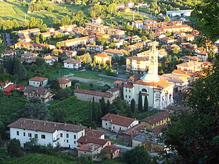
Scanzorosciate is a comune (municipality) in the Province of Bergamo in the Italian region of Lombardy, located about 50 kilometres (31 mi) northeast of Milan and about 6 kilometres (4 mi) northeast of Bergamo. As of 30 April 2013, it had a population of 10,018 and an area of 10.8 square kilometres (4.2 sq mi).

Forni di Sotto is a comune (municipality) in the Province of Udine in the Italian region Friuli-Venezia Giulia, located about 120 kilometres (75 mi) northwest of Trieste and about 60 kilometres (37 mi) northwest of Udine. As of 31 December 2004, it had a population of 701 and an area of 93.0 square kilometres (35.9 sq mi).
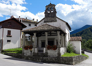
Socchieve is a comune (municipality) in the Province of Udine in the Italian region Friuli-Venezia Giulia, located about 110 kilometres (68 mi) northwest of Trieste and about 45 kilometres (28 mi) northwest of Udine.

Castelnovo di Sotto is a comune (municipality) in the Province of Reggio Emilia in the Italian region Emilia-Romagna, located about 70 kilometres (43 mi) northwest of Bologna and about 14 kilometres (9 mi) northwest of Reggio Emilia.
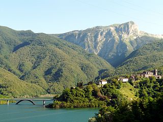
Vagli Sotto is a comune (municipality) in the Province of Lucca in the Italian region of Tuscany, located about 90 kilometres northwest of Florence and about 35 kilometres (22 mi) northwest of Lucca.

Meduno is a comune (municipality) in the Province of Pordenone in the Italian region Friuli-Venezia Giulia, located about 100 kilometres (62 mi) northwest of Trieste and about 30 kilometres (19 mi) northeast of Pordenone. As of 31 December 2004, it had a population of 1,737 and an area of 31.2 square kilometres (12.0 sq mi).

Germagno is a comune (municipality) in the Province of Verbano-Cusio-Ossola in the Italian region Piedmont, located about 110 kilometres (68 mi) northeast of Turin and about 9 kilometres (6 mi) west of Verbania. As of 31 December 2004, it had a population of 205 and an area of 2.9 square kilometres (1.1 sq mi).
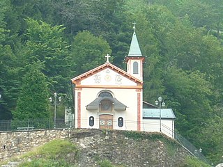
Valstrona is a comune (municipality) in the Province of Verbano-Cusio-Ossola in the Italian region Piedmont, located about 90 kilometres (56 mi) northeast of Turin and about 25 kilometres (16 mi) southwest of Verbania.


