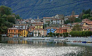
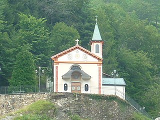
Bannio Anzino | ||
---|---|---|
Comune | ||
Comune di Bannio Anzino | ||
| ||
Coordinates: 45°59′2″N8°8′46″E / 45.98389°N 8.14611°E Coordinates: 45°59′2″N8°8′46″E / 45.98389°N 8.14611°E | ||
Country | Italy | |
Region | Piedmont | |
Province | Verbano-Cusio-Ossola (VB) | |
Frazioni | Bannio ( capoluogo ), Anzino, Pontegrande. [1] | |
Area [1] | ||
• Total | 38.98 km2 (15.05 sq mi) | |
Elevation [2] | 669 m (2,195 ft) | |
Population (Jan. 2008) [3] | ||
• Total | 539 | |
• Density | 14/km2 (36/sq mi) | |
Time zone | CET (UTC+1) | |
• Summer (DST) | CEST (UTC+2) | |
Postal code | 28032 | |
Dialing code | 0324 | |
Patron saint | Madonna della Neve [1] | |
Saint day | 5 August | |
Website | Official website |
Bannio Anzino (pop. 539) is a commune of the Province of Verbano-Cusio-Ossola in the Italian region Piedmont, located about 100 kilometres (62 mi) northeast of Turin and about 40 kilometres (25 mi) west of Verbania.
The comune is a basic administrative division in Italy, roughly equivalent to a township or municipality.
Verbano-Cusio-Ossola is the northernmost province in the Italian region of Piedmont. It was created in 1992 through the fusion of three geographical regions which had previously been part of the Province of Novara. The area flanking the western shore of Verbano forms the eastern part of the province; Cusio and its environs form the southern part; while the north and west of the province consists of the Ossola, a region of Alpine mountains and valleys. The ISO code for the province is VB.
Italy, officially the Italian Republic, is a country in Southern and Western Europe. Located in the middle of the Mediterranean Sea, Italy shares open land borders with France, Switzerland, Austria, Slovenia and the enclaved microstates San Marino and Vatican City. Italy covers an area of 301,340 km2 (116,350 sq mi) and has a largely temperate seasonal and Mediterranean climate. With around 61 million inhabitants, it is the fourth-most populous EU member state and the most populous country in Southern Europe.
The main population centres within the municipality are the frazioni [1] Bannio (site of the town hall), Pontegrande and Anzino (formerly a commune in its own right [4] ); further localities include Case Fornari, Case Prucci, Case Rovazzi, Castelletto, Fontane, Gaggieto, Parcineto, Scalaccia, and Valpiana. [1]
Bannio Anzino borders the following municipalities: Calasca-Castiglione, Carcoforo, Ceppo Morelli, Fobello, Rimella, Vanzone con San Carlo.
Calasca-Castiglione is a comune (municipality) in the Province of Verbano-Cusio-Ossola in the Italian region Piedmont, located about 120 kilometres (75 mi) northeast of Turin and about 35 kilometres (22 mi) northwest of Verbania.
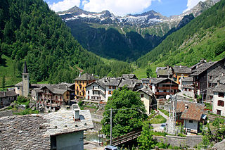
Carcoforo is a comune (municipality) in the province of Vercelli in the Italian region Piedmont, located about 100 kilometres (62 mi) northeast of Turin and about 70 kilometres (43 mi) northwest of Vercelli.
Ceppo Morelli is a comune (municipality) in the Province of Verbano-Cusio-Ossola in the Italian region Piedmont, located about 100 kilometres (62 mi) northeast of Turin and about 35 kilometres (22 mi) west of Verbania, on the border with Switzerland.
At the 2001 census, [2] the resident population of the commune was divided as follows:
Locality | Altitude (metres) | Males | Females | Total | Per cent |
---|---|---|---|---|---|
Anzino | 687 | 50 | 59 | 109 | 18.73% |
Bannio | 669 | 131 | 138 | 269 | 46.22% |
Pontegrande | 526 | 64 | 69 | 133 | 22.85% |
Case Fornari [5] | 576 | 2 | 1 | 3 | 0.52% |
Fontane | 775 | 11 | 14 | 25 | 4.30% |
Parcineto | 779 | 18 | 15 | 33 | 5.67% |
Scattered dwellings | - | 4 | 6 | 10 | 1.72% |
Totals | - | 280 | 302 | 582 | 100% |
Roburent is a comune of the Province of Cuneo in the Italian region Piedmont. It is located about 80 kilometres (50 mi) south of Turin and about 30 kilometres (19 mi) southeast of Cuneo. As of 1 January 2009 its population was 552. The comune extends over a largely wooded area of 29.9 km2 (11.5 sq mi) ranging in elevation from 580 to 1,819 metres above sea-level and straddling the Corsaglia and Casotto valleys. It borders the municipalities of Frabosa Soprana, Garessio, Montaldo di Mondovì, Ormea, Pamparato, and Torre Mondovì.
Cerrina Monferrato is a commune in the Province of Alessandria in the Italian region Piedmont, located about 40 kilometres (25 mi) east of Turin and about 40 kilometres (25 mi) northwest of Alessandria. Its municipal borders enclose an area of 17.1 square kilometres (6.6 sq mi) ranging in elevation from 158 to 422 metres above sea level. The commune borders Gabiano to the north, Mombello Monferrato to the east, Castelletto Merli and Odalengo Piccolo to the south, and Odalengo Grande and Villamiroglio to the west. The two principal population centres are Valle Cerrina which had a population of 583 at the time of the 2001 census, and Cerrina itself, the historic centre and capoluogo which had a population of 353. Montalero and Rosingo were both communes in their own right until 1928. The other settlements include Montaldo, Piancerreto and Gaminella: although the last lies mostly within the commune of Mombello Monferrato.
Bognanco, population about 250, is a commune in the Province of Verbano-Cusio-Ossola in the Italian region Piedmont, located in an Alpine valley about 120 kilometres (75 mi) northeast of Turin immediately to the west of Domodossola and on the border with Switzerland. Its municipal boundaries extend over an area of 58.1 square kilometres (22.4 sq mi) that ranges in elevation from 380 to 2,713 metres above sea-level and borders on the Italian communes of Antrona Schieranco, Crevoladossola, Domodossola, Montescheno and Trasquera, and Zwischbergen in the Swiss canton Valais.
Cossogno is a comune (municipality) in the Province of Verbano-Cusio-Ossola in the Italian region Piedmont, located about 130 kilometres (81 mi) northeast of Turin and about 20 kilometres (12 mi) north of Verbania.
Germagno is a comune (municipality) in the Province of Verbano-Cusio-Ossola in the Italian region Piedmont, located about 110 kilometres (68 mi) northeast of Turin and about 9 kilometres (6 mi) west of Verbania. As of 31 December 2004, it had a population of 205 and an area of 2.9 square kilometres (1.1 sq mi).
Intragna is a comune (municipality) in the Province of Verbano-Cusio-Ossola in the Italian region Piedmont, located about 120 kilometres (75 mi) northeast of Turin and about 8 kilometres (5 mi) northeast of Verbania. As of 31 December 2004, it had a population of 119 and an area of 9.9 square kilometres (3.8 sq mi).
Massiola is a comune (municipality) in the Province of Verbano-Cusio-Ossola in the Italian region Piedmont, located about 110 kilometres (68 mi) northeast of Turin and about 15 kilometres (9 mi) northwest of Verbania. As of 31 December 2004, it had a population of 169 and an area of 8.0 square kilometres (3.1 sq mi).
Mergozzo is a comune (municipality) in the Province of Verbano-Cusio-Ossola in the Italian region Piedmont, located about 120 kilometres (75 mi) northeast of Turin and about 9 kilometres (6 mi) northwest of Verbania.
Nonio is a comune (municipality) in the Province of Verbano-Cusio-Ossola in the Italian region Piedmont, located about 100 kilometres (62 mi) northeast of Turin and about 15 kilometres (9 mi) southwest of Verbania.
Oggebbio is a comune (municipality) in the Province of Verbano-Cusio-Ossola in the Italian region Piedmont, located about 130 kilometres (81 mi) northeast of Turin and about 11 kilometres (7 mi) northeast of Verbania.
Pallanzeno is a comune (municipality) in the Province of Verbano-Cusio-Ossola in the Italian region Piedmont, located about 120 kilometres (75 mi) northeast of Turin and about 25 kilometres (16 mi) northwest of Verbania.
Piedimulera is a comune (municipality) in the Province of Verbano-Cusio-Ossola in the Italian region Piedmont, located about 110 kilometres (68 mi) northeast of Turin and about 25 kilometres (16 mi) northwest of Verbania.
Premosello-Chiovenda is a comune (municipality) in the Province of Verbano-Cusio-Ossola in the Italian region Piedmont, located about 110 kilometres (68 mi) northeast of Turin and about 15 kilometres (9 mi) northwest of Verbania.
San Bernardino Verbano is a comune (municipality) in the Province of Verbano-Cusio-Ossola in the Italian region Piedmont, located about 120 kilometres (75 mi) northeast of Turin and about 2 kilometres (1.2 mi) northwest of Verbania.
Trasquera is a comune (municipality) in the Province of Verbano-Cusio-Ossola in the Italian region Piedmont, located about 120 kilometres (75 mi) northeast of Turin and about 35 kilometres (22 mi) northwest of Verbania, in the Val Divedro, on the border with Switzerland.
Valstrona is a comune (municipality) in the Province of Verbano-Cusio-Ossola in the Italian region Piedmont, located about 90 kilometres (56 mi) northeast of Turin and about 25 kilometres (16 mi) southwest of Verbania.
Varzo is a comune (municipality) in the Province of Verbano-Cusio-Ossola in the Italian region Piedmont, located about 130 kilometres (81 mi) northeast of Turin and about 35 kilometres (22 mi) northwest of Verbania, on the border with Switzerland. As of 31 December 2004, it had a population of 2,209 and an area of 94.4 square kilometres (36.4 sq mi).
Villette is a comune (municipality) in the Province of Verbano-Cusio-Ossola in the Italian region Piedmont, located about 140 kilometres (87 mi) northeast of Turin and about 20 kilometres (12 mi) north of Verbania. As of 31 December 2004, it had a population of 250 and an area of 7.4 square kilometres (2.9 sq mi).
This article on a location in the Province of Verbano-Cusio-Ossola is a stub. You can help Wikipedia by expanding it. |