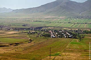
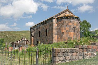
Noragavit

Last updated

Coordinates: 40°07′05″N44°28′31″E / 40.11806°N 44.47528°E / 40.11806; 44.47528

Geographic coordinate system Coordinate system

A geographic coordinate system is a coordinate system that enables every location on Earth to be specified by a set of numbers, letters or symbols. The coordinates are often chosen such that one of the numbers represents a vertical position and two or three of the numbers represent a horizontal position; alternatively, a geographic position may be expressed in a combined three-dimensional Cartesian vector. A common choice of coordinates is latitude, longitude and elevation. To specify a location on a plane requires a map projection.

Noragavit
Armenia adm location map.svg
Red pog.svg
Noragavit
Coordinates: 40°07′05″N44°28′31″E / 40.11806°N 44.47528°E / 40.11806; 44.47528
Country Armenia
Marz (Province) Yerevan
District Shengavit
Time zone   (UTC+4)

Noragavit or Noragavit’ (Armenian : Նորագավիթ), is a neighbourhood within the Shengavit District of Yerevan, Armenia.
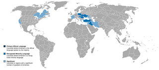
Armenian language Indo-European language

The Armenian language is an Indo-European language spoken primarily by Armenians. It is the official language of Armenia. Historically being spoken throughout the Armenian Highlands, today, Armenian is widely spoken throughout the Armenian diaspora. Armenian is written in its own writing system, the Armenian alphabet, introduced in 405 AD by Mesrop Mashtots.

Shengavit District Place in Yerevan, Armenia

Shengavit, is one of the 12 districts of Yerevan, the capital of Armenia, located at the southwestern part of the city. It has common borders with the districts of Malatia-Sebastia, Kentron, Erebuni and Nubarashen. Ararat Province forms the southern borders of the district.

Yerevan City in Armenia

Yerevan is the capital and largest city of Armenia as well as one of the world's oldest continuously inhabited cities. Situated along the Hrazdan River, Yerevan is the administrative, cultural, and industrial center of the country. It has been the capital since 1918, the fourteenth in the history of Armenia and the seventh located in or around the Ararat plain. The city also serves as the seat of the Araratian Pontifical Diocese; the largest diocese of the Armenian Apostolic Church and one of the oldest dioceses in the world.

Related Research Articles

The Psefir River is a river in Krasnodar Krai, Russia, which flows into the Kuban River. The area around the river is populated by various Abadzekh and Circassian tribes. The stanitsa of Kostromskaya stands on the river.

Margahovit Place in Lori, Armenia

Margahovit, is a major village in the Lori Province of Armenia.

Alagyaz Place in Aragatsotn Province, Armenia

Alagyaz is a village in the Aragatsotn Province of Armenia. Most of the population are Yazidis and Kurds.

Amrakits Place in Lori, Armenia

Amrakits formerly known as Nikolayevka and later as Kirov, is a village in the Lori Province of Armenia.

Arayi Place in Aragatsotn, Armenia

Arayi ; formerly known as Bazarjik and Ara, is a village in the Aragatsotn Province of Armenia. It is home to a ruined caravanserai dating back to 1213.

Haydarli, Lori Place in Lori Province, Armenia

Haydarli, is a village in the Lori Province of Armenia.

Chknagh Place in Aragatsotn, Armenia

Chknagh is a town in the Aragatsotn Province of Armenia.

Dian, Armenia Place in Aragatsotn, Armenia

Dian is a town in the Aragatsotn Province of Armenia.

Gogaran Place in Lori Province, Armenia

Gogaran, is a village in the Lori Province of Armenia.

Kayk, Armenia Place in Aragatsotn, Armenia

Kayk, formerly known as Melkon-kend and Mulki, is a village in the Aragatsotn Province of Armenia.

Nubarashen District Place in Yerevan, Armenia

Nubarashen, is one of the 12 districts of Yerevan, the capital of Armenia. It is situated at the southeastern part of the city. It is bordered by Shengavit and Erebuni districts from the north, and Ararat Province from the east, south and west.

Sipan, Armenia Place in Aragatsotn, Armenia

Sipan is a town in the Aragatsotn Province of Armenia. The town is mostly populated by Yezidis.

Nerkin Tsaghkavan Place in Tavush, Armenia

Nerkin Tsaghkavan ; formerly known as Melikgyugh or Melikgegh, is a village in the Tavush Province of Armenia.

Yeghegnut, Lori Place in Lori, Armenia

Yeghegnut is a town in the Lori Province of Armenia.

Pawłowice, Łódź Voivodeship Village in Łódź, Poland

Pawłowice is a village in the administrative district of Gmina Krzyżanów, within Kutno County, Łódź Voivodeship, in central parts of Poland. It lies approximately 3 kilometres (2 mi) south-east of Krzyżanów, 11 km (7 mi) south-east of Kutno, and 44 km (27 mi) north of the regional capital Łódź.

Zabłocie, Rawa County Village in Łódź, Poland

Zabłocie is a village in the administrative district of Gmina Sadkowice, within Rawa County, Łódź Voivodeship, in central Poland. It lies approximately 5 kilometres (3 mi) south-west of Sadkowice, 18 km (11 mi) south-east of Rawa Mazowiecka, and 71 km (44 mi) east of the regional capital Łódź.

National Archives of Armenia national archives

The National Archives of Armenia are the national archives of Armenia. The agency was officially founded in 1923. The headquarters are located in Yerevan, with regional branches in other cities.

Lõpi is a village in Saaremaa Parish, Saare County in western Estonia.

Hamples Corner, Wisconsin Unincorporated community in Wisconsin, United States

Hamples Corner is an unincorporated community in the town of Center, Outagamie County, Wisconsin, United States.

References