Parts of this article (those related to census data) need to be updated.(October 2015) |
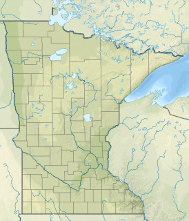
North Roseau is an unorganized territory in Roseau County, Minnesota, United States. The population was 160 at the 2000 census.
Parts of this article (those related to census data) need to be updated.(October 2015) |
North Roseau is an unorganized territory in Roseau County, Minnesota, United States. The population was 160 at the 2000 census.
According to the United States Census Bureau, the unorganized territory has a total area of 119.8 square miles (310.2 km2); 119.8 square miles (310.2 km2) is land and 0.01% is water.
As of the census [1] of 2000, there were 160 people, 55 households, and 47 families residing in the unorganized territory. The population density was 1.3 people per square mile (0.5/km2). There were 65 housing units at an average density of 0.5/sq mi (0.2/km2). The racial makeup of the unorganized territory was 98.12% White, 1.25% Asian, and 0.62% from two or more races.
There were 55 households, out of which 45.5% had children under the age of 18 living with them, 70.9% were married couples living together, 7.3% had a female householder with no husband present, and 14.5% were non-families. 12.7% of all households were made up of individuals, and 5.5% had someone living alone who was 65 years of age or older. The average household size was 2.91 and the average family size was 3.17.
In the unorganized territory the population was spread out, with 30.0% under the age of 18, 6.9% from 18 to 24, 28.8% from 25 to 44, 21.3% from 45 to 64, and 13.1% who were 65 years of age or older. The median age was 37 years. For every 100 females, there were 105.1 males. For every 100 females age 18 and over, there were 115.4 males.
The median income for a household in the unorganized territory was $43,750, and the median income for a family was $44,583. Males had a median income of $31,528 versus $20,972 for females. The per capita income for the unorganized territory was $18,447. None of the population or families were below the poverty line.

East Hancock is an unorganized territory in Hancock County, Maine, United States. The population was 94 at the 2010 census.

South Oxford is an unorganized territory located in Oxford County, Maine, United States. The population was 579 at the 2010 census. The unorganized territory encompasses the areas designated under state law as Albany Township, Mason Township, and Batchelder's Grant. Albany and Mason were formerly incorporated as towns. Albany disincorporated in 1937 while Mason disincorporated in 1935.
North Beltrami is an unorganized territory in Beltrami County, Minnesota, United States. The population was 43 at the 2000 census.
Shotley Brook is an unorganized territory in Beltrami County, Minnesota, United States. The population was 17 at the 2000 census.

Upper Red Lake is an unorganized territory in Beltrami County, Minnesota, U.S. It is a part of the Red Lake Indian Reservation. The population was 25 at the 2000 census.
North Clearwater is an unorganized territory in Clearwater County, Minnesota, United States. The population was 85 at the 2000 census.
South Clearwater is an unorganized territory in Clearwater County, Minnesota, United States. The population was 10 at the 2010 census, down from 72 in 2000.
East Koochiching is an unorganized territory in Koochiching County, Minnesota, United States. The population was 383 at the 2000 census.
Northwest Koochiching is an unorganized territory in Koochiching County, Minnesota, United States. The population was 541 at the 2000 census.
Rainy Lake is an unorganized territory in Koochiching County, Minnesota, United States. The population was 4,469 at the 2000 census.
Northwest Roseau is an unorganized territory in Roseau County, Minnesota, United States. The population was 18 at the 2000 census.
Southeast Roseau is an unorganized territory in Roseau County, Minnesota, United States. The population was 229 at the 2000 census.
Camp A Lake is an unorganized territory in Saint Louis County, Minnesota, United States. The population was 16 at the 2000 census.
Heikkala Lake is an unorganized territory in Saint Louis County, Minnesota, United States. The population was 322 at the 2000 census.
Northeast St. Louis is an unorganized territory in Saint Louis County, Minnesota, United States. The population was 177 at the 2000 census.
Northwest St. Louis is an unorganized territory in Saint Louis County, Minnesota, United States. The population was 306 at the 2000 census.
Potshot Lake is an unorganized territory in Saint Louis County, Minnesota, United States, located near Floodwood. The population was 73 at the 2000 census.
Slim Lake is an unorganized territory in Saint Louis County, Minnesota, United States, located north of Ely and Morse Township. The population was 75 at the 2000 census.
Whiteface Reservoir is an unorganized territory in Saint Louis County, Minnesota, United States. The population was 292 at the 2000 census.
Nett Lake is an unorganized territory in Saint Louis County, Minnesota, United States. The population was 272 at the 2000 census.