George Throssell was the second Premier of Western Australia. He served for just three months, from 15 February to 27 May 1901, during a period of great instability in Western Australian politics.

Northam is a market town, civil parish and electoral ward in Devon, England, lying north of Bideford. The civil parish also includes the villages of Westward Ho!, Appledore, West Appledore, Diddywell, Buckleigh and Silford, and the residential areas of Orchard Hill and Raleigh Estate.

Northam is a town in the Wheatbelt region of Western Australia, situated at the confluence of the Avon and Mortlock Rivers. It is the largest town and regional centre in the Avon Valley region of the Central Wheatbelt. It is located approximately 97 kilometres north east of Perth, the capital city of Western Australia. At the time of the 2021 census, Northam had a population of 6,679.

Toodyay, known as Newcastle between 1860 and 1910, is a town on the Avon River in the Wheatbelt region of Western Australia, 85 kilometres (53 mi) north-east of Perth. The first European settlement occurred in the area in 1836. After flooding in the 1850s, the townsite was moved to its current location in the 1860s. It is connected by railway and road to Perth. During the 1860s, it was home to bushranger Moondyne Joe.

The Eastern Shore of Virginia is the easternmost region of the Commonwealth of Virginia in the United States. It consists of two counties on the Atlantic coast. It is detached from the mainland of Virginia by the Chesapeake Bay. The 70-mile-long (110 km) region is part of the Delmarva Peninsula. Its population was 45,695 as of 2020.

The Wheatbelt is one of nine regions of Western Australia defined as administrative areas for the state's regional development, and a vernacular term for the area converted to agriculture during colonisation. It partially surrounds the Perth metropolitan area, extending north from Perth to the Mid West region, and east to the Goldfields–Esperance region. It is bordered to the south by the South West and Great Southern regions, and to the west by the Indian Ocean, the Perth metropolitan area, and the Peel region. Altogether, it has an area of 154,862 square kilometres (59,793 sq mi).

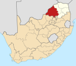
Bronkhorstspruit is a town 50 km east of Pretoria, Gauteng, South Africa along the N4 highway towards eMalahleni. It also includes three townships called Zithobeni, Rethabiseng and Ekangala. On 18 May 2011, the Tshwane Metropolitan Municipality took over the municipal administration from the abolished Kungwini Local Municipality, which makes Bronkhorstspruit part of Tshwane.

Great Eastern Highway is a 590-kilometre-long (370 mi) road that links the Western Australian capital of Perth with the city of Kalgoorlie. A key route for road vehicles accessing the eastern Wheatbelt and the Goldfields, it is the western portion of the main road link between Perth and the eastern states of Australia. The highway forms the majority of National Highway 94, although the alignment through the Perth suburbs of Guildford and Midland, and the eastern section between Coolgardie and Kalgoorlie are not included. Various segments form parts of other road routes, including National Route 1, Alternative National Route 94, and State Route 51.
Bethal is a farming town in Mpumalanga, South Africa. The farms in the region produce maize, sunflower seeds, sorghum, rye and potatoes. The town lies 155 km (96 mi) east of Johannesburg on the N17 national route.
Delmas is a small maize farming town situated east of Johannesburg in Mpumalanga, South Africa. The town is located some 19 km north-east of Springs and 73 km south-east of Pretoria.

Oudtshoorn is a town in the Western Cape province of South Africa, located between the Swartberg mountains to the north and the Outeniqua Mountains to the south. Dubbed the "ostrich capital of the world", Oudtshoorn is known for its ostrich-feather booms, during 1865–1870 and 1900–1914. With approximately 60,000 inhabitants, it is the largest town in the Klein Karoo region. The town's economy is primarily reliant on the ostrich farming and tourism industries. Oudtshoorn is home to the world's largest ostrich population, with a number of specialised ostrich breeding farms, such as the Safari Show Farm and the Highgate Ostrich Show Farm, as stated by Pierre D. Toit.

The Bushveld is a sub-tropical woodland ecoregion of Southern Africa. The ecoregion straddles the Tropic of Capricorn and constitutes the southern part of the Zambezian region. It encompasses most of Limpopo and a small part of North West in South Africa, the Central and North-East Districts of Botswana and the Matabeleland South and part of Matabeleland North provinces of Zimbabwe. The Kruger National Park has a number of 'Bushveld' camps, but these are strictly speaking in the lowveld, as these terms are sometimes used interchangeably. Although their limits are somewhat blurred, lowveld is generally restricted to the more easterly parts of South Africa and Zimbabwe.

Northam is a suburb of Southampton in Hampshire. On the West bank of the River Itchen, it shares borders with St Mary's, Bitterne and Bevois Valley. Beside the border with St Mary's is the Chapel area, which has been home to some recent apartment building developments in Northam. The A3024 road runs through the suburb and crosses the Northam Bridge, which links Northam with Bitterne via Bitterne Manor. Although St Mary's Stadium takes its name from the neighbouring St Mary's, the stadium itself is in Northam, and home to Southampton F.C.

Constantia is an affluent suburb of Cape Town, South Africa, situated about 15 kilometres south of the centre of Cape Town. It is considered to be one of the most prestigious suburbs in South Africa. The Constantia Valley lies to the east of and at the foot of the Constantiaberg mountain. Constantia Nek is a low pass linking to Hout Bay in the west.
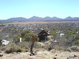
Oppikoppi was a music festival held in the Limpopo Province of South Africa, near the mining town of Northam. The festival started off focusing mostly on rock music, but gradually added more genres and now plays host to a complete mixed bag of genres. Anything from jazz, world music, house music, acoustic, comedy and all else in between can be heard on one of the multiple stages. Each year in the first week of August — except for 2017, when the festival was held in October — thousands of people used to flock to the farm to camp out in the bush and enjoy the music for several days. The festival features mostly South African bands, although international acts are included in the line-up.
The Shire of Northam is a local government area in the Wheatbelt region of Western Australia, beyond the northeastern fringe of the Perth metropolitan area centred on the town of Northam itself. The Shire covers an area of 1,431 square kilometres (553 sq mi). In 2007, it merged with the Town of Northam, almost tripling its population in the process from a previous size of 3,794.

Clackline is a locality in the Wheatbelt region of Western Australia, about 80 kilometres (50 mi) east-north-east of Perth.

Highways and main roads in the Wheatbelt region of Western Australia form the basis of a road network, which is primarily used by the mining, agriculture, and tourism industries. Main Roads Western Australia maintains and controls these major roads, with offices based in Northam and Narrogin.
First Mountain State Forest is a state forest located in Rockingham County, Virginia northwest of the town of Elkton. The land is adjoined with George Washington and Jefferson National Forests. The land was dedicated as the 25th state forest by Governor Ralph Northam on 7 October 2019.
The Philippi Horticultural area is a large semi-rural area of Philippi on the Cape Flats region of Cape Town, in the Western Cape province of South Africa.