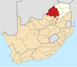
Pre-2011 map of South Africa showing Waterberg (within Limpopo province)
The Waterberg District Municipality (Northern Sotho: Mmasepala wa Selete wa Waterberg; Tswana: Mmasepala wa Sedika wa Waterberg) is one of the 5 districts of the Limpopo province of South Africa. The seat is Modimolle. As of 2016, the majority of its 745,758 residents spoke Sepedi, also known as Northern Sotho. The district code is DC36. The area is adminstred by tribal tribal communities, it consists of 12 traditional leaders in the district: Babirwa, Lebelo Kgomo, Seleka, Lekalakala, Mokopane(Kekana), Mapela, Litho, Ledwaba (Nkidikitlana), Shongoane, Bakone (Matlala), Tauetsoala & Langa.Bakenburg.
The municipality contains much of the Waterberg Biosphere, a UNESCO desLanga, Mapela, Bakoneignated Biosphere Reserve. The Waterberg Biosphere is a massif of approximately 654,033 hectare. Waterberg is the first region in the northern part of South Africa to be named as a Biosphere Reserve by UNESCO. The extensive rock formation was shaped by hundreds of millions of years of riverine erosion to yield diverse bluff and buttelandform.[3] The ecosystem can be characterised as a dry deciduous forest or Bushveld. Within the Waterberg there are archaeological finds dating to the Stone Age, and nearby are early evolutionary finds related to the origin of humans.
The following sets forth neighboring municipalities and principal municipalities within the Waterberg District Municipality:
This page is based on this Wikipedia article Text is available under the CC BY-SA 4.0 license; additional terms may apply. Images, videos and audio are available under their respective licenses.