Maruleng Local Municipality

Last updated
Maruleng
Maruleng CoA.png
Map of Limpopo with Maruleng highlighted.svg
Location in Limpopo
Country South Africa
Province Limpopo
District Mopani
Seat Hoedspruit
Wards 14
Government
[1]
  Type Municipal council
  MayorThobejane M.H
Area
  Total3,244 km2 (1,253 sq mi)
Population
 (2011) [2]
  Total94,857
  Density29/km2 (76/sq mi)
Racial makeup (2011)
[2]
   Black African 95.5%
   Coloured 0.3%
   Indian/Asian 0.2%
   White 3.8%
First languages (2011)
[2]
   Northern Sotho 89.7%
   Tsonga 3.9%
   Afrikaans 2.7%
   English 1.6%
  Other3.6%
Time zone UTC+2 (SAST)
Municipal codeLIM335

Maruleng Local Municipality is located in the Mopani District Municipality of Limpopo province, South Africa. The seat of Maruleng Local Municipality is Hoedspruit.

Contents

Main places

The 2001 census divided the municipality into the following main places: [3]

PlaceCodeArea (km2)PopulationMost spoken language
Banereng Ba Letsoalo 92201 122.296,752 Northern Sotho
Banereng Ba Sekororo 92202 210.5135,268Northern Sotho
Hoedspruit 92203 7.172,052 Afrikaans
Letaba 92204 21.582,483Northern Sotho
Mametja 92205 316.0826,702Northern Sotho
Naphuno 92207 10.368,188Northern Sotho
Remainder of the municipality 92206 2,543.6412,929 Tsonga

Politics

The municipal council consists of twenty-seven members elected by mixed-member proportional representation. Fourteen councillors are elected by first-past-the-post voting in fourteen wards, while the remaining thirteen are chosen from party lists so that the total number of party representatives is proportional to the number of votes received. In the election of 3 August 2016 the African National Congress (ANC) won a majority of fifteen seats on the council. The following table shows the results of the election. [4] [5]

PartyVotesSeats
WardListTotal %WardListTotal
ANC 15,53716,36231,89954.711415
EFF 4,9705,07310,04317.2055
Democratic Alliance 3,6953,6647,35912.6123
Civic Warriors of Maruleng 2,8192,8105,6299.7123
Independent 1,1531,1532.011
COPE 3202886081.0000
Others7048771,5812.7000
Total29,19829,07458,272100.0141327
Spoilt votes345421766

Related Research Articles

<span class="mw-page-title-main">Westonaria Local Municipality</span> Local municipality in Gauteng, South Africa

Westonaria Local Municipality was a local municipality in West Rand District Municipality, Gauteng, South Africa. After municipal elections on 3 August 2016 it was merged with the Randfontein Local Municipality into the larger Rand West City Local Municipality.

<span class="mw-page-title-main">Umjindi Local Municipality</span> Local municipality in Mpumalanga, South Africa

Umjindi was a local municipality of the Ehlanzeni District in Mpumalanga, South Africa. Barberton was the seat of the municipality. The municipality had a population of 53,744 according to the 2001 census.

<span class="mw-page-title-main">Thaba Chweu Local Municipality</span> Local municipality in Mpumalanga, South Africa

Thaba Chweu Local Municipality, is a municipality of South Africa, located in the Ehlanzeni District Municipality, Mpumalanga.

<span class="mw-page-title-main">Dipaleseng Local Municipality</span> Local municipality in Mpumalanga, South Africa

Dipaleseng Local Municipality is a South African local municipality situated in the Gert Sibande District Municipality, of Mpumalanga. Balfour is the seat of the municipality.

<span class="mw-page-title-main">Molemole Local Municipality</span> Local municipality in Limpopo, South Africa

Molemole Local Municipality, is located in the Capricorn District Municipality, of Limpopo province, South Africa. The seat of Molemole Local Municipality is Mogwadi.

<span class="mw-page-title-main">Lepelle-Nkumpi Local Municipality</span> Local municipality in Limpopo, South Africa

Lepelle-Nkumpi Local Municipality, is located in the Capricorn District Municipality, of Limpopo province, South Africa. The seat is Lebowakgomo.

<span class="mw-page-title-main">Bela-Bela Local Municipality</span> Local municipality in Limpopo, South Africa

Bela-Bela Local Municipality is located in the Waterberg District Municipality of Limpopo province, South Africa. The seat of Bela-Bela Local Municipality is Bela-Bela.

<span class="mw-page-title-main">Lephalale Local Municipality</span> Local municipality in Limpopo, South Africa

Lephalale Local Municipality is located in the Waterberg District Municipality of Limpopo province, South Africa. The seat of Lephalale Local Municipality is Lephalale.

<span class="mw-page-title-main">Modimolle Local Municipality</span> Local municipality in Limpopo, South Africa

Modimolle Local Municipality was a municipality located in the Waterberg District Municipality of Limpopo province, South Africa. The seat of Modimolle Local Municipality was Modimolle.

<span class="mw-page-title-main">Mogalakwena Local Municipality</span> Local municipality in Limpopo, South Africa

Mogalakwena Local Municipality is located in the Waterberg District Municipality of Limpopo province, South Africa. The seat of Mogalakwena Local Municipality is Mokopane.

<span class="mw-page-title-main">Thabazimbi Local Municipality</span> Local municipality in Limpopo, South Africa

Thabazimbi Local Municipality is an administrative area in the Waterberg District of Limpopo in South Africa. The seat of Thabazimbi Local Municipality is Thabazimbi.

<span class="mw-page-title-main">Greater Tzaneen Local Municipality</span> Local municipality in Limpopo, South Africa

Greater Tzaneen Local Municipality is located in the Mopani District Municipality of Limpopo province, South Africa. The seat of the municipality is Tzaneen.

<span class="mw-page-title-main">Greater Letaba Local Municipality</span> Local municipality in Limpopo, South Africa

Greater Letaba Local Municipality is located in the Mopani District Municipality of Limpopo province, South Africa. The seat of Greater Letaba Local Municipality is Modjadjiskloof.

<span class="mw-page-title-main">Ba-Phalaborwa Local Municipality</span> Local municipality in Limpopo, South Africa

Ba-Phalaborwa Local Municipality is located in the Mopani District Municipality of Limpopo province, South Africa. The seat of Ba-Phalaborwa Local Municipality is Phalaborwa.

<span class="mw-page-title-main">Thembisile Hani Local Municipality</span> Local municipality in Mpumalanga, South Africa

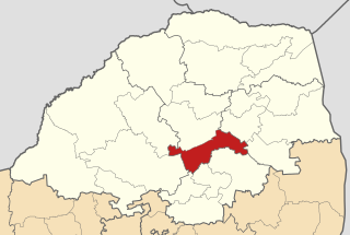
Thembisile Hani Local Municipality is located in the Nkangala District Municipality of Mpumalanga province, South Africa. It is a semi-urban local Municipality consisting of 57 villages within which there are 5 (five) established townships.

<span class="mw-page-title-main">Nkandla Local Municipality</span> Local municipality in KwaZulu-Natal, South Africa

Nkandla Local Municipality is an administrative area in the King Cetshwayo District of KwaZulu-Natal province in South Africa. The town of Nkandla is the home town of the former President of South Africa, Jacob Zuma.

<span class="mw-page-title-main">Camdeboo Local Municipality</span> Former local municipality in Eastern Cape, South Africa

Camdeboo Local Municipality was a local municipality in the Sarah Baartman District Municipality of the Eastern Cape in South Africa. After municipal elections on 3 August 2016 it was merged into the larger Dr Beyers Naudé Local Municipality.

<span class="mw-page-title-main">Baviaans Local Municipality</span> Former local municipality in Eastern Cape, South Africa

Baviaans Local Municipality was an administrative area in the Sarah Baartman District of the Eastern Cape in South Africa. After the municipal elections on 3 August 2016 it was merged into the larger Dr Beyers Naudé Local Municipality.

<span class="mw-page-title-main">Joe Morolong Local Municipality</span> Local municipality in Northern Cape, South Africa

Joe Morolong Local Municipality is an administrative area in the John Taolo Gaetsewe District of the Northern Cape in South Africa.

<span class="mw-page-title-main">Umvoti Local Municipality</span> Local municipality in KwaZulu-Natal, South Africa

Umvoti Local Municipality is an administrative area in the Umzinyathi District of KwaZulu-Natal in South Africa.

References

  1. "Contact list: Executive Mayors". Government Communication & Information System. Archived from the original on 14 July 2010. Retrieved 22 February 2012.
  2. 1 2 3 "Statistics by place". Statistics South Africa. Retrieved 27 September 2015.
  3. Lookup Tables - Statistics South Africa [ permanent dead link ]
  4. "Results Summary – All Ballots: Maruleng" (PDF). Independent Electoral Commission. Retrieved 14 January 2017.
  5. "Seat Calculation Detail: Maruleng" (PDF). Independent Electoral Commission. Retrieved 14 January 2017.

Coordinates: 24°21′15″S30°56′50″E / 24.35417°S 30.94722°E / -24.35417; 30.94722