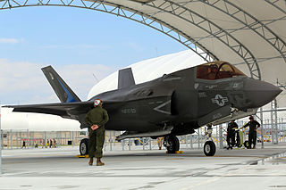
Marine Corps Air Station Beaufort or MCAS Beaufort is a United States Marine Corps (USMC) air base located 5 kilometres (3.1 mi) northwest of the central business district of Beaufort, a city in Beaufort County, South Carolina, United States. About 4,700 personnel serve at the station, and it is home to four Marine Corps F/A-18 Hornet fighter-attack squadrons and one F-35B Lighting II training squadron.

Marine Corps Air Station Miramar is a United States Marine Corps installation that is home to the 3rd Marine Aircraft Wing, which is the aviation element of the 1st Marine Expeditionary Force. It is located in Miramar, a community of San Diego, California, about 14 miles (23 km) north of downtown San Diego.

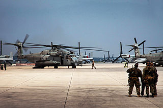
Marine Corps Air Station New River is a United States Marine Corps helicopter and tilt-rotor base in Jacksonville, North Carolina, in the eastern part of the state. In 1972, the airfield was named McCutcheon Field for General Keith B. McCutcheon, one of the fathers of Marine Corps helicopter aviation. Near Marine Corps Base Camp Lejeune, it shares some facilities with Camp Geiger.

Naval Air Station Jacksonville is a large naval air station located approximately eight miles (13 km) south of the central business district of Jacksonville, Florida, United States.

Naval Air Station Lemoore or NAS Lemoore is a United States Navy base, located in Kings County and Fresno County, California, United States. Lemoore Station, a census-designated place, is located inside the base's borders.

McEntire Joint National Guard Base or McEntire JNGB is a military airport located in Richland County, South Carolina, United States, 10 miles (16 km) west of the town of Eastover and approximately 15 miles southeast of the city of Columbia. It is owned by the U.S. Air Force affiliated with the South Carolina Air National Guard (SCANG).

Naval Air Station (NAS) Oceana or NAS Oceana is a United States Navy Naval Air Station located in Virginia Beach, Virginia.

Gillespie Field is a county-owned public towered airport 11.5 miles northeast of downtown San Diego, in El Cajon, San Diego County, California, United States.

Coastal Carolina Regional Airport is a commercial airport located three miles (5 km) southeast of the central business district of New Bern, a city in Craven County, North Carolina, United States. EWN covers 785 acres of land.
The Millington-Memphis Airport is a public airport in the city of Millington, Tennessee, in Shelby County, United States. The airport is located 16 miles (26 km) north of Memphis. It was historically known as Naval Air Station Memphis, and it still provides support to military aircraft visiting the adjacent Naval Support Activity Mid-South.

Naval Air Station Sanford was a naval air station of the United States Navy in Sanford, Florida, approximately 20 miles north of Orlando, Florida. Opening less than a year after the start of World War II, NAS Sanford's initial function was as an advanced training base for land-based patrol bombers, followed by carrier-based fighter aircraft. The air station briefly closed in 1946 and was placed in caretaker status until being reactivated in 1950. It eventually served as a Master Jet Base for carrier-based heavy attack and reconnaissance aircraft until 1969. After its closure, it reopened as civilian general aviation airport under various names with a non-Navy civilian airport identifier until finally transitioning to a scheduled air carrier airport under its current name of Orlando-Sanford International Airport.

Marine Corps Outlying Field (MCOLF) Camp Davis is a military use airport northeast of the central business district of Holly Ridge, in Onslow County, North Carolina, United States. It is used as a training facility by the United States Marines of Camp Lejeune and Marine Corps Air Station New River.

Marine Operational Training Group 81 (MOTG-81) was a United States Marine Corps aviation training group that was established during World War II. Squadrons from MOTG-81 trained pilots, aircrew and ground crew on the PBJ-1 medium bomber. The Marine Corps divested its medium bomber fleet immediately after the war and the Group was decommissioned in December 1945.

Northeast Florida Regional Airport, is located approximately four miles (6 km) north of historic St. Augustine, in St. Johns County, Florida, United States. NFRA serves as a key connection point for air travel in the Northeast Florida region. It is a public airport managed by the St. Johns County Airport Authority on behalf of the citizens of St. Johns County. Airport facilities include both commercial and general aviation terminals.

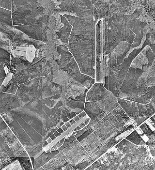
Marine Corps Auxiliary Landing Field Bogue, also known as Bogue Field, is an 875-acre (3.54 km2) landing field located on Bogue Sound that serves as a Marine Corps’ East Coast site for Field Carrier Landing Practice (FCLP). It is a sub facility of MCAS Cherry Point in Havelock in Craven County and one of three USMC facilities in Carteret County. The others include Atlantic Airfield, a Cherry Point sub installation which is sparsely manned and Radio Island shipping terminal, between Morehead City and Beaufort, which falls under control of Camp Lejeune, though it is only manned during active military operations. Another USMC facility, Oak Grove Airfield, near Pollocksville in Jones County, in also controlled by Cherry Point and in rarely manned unless training is conducted there. By Bogue Field being available for performing many of these landings at night, pilots simulate landing on an aircraft carrier or an amphibious assault ship, which provides the force with the means to forward deploy its aviation assets in order to have a more readily accessible aviation punch for the Marine Air Ground Task Force (MAGTF) commander on the battlefield.

Marine Corps Air Facility Quantico is a United States Marine Corps airfield located within Marine Corps Base Quantico, Virginia. It was commissioned in 1919 and is currently home to HMX-1, the squadron that flies the President of the United States. The airfield is also known as Turner Field, after Colonel Thomas C. Turner, a veteran Marine aviator and the second director of Marine Corps Aviation, who lost his life in Haiti in 1931.

Marine Corps Air Station Kaneohe Bay or MCAS Kaneohe Bay is a United States Marine Corps (USMC) airfield located within the Marine Corps Base Hawaii complex, formerly known as Marine Corps Air Facility (MCAF) Kaneohe Bay or Naval Air Station (NAS) Kaneohe Bay. It is located two miles northeast of the central business district of Kaneohe, in Honolulu County, Hawaii, United States. The airfield has one runway (4/22) with a 7,771 x 200 ft asphalt surface.

Marine Corps Air Station Cherry Point or MCAS Cherry Point is a United States Marine Corps airfield located in Havelock, North Carolina, United States, in the eastern part of the state. It was built in 1941, and was commissioned in 1942 and is currently home to the 2nd Marine Aircraft Wing.

Joint Base Charleston is a United States military facility located partly in the City of North Charleston, South Carolina and partly in the City of Goose Creek, South Carolina. The facility is under the jurisdiction of the United States Air Force 628th Air Base Wing, Air Mobility Command (AMC).


