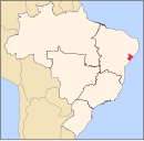
Aracaju is the capital of the state of Sergipe, Brazil, located in the northeastern part of the country on the coast, about 350 km (217 mi) north of Salvador. According to the 2020 estimate, the city has 664,908 inhabitants, which represents approximately 33% of the state population. Adding to the populations of the municipalities forming the Metropolitan area: Barra dos Coqueiros, Nossa Senhora do Socorro and São Cristóvão. Its Metropolitan Cathedral Nossa Senhora da Conceiçao, dedicated to Our Lady of Immaculate Conception, is the archiepiscopal see of the Roman Catholic Archdiocese of Aracaju.
In Brazil, public holidays may be legislated at the federal, statewide and municipal levels. Most holidays are observed nationwide.

Aparecida is a Brazilian municipality in the state of São Paulo. It is located in the fertile valley of the River Paraíba do Sul on the southern (right) bank. It is part of the Metropolitan Region of Vale do Paraíba e Litoral Norte. The population is 36,185 in an area of 121.08 km². The municipality is sometimes referred as Aparecida do Norte.

São Cristóvão is a Brazilian municipality in the Northeastern state of Sergipe. Founded at the mouth of the Vaza-Barris River on January 1, 1590, the municipality is the fourth oldest settlement in Brazil. São Cristóvão is noted for its historic city square, São Francisco Square, and numerous early colonial-period buildings. The 3 hectares site was designated a UNESCO World Heritage Site in 2010.

Sertãozinho is a Brazilian municipality in the state of São Paulo. The population in 2020 was about 127,142. Its area is 403 km2. The municipality consists of Sertãozinho city and two districts: Cruz das Posses and Vila Garcia. Sertãozinho is 325 km from São Paulo and 702 km from Brasília.
Divina Pastora is a municipality located in the Brazilian state of Sergipe. The Parish Church of Our Lady of the Divine Shepherd, a listed historic structure by the National Institute of Historic and Artistic Heritage (IPHAN), was constructed in the late 18th century and is located at the east of the city center. Its population was 5,215 (2020) and its area is 92 square kilometres (36 sq mi).

Estância is a municipality located in the Brazilian state of Sergipe. Its population is 69,556 (2020). Estância covers 644.5 km2 (248.8 sq mi), and has a population density of 110 inhabitants per square kilometer. It is located 66 km (41 mi) from the state capital of Sergipe, Aracaju. The city is the seat of the Roman Catholic Diocese of Estância.

Itaporanga d'Ajuda is a Brazilian municipality in the Northeastern state of Sergipe. It covers 757 square kilometres (292 sq mi), has a population of 34,709 (2020) and a population density of 46 residents per km2. It is home to the Tejupeba House and the Chapel of the Colégio Sugar Plantation, a plantation house and chapel cited as the first Jesuits settlement in Portuguese Brazil.

Laranjeiras is a municipality located in the Brazilian state of Sergipe. Its population was 30,080 (2020) and covers 162.27 km2 (62.65 sq mi). Laranjeiras has a population density of 180 inhabitants per square kilometer. Laranjeiras is located 19 km (12 mi) from the state capital of Sergipe, Aracaju. It borders the municipalities of Riachuelo, Areia Branca, Nossa Senhora do Socorro, São Cristóvão, Maruim, and Santo Amaro das Brotas, all within the state of Sergipe. The municipality contains part of the Serra de Itabaiana National Park.

Moita Bonita is a municipality located in the Brazilian state of Sergipe. Its population was 11,348 (2020) and covers 96.53 km2 (37.27 sq mi). Moita Bonita has a population density of 120 inhabitants per square kilometer. Moita Bonita is located 64 km (40 mi) from the state capital of Sergipe, Aracaju. Riachuelo borders the municipalities of Itabaiana, Ribeirópolis, Nossa Senhora das Dores, Santa Rosa de Lima, and Malhador, all within the state of Sergipe.
Nossa Senhora da Glória is a municipality located in the Brazilian state of Sergipe. Its population was 37,324 (2020) and its area is 757.45 km2 (292.45 sq mi). It has a population density of 48 inhabitants per square kilometer. Nossa Senhora da Glória is located 126 km2 (49 sq mi) from the state capital of Sergipe, Aracaju.
Nossa Senhora das Dores is a municipality located in the Brazilian state of Sergipe. Its population was 26,795 (2020) and its area is 471 km².
Nossa Senhora de Lourdes is a municipality located in the Brazilian state of Sergipe. Its population was 6,496 (2020) and its area is 80 km2.

Nossa Senhora do Socorro is a municipality located in the Brazilian state of Sergipe. Its population was 185,706 (2020) and its area is 155.02 km2 (59.85 sq mi). Nossa Senhora do Socorro is located 36 km (22 mi) from the state capital of Sergipe, Aracaju.
Riachuelo is a municipality located in the Brazilian state of Sergipe. Its population was 10,284 (2020) and covers 78.31 km2 (30.24 sq mi). Riachuelo has a population density of 130 inhabitants per square kilometer. Riachuelo is located 23 km (14 mi) from the state capital of Sergipe, Aracaju. Riachuelo borders the municipalities of Laranjeiras, Divina Pastora, Santa Rosa de Lima, and Areia Branca, all within the state of Sergipe. The municipality is site of the Nossa Senhora da Penha Sugar Plantation and the Chapel of the Nossa Senhora da Penha Sugar Plantation. The chapel was listed as a historic structure by National Institute of Historic and Artistic Heritage (IPHAN) in 1943, but has fallen into an advanced state of neglect and decay and is considered abandoned.
Tomar do Geru is a municipality located in the Brazilian state of Sergipe. Its population was 13,535 (2020) and it covers 305 km2 (118 sq mi). Tomar do Geru has a population density of 43 inhabitants per square kilometer. It is located 131 km (81 mi) from the state capital of Sergipe, Aracaju. The Church of Nossa Senhora do Socorro was built by the Society of Jesus in 1688. It was listed as a historic structure by the Brazilian National Institute of Historic and Artistic Heritage (IPHAN) in 1943.

Pinheiro Machado is a municipality in the state of Rio Grande do Sul, Brazil.

São Francisco do Conde is a municipality in the state of Bahia in the North-East region of Brazil. São Francisco do Conde covers 262.856 km2 (101.489 sq mi), and has a population of 40,245 with a population density of 150 inhabitants per square kilometer. It is located 67 kilometres (42 mi) from the state capital of Salvador. According to the Brazilian Institute of Geography and Statistics São Francisco do Conde has the highest concentration of Brazilians of African descent (90%) in Bahia.

Nazaré, also known as Nazaré das Farinhas, is a municipality in the state of Bahia in the North-East region of Brazil. The municipality has a population of 28,594 with a population density of 107 inhabitants per square kilometer. It is located 110 km (68 mi) from the state capital of Bahia, Salvador. Nazaré is within the Bahian Recôncavo, an interior region of the state of Bahia. It borders the municipalities of Muniz Ferreira, Aratuípe, Jaguaripe, São Felipe, and Maragogipe. The Jaguaripe River crosses through the middle of the town. It is sits on the intersection of two Bahian state highways, BA-001 and BA-046.