New Santander | |||||||
|---|---|---|---|---|---|---|---|
| 1746–1821 | |||||||
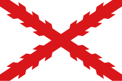 Cross of Burgundy, flag of New Spain. | |||||||
 | |||||||
| Status | Spanish colony | ||||||
| Capital | Santander Jiménez | ||||||
| Common languages | Spanish | ||||||
| Religion | Roman Catholicism | ||||||
| Government | Monarchy | ||||||
| King of Spain | |||||||
• July 9, 1746 – August 10, 1759 | Ferdinand VI | ||||||
• December 11, 1813 – September 29, 1833 | Ferdinand VII | ||||||
| Royal Governor | |||||||
• May 31, 1748 - April 8, 1767 | José de Escandón | ||||||
• July 7, 1821 - September 22, 1822 | Felipe de la Garza Cisneros | ||||||
| Historical era | Colonial era | ||||||
• Established | 1746 | ||||||
• Disestablished | 1821 | ||||||
| Population | |||||||
• 1790 | 43,739 | ||||||
| Currency | Spanish colonial real | ||||||
| |||||||
| Today part of | Mexico (Nuevo León & Tamaulipas) United States (Texas) | ||||||

Nuevo Santander (New Santander) was a region of the Viceroyalty of New Spain, covering the modern Mexican state of Tamaulipas and extending into modern-day southern Texas in the United States. [1]
Contents
Nuevo Santander was named after Santander, Cantabria, Spain, and settled by Spanish American colonists in a concerted settlement campaign peaking in 1748–1750. It fell under the jurisdiction of the Real Audiencia of Guadalajara in judicial matters, and in 1776, Nuevo Santander became part of the semi-autonomous Provincias Internas.
José de Escandón founded the colony in 1747. In 1755, Jiménez was founded, which became the major town and capital of the colony. The state was subsequently renamed to Tamaulipas once Mexico gained its independence in 1821. [2]