
Birling is a small settlement and former civil parish, now in the parish of Warkworth, in the county of Northumberland, England. It is situated immediately to the north of the village of Warkworth on the A1068, separated from Warkworth by the River Coquet. There are facilities for static and touring caravans at Birling. To the east are Warkworth Golf Club, Birling Links and beach. In 1951 the parish had a population of 81.

Beanley is a village and former civil parish, now in the parish of Hedgeley in the county of Northumberland, England. It is situated to the north-west of Alnwick, near Eglingham. In 1951 the parish had a population of 53.

Broomhaugh is a village and former civil parish, now in the parish of Broomhaugh and Riding, in Northumberland, England. It is situated between Hexham and Newcastle upon Tyne, to the south of the River Tyne near Riding Mill, and adjacent to the A695 road. In 1951 the parish had a population of 228.

Branton is a village and former civil parish, now in the parish of Ingram, in Northumberland, England. It is about 9 miles (14 km) west of Alnwick. In 1951 the parish had a population of 50.

Coupland is a village and former civil parish, now in the parish of Ewart, in Northumberland, England. It is on the north bank of the River Glen about 4 miles (6 km) to the northwest of Wooler. In 1951 the parish had a population of 216.
Cowpen is an area of Blyth and former civil parish, now in the parish of Blyth in the county of Northumberland, England. It is just east of the A189 road. The Ward population taken at the 2011 census was 4,466. In 1911 the parish had a population of 21,295.

Hexhamshire Low Quarter is a former civil parish, now in the parish of Hexhamshire, in Northumberland, England. It was situated to the south of Hexham and to the north of Hexhamshire civil parish proper. The largest settlement in the parish was Juniper. In 1961, the parish had a population of 223.

Mickley is a cluster of villages in the civil parish of Prudhoe in Northumberland, England. It lies south of the River Tyne and is accessible via the A695. The electoral ward of Mickley comprises the hamlets of Mickley Square, West Mickley, High Mickley, plus Cherryburn and Eltringham Farm. The population is a little under one thousand. In 1951 the parish had a population of 1862.

Eshott is a village and former civil parish, now in the parish of Thirston, in Northumberland, England. In 1951 the parish had a population of 114.

Hartley is a village and former civil parish, now in the parish of Seaton Valley in Northumberland, England. The village lies on the A193 road 4 miles (6 km) south of Blyth and 4 miles (6 km) north of Tynemouth. It was a farming and later colliery village but today is part of Seaton Sluice. However it has given its name to the ward of Hartley which covers Seaton Sluice and New Hartley. The population of this ward at the 2011 Census was 4,923. Hartley is sometimes called Old Hartley to distinguish it from New Hartley.

Aydon Castle, previously sometimes called Aydon Hall, is a fortified manor house at Aydon near to the town of Corbridge, Northumberland, England. It is a Scheduled Ancient Monument, and is designated by English Heritage as a Grade I listed building.

Darras Hall is an upland housing estate located in the village of Ponteland, in the civil parish of Ponteland, in Northumberland, England. It is on the southwestern outskirts of the village, 7.4 miles (11.9 km) northwest of Newcastle upon Tyne. It is generally regarded as the most expensive and exclusive place to live in the North East of England and is home to numerous celebrities, professional footballers and some of the region's most powerful business leaders.

Ramshope is a hamlet and former civil parish, now in the parish of Rochester in Northumberland, England located in Northumberland National Park. It lies on the A68 road, between Byrness and Carter Bar on the Scottish border. In 1881 the parish had a population of 13.

Rochester is a small village and civil parish in north Northumberland, England. It is 5 miles (8 km) north-west of Otterburn on the A68 road between Corbridge and Jedburgh. The village is the site of the Roman fort of Bremenium, built there to protect the important Roman road of Dere Street, which passes through the village.

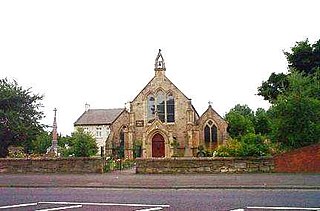
Stamfordham is a village and civil parish in Northumberland, England. The population of the civil parish at the 2001 Census was 1,047, rising to 1,185 at the 2011 Census. The place-name Stamfordham is first attested in the Pipe Rolls for 1188, where it appears as Stanfordhamn, which roughly translates as 'village at the stony ford'.
Newton on the Moor is a village and former civil parish in Northumberland, England. It is located 5 miles (8 km) south of Alnwick, on the old route of the A1 road although the village has now been bypassed just to the east. The village is now in the civil parish of Newton on the Moor and Swarland, which also includes the village of Swarland, south-west of Newton on the Moor. The population of Newton on the Moor and Swarland parish in 2001 was 822, increasing to 905 at the 2011 Census. The village is a conservation area.

Murton is a small village in the metropolitan borough of North Tyneside, in the ceremonial county of Tyne and Wear, England. The village is separated by fields from the nearby areas of West Monkseaton, New York, Earsdon and Shiremoor. Until 1974 Murton was in Northumberland. Murton was a civil parish between 1866 and 1935. In 1931 the parish had a population of 1164.

Kirkheaton is a village and former civil parish, now in the parish of Capheaton, in the county of Northumberland, England. The village lies about 10 miles (16 km) north east of Hexham and about 5 miles (8 km) west of Belsay. In 1951 the parish had a population of 70.

Glororum is a hamlet and former civil parish, now in the parish of Bamburgh in the county of Northumberland, England, about 1.25 miles (2.01 km) south west of Bamburgh. In 1951 the parish had a population of 13.

Harlow Hill is a small village and former civil parish, now in the parish of Stamfordham, in Northumberland, England. In 1951 the parish had a population of 61.

