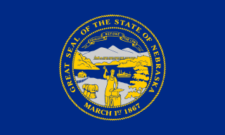
South Omaha is a former city and current district of Omaha, Nebraska, United States. During its initial development phase the town's nickname was "The Magic City" because of the seemingly overnight growth, due to the rapid development of the Union Stockyards. Annexed by the City of Omaha in 1915, the community has numerous historical landmarks many are within the South Omaha Main Street Historic District.
Gifford Park is a historic neighborhood in midtown Omaha, Nebraska. It is roughly bounded by the North Freeway on the east, North 38th Street on the west, Dodge Street on the south and Cuming Street on the north. Its namesake park was added to the City parks network in 1916. The neighborhood is bounded by several historic neighborhoods, including Bemis Park, Gold Coast, and the Near North Side.
The Union Stockyards of Omaha, Nebraska were founded in 1883 in South Omaha by the Union Stock Yards Company of Omaha. A fierce rival of Chicago's Union Stock Yards, the Omaha Union Stockyards were third in the United States for production by 1890. In 1947 they were second to Chicago in the world. Omaha overtook Chicago as the nation's largest livestock market and meat packing industry center in 1955, a title which it held onto until 1971. The 116-year-old institution closed in 1999. The Livestock Exchange Building was listed on the National Register of Historic Places in 1999.

Hanscom Park is a historic neighborhood in Midtown Omaha, Nebraska. Its namesake public park is one of the oldest parks in Omaha, donated to the City in 1872. U.S. President Gerald R. Ford was born in a house in the Hanscom Park neighborhood. Its boundaries are Center Street on the north, South 42nd on the west, Interstate 480 on the east and I-80 on the south.
Walnut Hill is a historic neighborhood located in north Omaha, Nebraska. It is bounded by North 40th Street on the east, Cuming Street on the south, Northwest Radial Highway and Saddle Creek Road on the west and Hamilton Street on the north.

The Vinton Street Commercial Historic District is located along Vinton Street between Elm Street on the west and South 17th Street on the east in south Omaha, Nebraska. This district is located adjacent to Sheelytown, a residential neighborhood that had historically significant populations of Irish, Poles, and Eastern European immigrants. It grew along with the success of the Union Stockyards and South Omaha. It was added to the National Register of Historic Places in 2006.
Hanscom Park United Methodist Church is located at 4444 Frances Street in the Hanscom Park neighborhood of Omaha, Nebraska. Established in 1886, the congregation has long been a leader in Nebraska Conference of the United Methodist Church, and hosted at least one annual regional meeting. In 1953, the congregation's pastor gained national attention for forming a psychiatric support group for Methodist ministers.
Sheelytown was a historic ethnic neighborhood in South Omaha, Nebraska, USA with populations of Irish, Polish and other first generation immigrants. Located north of the Union Stockyards, it was bounded by Edward Creighton Boulevard on the north, Vinton Street on the south, South 24th Street to the east, and 35th Street to the west. Sheelytown was named for the Sheely Brothers Packing Houses that were located in the area. Sheelytown was annexed by Omaha in 1887. The Omaha Quartermaster Depot was built just east of the community across the Union Pacific tracks.

Transportation in Omaha, Nebraska, includes most major modes, such as pedestrian, bicycle, automobile, bus, train and airplane. While early transportation consisted of ferries, stagecoaches, steamboats, street railroads, and railroads, the city's transportation systems have evolved to include the Interstate Highway System, parklike boulevards and a variety of bicycle and pedestrian trails. The historic head of several important emigrant trails and the First Transcontinental Railroad, its center as a national transportation hub earned Omaha the nickname "Gate City of the West" as early as the 1860s.
Railroads in Omaha, Nebraska have been integral to the growth and development of the city, the state of Nebraska, the Western United States and the entire United States. The convergence of many railroad forces upon the city was by happenstance and synergy, as none of the Omaha leaders had a comprehensive strategy for bringing railroads to the city.
The Saddle Creek Underpass is located in the Midtown area of Omaha, Nebraska. Designed to carry Saddle Creek Road under Dodge Street, the underpass was constructed in 1934 by the Works Progress Administration. It was included on the Bridges in Nebraska Multiple Property Submission on June 29, 1992.
Dodge Street is the main east–west street in Omaha, Nebraska. Numbered as U.S. Route 6 (US 6), the street starts in Downtown Omaha and connects to West Dodge Road around 78th Street. From there, it continues westward through the remainder of Douglas County.
The Redick Mansion, also known as the Mayne Mansion and Redick Hall, was located at 3612 North 24th Street in North Omaha, Nebraska. It served as the first home of Omaha University, now known as the University of Nebraska at Omaha, from 1909 through 1917. A five story tower on the front of the mansion was a notable landmark throughout the area.
Gibson Bend of the Missouri River is a meander located in Pottawattamie County, Iowa and Douglas County, Nebraska, located at 41°11′15″N95°55′15″W. The Gibson neighborhood is a community area in Omaha, Nebraska abutting the Gibson Bend.
The Swift Packing Plant was a division of Swift and Company located at South 27th and Q Streets in South Omaha, Nebraska. The plant was opened in 1887 and closed in 1969. It covered approximately eight square blocks and consisted of several brick and stone buildings, and was located in proximity to the Omaha Stockyards. It was located on the South Omaha Terminal Railway, and next to the Omaha Stockyards, making Swift one of the "Big Four" packing companies in Omaha.
The Armour Packing Plant was a division of Armour and Company located at South 29th and Q Streets in South Omaha, Nebraska. The plant opened in 1897 and closed in 1968. The plant included several buildings, including a remarkable red brick administrative building, and a large, tall wall which surrounded the facility. It was located on the South Omaha Terminal Railway, and next to the Omaha Stockyards, making Armour one of the "Big Four" packing companies in Omaha.
The Wilson Packing Plant was a division of the Wilson and Company meatpacking company located near South 27th and Y Streets in South Omaha, Nebraska. Founded in the 1890s, it closed in 1976. It occupied the area bounded by Washington Street, South 27th Street, W Street and South 30th Street. Located on the South Omaha Terminal Railway and next to the Omaha Stockyards, Wilson was regarded as one of the "Big Four" packing companies in Omaha.
The Sheely Packing Company was located at South 27th Avenue and Martha Street in South Omaha, Nebraska. The plant was the namesake of the surrounding Sheelytown neighborhood, which was predominantly Polish, with many other immigrants as well. It was the first substantial meatpacking operation in Omaha, which preceded the founding of the city's large meatpacking industry.
Fair Deal Cafe was a historically significant diner for the African American community in North Omaha, Nebraska. Once known as the "Black City Hall", Fair Deal was located at North 24th & Burdette in the Near North Omaha neighborhood from 1954 - 2003.
The Carver Savings and Loan Association opened in 1944 as the first African-American financial institution in Omaha, Nebraska. Located at 2416 Lake Street next to the historic North 24th Street corridor, it was in the heart of the Near North Omaha neighborhood, Omaha's African-American business district.