Oasis of Bukhara

Last updated

Bukhara Oasis (Uzbek : Buxoro vohasi) is a fertile area in the south-eastern part of Uzbekistan formed by the Zerafshan River. The oasis is heavily populated and Bukhara is the largest city.

Contents

The oasis has been inhabited for at least two and a half millennia. After becoming a part of the Silk Road, Bukhara Oasis' influence grew over its neighbours. It was conquered by Arabs in the 9th century.

As of 2019, approximately 1.2 million people live in the oasis while the area of irrigation stretches to 2,300 km2 (570,000 acres). [1]

Geography

Bukhara Oasis is located in the south-east of Uzbekistan, near the smaller Qaraqol Oasis, on the alluvial plain formed by the meandering Zerafshan River. [1]

The Oasis emerged at the Zerafshan River delta between two larger waterways, Syr Darya and Amu Darya; it divides two cultural regions: Mediterranean-Iranian and China. [2] The northern reach of the oasis is framed by the Kouldouktou mountains, but the average altitudes of the oasis are low: 200 to 260 m above the sea level. [1] It is bordered by the Qara Kum desert on the south and by Kyzylkum Desert on the north and occupied around 5,000 m2 (1.2 acres) of land. [3] The channels of the Zerafshan River are very mobile, and human settlements moved with the channels over the centuries. [1]

The Bukhara Oasis has an arid climate with only about 160 mm of annual precipitation, so Zerafshan was a crucial source of water for local residents. [1] In the 1970, a channel connected Zerafshan with Amu Darya, but only a decade later, Bukhara Oasis started experiencing waterlogging, water pollution, increasing soil salinity, and other hydrological problems. [1] Since the Zerafshan channels in the western part of the oasis are more numerous and dense, this part has more human settlements compared to the rest of the oasis. [4]

A study conducted by the Mission Archéologique Franco-Ouzbèke dans l'Oasis de Boukhara (MAFOUB) in late 2010s found eight channels that Zerafshan used to flow in, but later changed course. [5] Melting of the glaciers after the Last Glacial Maximum along with possible earthquakes blocked the river several times; then the temporary dams would get broken by the mass of water gathered upstream, which created avulsions that destroyed all the human-made structures. [5] Earliest human settlements located near the current channel appeared not earlier than the 3rd century BCE with earlier settlements located at the ends of the Zerafshan channels and around lacustrine areas. [5]

History

Earliest settlement

From 3rd century BCE to the 16th century CE, over 1,000 settlements have been identified in the oasis, mostly associated with the tepe. [6] Shishkin  [ ru ] identified two types of tepe: a "monolithic" type with walls but no citadel, and a "two-level" type with a citadel and a shahrestan. [6] The survey led by Chiara Silvi Antonini developed a much more detailed typology, which the MAFOUB abandoned in favour of a simpler classification: 1) cities with a citadel, a shahrestan, and a rabad; 2) cities with a citadel and a shahrestan only; 3) cities with a unique mound, such as mills, caravanserais, or kurgans; 4) open sites such as ceramic distribution zones, production zones etc. [7] The tripartite cities with a citadel, a shahrestan, and a rabad are the most stable ones, appearing in the 2nd to 3rd century BCE (surrounding suburbs start appearing in the 5th century CE) and lasting at least until the Mongol and Timurid periods in the 13–15th centuries. [8]

During the Neolithic era, humans lived in the south-western part of the oasis and in the east, near an old channel of Kashka Darya; during Bronze Age, people inhabited the south-western and western areas; however, no artifacts from this period remain. [9] The central part of the oasis was likely an uninhabitable marshland at this time. [9] [10]

First modern settlements

Excavations in Varakhsha, founded in the 1st century BCE Varahsha20.jpg
Excavations in Varakhsha, founded in the 1st century BCE

After Zerafshan's last change in course in the 3rd to 2nd century BCE, the first modern settlement of Paykend appeared. [11] It was not alone: several modern settlements developed fortifications by 3—1 century BCE; they likely evolved from earlier hamlets that had no walls. [4] Most of them are located close to a water source with the Sivanj settlement being a rare exception: it probably drew its water from artificial canals leading to Romitan. [4]

Bukhara Oasis is included in the caravan network of the Silk Road starting from the 4th century BCE, but it was not an active member of the trade network until the end of the 1st century BCE, possibly because of the lack of pasture for the animals, unlike the road through Bactria to the south. [12]

Rise of Bukhara

A portrait of a woman and a man from Bukhara; 17 century Double portrait of a man and woman from Bukhara 1974,0617,0.1.14.png
A portrait of a woman and a man from Bukhara; 17 century
Water management remains an ongoing issue in Bukhara 20230610 Boukhara279.jpg
Water management remains an ongoing issue in Bukhara

By the 1st through 3rd centuries CE, the earliest settlements acquired citadels and shahrestans while many smaller others appeared near them. [4] The reason for this urbanisation and efforts to protect the settlements was the rise of Sogdia and Chach, which used to be vassals of the nomadic Kangju kingdom; Bukhara Oasis was a part of Sogdia. [13] At this point, Bukhara became the main settlement in the oasis. [10] After that and until the early 8th century the population of the oasis grew exponentially. [13] Its strategic location along the north-eastern part of the Silk Road facilitated a massive resettlement of people, especially from the north-east. [14] A new type of ceramics appeared: starting from the 3rd century, Kaunchi pottery is found in the oasis. [14]

In the early 7th century, the first textual mention of Bukhara appeared in Arabic sources after the collapse of the Hephthalite Empire. [15] Al-Tabari mentioned a "lord of Varakhsha" who became "the king of Bukhara" (that is, the whole oasis) for a short time right before the Arabic invasion in the 9th century. [16] The Muslim conquest of Transoxiana began the Islamic period in the history of the oasis, which is characterised by resettlement of depopulated places and temporary or permanent abandonment of established cities such as Ramitan (later repopulated) and Varakhsha (last ceramics found there are dated to the 13th century). [14] These cities also exemplify the main reasons for the population decline: the washing out of the mud brick structures (Ramitan) and instabilities with water supply (Varakhsha). [17] The population changes ended in the 15th through 16th centuries: settlements such as Kakishtuvan, Barkad, Pinjan and Iskijkat, which had no access to water, were abandoned; later the ancient tepe of Bukhara, Gijduvon and Vobkent were swallowed by new buildings. [18] Bukhara, previously being associated with the oasis, became synonymous with its metropoly. [15]

Surveys and expeditions

The first systematic investigation of the Bukhara Oasis was conducted by a team led by a Russian diplomat Alexander Fedorovich Negri  [ ru ] in 1820s; it included cartographers, a doctor, and a naturalist. [19] British diplomat Alexander Burnes contributed to the study of the Oasis by making archaeological notes during his visit in the late 1820s. [19] An expedition conducted by the military topographer N. S. Sitnjakovskij in 1896 recorded a lot of information on the oasis' management. [19] Investigations led by Leonid Aleksandrovich Zimin  [ ru ] in 1913–1915 were mostly concerned with the Paykend region, but provided some data about other parts of the oasis as well. [19] Starting from the 1930s, researchers became increasingly interested in Bukhara Oasis' archaeology while their investigations became more thorough. [19]

After the territory of the oasis was acquired by the USSR, Soviet authorities launched several surveys with teams of scientists studying the oasis region; the most important ones were conducted by Shishkin (1937), Mukhamedjanov (1975, 1978), Guliamov  [ ru ], Islamov  [ ru ] and Askarov  [ ru ] (1966); another major study of the oasis' monuments was organised by the USSR Archaeological Institute in 1985. [19]

As for the studies conducted in the independent Uzbekistan, Shukhrat Adilov (2006) surveyed the hydrography of the region while several Italian expeditions published materials from local excavations. [19]

See also

Notes

Related Research Articles

<span class="mw-page-title-main">Amu Darya</span> River in Central Asia

The Amu Darya, also called the Amu, the Amo, and historically the Oxus, is a major river in Central Asia and Afghanistan. Rising in the Pamir Mountains, north of the Hindu Kush, the Amu Darya is formed by the confluence of the Vakhsh and Panj rivers, in the Tigrovaya Balka Nature Reserve on the border between Afghanistan and Tajikistan, and flows from there north-westwards into the southern remnants of the Aral Sea. In its upper course, the river forms part of Afghanistan's northern border with Tajikistan, Uzbekistan, and Turkmenistan. In ancient history, the river was regarded as the boundary of Greater Iran with Turan, which roughly corresponded to present-day Central Asia. The Amu Darya has a flow of about 70 cubic kilometres per year on average.

<span class="mw-page-title-main">Qarshi</span> City in southern Uzbekistan

Qarshi is a city in southern Uzbekistan. It is the capital of Qashqadaryo Region. Administratively, Qarshi is a district-level city, that includes the urban-type settlement Qashqadaryo. It has a population of 278,300. It is about 520 km south-southwest of Tashkent, and about 335 km north of Uzbekistan's border with Afghanistan. It is located at latitude 38° 51' 48N; longitude 65° 47' 52E at an altitude of 374 meters. The city is important in natural gas production, but Qarshi is also famous for its production of woven flat carpets.

<span class="mw-page-title-main">Syr Darya</span> River in Central Asia

The Syr Darya, historically known as the Jaxartes, is a river in Central Asia. The name, which is Persian, literally means Syr Sea or Syr River. It originates in the Tian Shan Mountains in Kyrgyzstan and eastern Uzbekistan and flows for 2,256.25 kilometres (1,401.97 mi) west and north-west through Uzbekistan and southern Kazakhstan to the northern remnants of the Aral Sea. It is the northern and eastern of the two main rivers in the endorheic basin of the Aral Sea, the other being the Amu Darya (Jayhun).

<span class="mw-page-title-main">Bactria–Margiana Archaeological Complex</span> c. 2250–1700 BC Central Asian archaeological culture

The Bactria–Margiana Archaeological Complex (BMAC) is the modern archaeological designation for a particular Middle Bronze Age civilisation of southern Central Asia, also known as the Oxus Civilization. The civilisation's urban phase or Integration Era, was dated in 2010 by Sandro Salvatori to c. 2400–1950 BC, but a different view is held by Nadezhda A. Duvoba and Bertille Lyonnet, c. 2250–1700 BC.

<span class="mw-page-title-main">Türkmenabat</span> Capital of Lebap Province, Turkmenistan

Türkmenabat, formerly Amul, Çärjew, and Novy Chardzhuy, is the second-largest city in Turkmenistan and the administrative centre of Lebap Province. As of 2009, it had a population of approximately 254,000 people. From 1924 to 1927, it was also named Leninsk in honor of Vladimir Lenin.
<span class="mw-page-title-main">Zarafshon (river)</span> River in Tajikistan, Uzbekistan

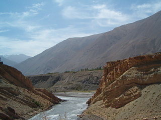
The Zarafshon is a river in Tajikistan and Uzbekistan in Central Asia. Its name, "spreader of gold" in Persian, refers to the presence of gold-bearing sands in the upper reaches of the river. To the ancient Greeks it was known as the Polytimetus. It was also formerly known as Sughd River. The river is 877 kilometres (545 mi) long and has a basin area of 17,700 square kilometres (6,800 sq mi).

<span class="mw-page-title-main">Termez</span> Ancient city in Surxondaryo Region, Uzbekistan

Termez is the capital of Surxondaryo Region in southern Uzbekistan. Administratively, it is a district-level city. Its population is 182,800 (2021). It is notable as the site of Alexander the Great's city Alexandria on the Oxus, as a center of early Buddhism, as a site of Muslim pilgrimage, and as a base of Soviet Union military operations in Afghanistan, accessible via the nearby Hairatan border crossing.

<span class="mw-page-title-main">Ark of Bukhara</span> 5th-century fortress in Bukhara, Uzbekistan

The Ark of Bukhara is a massive fortress located in the city of Bukhara, Uzbekistan, that was initially built and occupied around the 5th century AD. In addition to being a military structure, the Ark encompassed what was essentially a town that, during much of the fortress's history, was inhabited by the various royal courts that held sway over the region surrounding Bukhara. The Ark was used as a fortress until it fell to Russia in 1920. Currently, the Ark is a tourist attraction and houses museums covering its history. The museums and other restored areas include an archaeological museum, the throne room, the reception and coronation court, a local history museum, and the court mosque.

<span class="mw-page-title-main">Kangju</span> Ethnic group mentioned in Chinese history; probably the Sogdians

Kangju was the Chinese name of a kingdom in Central Asia during the first half of the first millennium CE. The name Kangju is now generally regarded as a variant or mutated form of the name Sogdiana. According to contemporaneous Chinese sources, Kangju was the second most powerful state in Transoxiana, after the Yuezhi. Its people, known in Chinese as the Kāng (康), were evidently of Indo-European origins, spoke an Eastern Iranian language, and had a semi-nomadic way of life. The Sogdians may have been the same people as those of Kangju and closely related the Sakas, or other Iranian groups such as the Asii.

<span class="mw-page-title-main">Dalverzin Tepe</span> Bactrian archaeological site

Dalverzin Tepe is an ancient archaeological site founded by the Graeco-Bactrian Kingdom and located near to the modern city of Denau in the Surxondaryo Region of Uzbekistan. The city was founded in the 3rd century BC and rose to prominence in the Kushan period when two important Buddhist temples were built here. Dalverzin Tepe was excavated by the famed Soviet archeologist Galina Pugachenkova.

<span class="mw-page-title-main">Paykend</span> Archaeological site in Uzbekistan

Paykend or Poykent, an ancient city in Uzbekistan, is located in the lower stream of Zarafshan River and was one of the largest cities of the Bukhara oasis. The city consisted of a citadel, two settlements, and a rabod (suburb). Paykend is currently under consideration for inscription as a UNESCO World Heritage site.

Shahrukhiya is a site of ancient settlement located 88 km to the southwest of Tashkent, Uzbekistan, on the right coast of Syrdarya River. It is the first large city of the Tashkent oases, situated on the Great Silk Road through Yaksart (Syrdarya). In the oriental sources, it was famous under the name Benaket, and the portion of the Great Silk Road direction called by its name.

The site of ancient settlement at Kanka, Uzbekistan, is located in 80 km southeast of Tashkent, in the southeastern outskirts of the Eltamgali settlement. It is one of the large, ancient city centers of the Tashkent oasis. Kanka is the first capital of the Chach state, a small estate of Kanguy.

Gurlan is a town and seat of Gurlan District in Xorazm Region in Uzbekistan. It is located near the border with Turkmenistan in western Uzbekistan, 42 kilometres (26 mi) north-west of Urgench, north of Shovot, and south of the Amu Darya river. Gurlen is a major centre for cotton production, and rice and yams are also significant other crops.

The history of Bukhara stretches back millennia. The origin of its inhabitants goes back to the period of Aryan immigration into the region. The city itself, currently the capital of the Bukhara Region (viloyat) of Uzbekistan, is about two and a half thousand years old. Located on the Silk Road, the city has long been a centre of trade, scholarship, culture, and religion. During the Golden age of Islam, under the rule of Samanids, Bukhara became the intellectual centre of the Islamic world. In medieval times, Bukhara served as the capital of the Khanate of Bukhara and was the birthplace of Imam Bukhari.

<span class="mw-page-title-main">Syr-Darya Oblast</span> Oblast in Turkestan, Russian Empire

The Syr-Darya Oblast was one of the oblasts of the Russian Empire, a part of Russian Turkestan. Its center was Tashkent.

<span class="mw-page-title-main">Aqcha</span> Town in Jowzjan Province, Afghanistan

Aqcha or Akcha, is a city in northern Afghanistan. It is located approximately 50 kilometres (31 mi) east of Sheberghan and 100 kilometres (62 mi) west of Mazar-i-Sharif. It serves as the center of the Aqcha District of Afghanistan's Jowzjan Province. The town is situated a few kilometers north of the main Sheberghan-Mazar-i-Sharif road called Aqyol.
<span class="mw-page-title-main">Varakhsha</span> Archaeological site in Uzbekistan

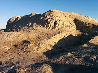
Varakhsha, also Varasha or Varahsha, was an ancient city in the Bukhara oasis in Sogdia, founded in the 1st century BCE. It is located 39 kilometers to the northwest of Bukhara. Varakhsha was the capital of the Sogdian dynasty of the kings of Bukhara, the Bukhar Khudahs. It ultimately never recovered from the Muslim conquest of Transoxiana.

Kampir Tepe is an archaeological site located within the Surxondaryo Region of Uzbekistan, near the village Shoʻrob, northwest of the city of Termez. It is thought to be the lost city of Alexandria on the Oxus described by Ptolemy, though the Amu Darya river has now changed its course. The Telegraph newspaper describes Kampir Tepe as “the Pompeii of Central Asia.”

<span class="mw-page-title-main">Tudakul</span> Reservoir near Bukhara

Tudakul lake, Tudakul reservoir, or simply Tudakul is located in the Qiziltepa district of Navoiy region. It was formed in 1952 due to the subsidence of the Zarafshan River waters into the Tudakul depression, naturally occurring as a result. Situated about 26 kilometers east of Bukhara in a natural depression, it's positioned in the eastern part of the Quyimozor Water Reservoir. This water basin was converted into a water reservoir in 1968.

References

39°55′45″N64°25′25″E / 39.92917°N 64.42361°E / 39.92917; 64.42361