Odness

Last updated

Odness
Odiness Farm, Stronsay. - geograph.org.uk - 531502.jpg
Odiness Farm, viewed from the sea
Orkney Islands UK location map.svg
Red pog.svg
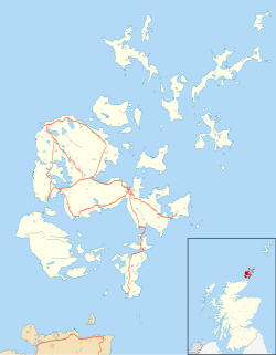
Odness
Location within Orkney
OS grid reference HY687262
Civil parish
Council area
Lieutenancy area
Country Scotland
Sovereign state United Kingdom
Post town ORKNEY
Postcode district KW17
Dialling code 01856
Police Scotland
Fire Scottish
Ambulance Scottish
UK Parliament
Scottish Parliament
List of places
UK
Scotland
59°07′N2°32′W / 59.12°N 2.54°W / 59.12; -2.54 Coordinates: 59°07′N2°32′W / 59.12°N 2.54°W / 59.12; -2.54

Odness is a peninsula and headland on the island of Stronsay, in Orkney, Scotland. The Odness peninsula contains the farm of Odiness. Odness is also within the parish of Stronsay. [1]

The coast near Odness Coast near Odness, Stronsay - geograph.org.uk - 212969.jpg
The coast near Odness

Related Research Articles

Callanish Human settlement in Scotland

Callanish is a village (township) on the west side of the Isle of Lewis, in the Outer Hebrides, Scotland. Callanish is within the parish of Uig. A linear settlement with a jetty, it is on a headland jutting into Loch Roag, a sea loch 13 miles west of Stornoway. Callanish is situated alongside the A858, between Breasclete and Garynahine.

Stronsay

Stronsay is an island in Orkney, Scotland. It is known as Orkney's 'Island of Bays', owing to an irregular shape with miles of coastline, with three large bays separated by two isthmuses: St Catherine's Bay to the west, the Bay of Holland to the south and Mill Bay to the east. Stronsay is 3,275 hectares in area, and 44 metres in altitude at its highest point. It has a usually resident population of 349. The main village is Whitehall, home to a heritage centre.

Port Bannatyne Human settlement in Scotland

Port Bannatyne is a coastal village on the Isle of Bute, Firth of Clyde, Scotland. Port Bannatyne developed into the 1900s as a quieter alternative to Rothesay. It is a popular harbour, with a small yacht marina and boatyard and an unusual 13-hole golf course rather than the standard 18.

Portnaguran Human settlement in Scotland

Portnaguran is a settlement situated within Point, on the Isle of Lewis, in the Outer Hebrides, Scotland. Portnaguran is the township at the north-easternmost point of the peninsula. It lies 1 mile (1.6 km) southwest of Tiumpan Head and just south of the headland called Geòdha 'ic Sheòrais or sometimes Small Head amongst locals. Portnaguran is situated at the north-eastern end of the A866, within the parish of Stornoway.

Aignish Human settlement in Scotland

Aignish is located northwest of Knock and east of Stornoway on the east coast of the Isle of Lewis, in the Outer Hebrides, Scotland. The township is at the island side of the isthmus connecting to the Eye peninsula. Aignish is within the parish of Stornoway, and is situated on the A866 between Stornoway and Portnaguran.

Port Askaig Human settlement in Scotland

Port Askaig is a port village on the east coast of the island of Islay, in Scotland.

Aird, Lewis Human settlement in Scotland

Aird is a village in the Scottish council area of Eileanan Siar. It is located on the Eye Peninsula on the east coast of the Isle of Lewis. Aird is within the parish of Stornoway, and is situated on the A866 near the northern end of the road.

Skigersta Human settlement in Scotland

Skigersta is a village to the south east of Ness on the Isle of Lewis, in the Outer Hebrides, Scotland. Skigersta is situated within the parish of Barvas. There is a quay built in 1901 and a shingle beach. Skigersta was a location for fish curing in the 19th century with the ruins of the curing bothies still visible next to the river and a man-made channel in the shoreline allowing easier access for the boats. The area of Skigersta near the shore is called 'Lachamore'.

Canmore is an online database of information on over 320,000 archaeological sites, monuments, and buildings in Scotland. It was begun by the Royal Commission on the Ancient and Historical Monuments of Scotland. Historic Environment Scotland has maintained it since 2015. The Canmore database is part of the National Record of the Historic Environment, formerly the National Monuments Record of Scotland and contains around 1.3 million catalogue entries. It includes marine monuments and designated official wreck sites, such as the wreck of HMS Pheasant (1916).

Shulishader Human settlement in Scotland

Shulishader is a small village with a population of around 120 people in Point, Outer Hebrides on the Isle of Lewis, Scotland. Located on the north-western side of the Eye Peninsula, it overlooks Broad Bay. Most of the village is over 60m above sea level, affording excellent views across the bay and northern Lewis, though the land falls gently towards the sea before ending in small cliffs. There are several small, difficult to access, sandy beaches, and a small cove on the coastline. The cove is accessible via 88 dilapidated steps, and contains a pebble peach, some natural caves and a concrete structure once used for boat moorings above the high tide line.

Pirnmill Human settlement in Scotland

Pirnmill is a small village on the north-west coast of the Isle of Arran, Scotland. The village is situated on the Kilbrannan Sound, facing Grogport on the Kintyre peninsula.

North Roe Human settlement in Scotland

North Roe is a village, and protected area at the northern tip in the large Northmavine peninsula of the Mainland of Shetland, Scotland. It is a small village, with a school with less than a dozen pupils in 2011. The moorland plateau to the south-west of the settlement is part of the Ronas Hill-North Roe and Tingon internationally recognised wetland site, protected under the terms of the Ramsar Convention on Wetlands, and also a Special Protection Area under the Birds Directive. The village is served by the A970 road which runs the length of the Shetland mainland from south to north and is a single-carriageway for the final nine miles.

Garrabost Human settlement in Scotland

Garrabost is a village in the Point peninsula isthmus on the east coast of the Isle of Lewis, in the Outer Hebrides, Scotland. The village is one of the largest in Point, comprising Upper and Lower Garrabost, and Claypark. Garrabost is within the civil parish of Stornoway. The church parish for Point is called Knock, and both Knock Church of Scotland and Knock Free Church of Scotland are located in Garrabost. Garrabost is situated on the A866, between Stornoway and Portnaguran.

Bogach Human settlement in Scotland

Bogach is a village on the island of Barra in the Outer Hebrides, Scotland. Bogach is also within the parish of Barra, and is situated on a minor road, linked to the A888. It consists of just 8 crofts, each of which lies on a small strip of land running from north coast to south. It separates the main island at Bagherivagh from the peninsula known as Bruairnis.

Cross, Lewis Human settlement in Scotland

Cross is a township on the Isle of Lewis in the community of Ness, in the Outer Hebrides, Scotland. Cross is within the parish of Barvas. Cross is also situated on the A857, between Stornoway and Port of Ness.

Aird Uig Human settlement in Scotland

Aird Uig is a village on the Isle of Lewis, in the Outer Hebrides, Scotland. Aird Uig is within the parish of Uig, and is situated on the C40 minor road which joins to the B8011 at Timsgarry.

Cliff, Lewis Human settlement in Scotland

Cliff is a small settlement on the Isle of Lewis, in the Outer Hebrides, Scotland. Cliff is within the parish of Uig. The settlement is situated on a minor road, off the B8011. The picturesque beach is unsafe for swimming. At low to mid tide holds an excellent barrelling beach break wave. Breaks up to 12 ft+ for experienced surfers and bodyboarders

Loch Ruel Sea loch in Scotland

Loch Ruel or Loch Riddon; extends north from the Kyles of Bute and is a Sea Loch, on the Cowal peninsula, Argyll and Bute, Scotland.

Loch of Tankerness

Loch of Tankerness is a large, lowland, freshwater loch on the Orkney mainland in Scotland. The loch is roughly triangular in shape and is shallow with a flat bottom that gradually deepens from west to east. It lies approximately 4 mi (6.4 km) southeast of Kirkwall.

References

  1. "Details of Odness". Scottish Places. Retrieved 1 January 2015.