Oyigbo is a town, 30 kilometers from the port city of Port Harcourt and a local government area of Rivers State, Nigeria.
Bayo is a Local Government Area of Borno State, Nigeria. Its headquarters are in the town Fikayel.
Gubio, also Gobiyo, is a Local Government Area of Borno State, in northeastern Nigeria. Its headquarters are in the town of Gubio.
Guzamala is a Local Government Area of Borno State, Nigeria. Its headquarters are in the town of Gudumbali. It's located approximately 125 kilometres north of the state capital, Maiduguri. It has an area of 2,517 km2 and a population of 95,648 at the 2006 census.
Jere is a local government area of Borno State, Nigeria. It has its headquarters in the town of Khaddamari. London ciki is a community in Jere under maimusari ward.
Kala/Balge is a Local Government Area of Borno State, Nigeria. It is the easternmost LGA of Nigeria. It has its headquarters in the town of Rann.

Egor is a Local Government Area of Edo State, Nigeria. Its headquarters are in the town of Uselu. Egor is one of the Local Government Areas that are part of the larger metropolitan area of Benin City.

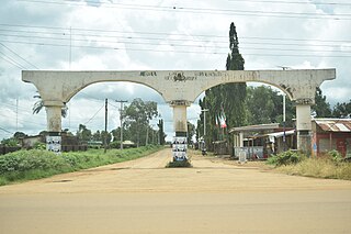
Oru-East is a Local Government Area of Imo State, Nigeria. Its headquarters is at Omuma. The following are towns that make up Oru East: Akatta, Akuma, Amagu, Amiri, Awo-Omamma, and Omuma.
Chikun is a Local Government Area in central Kaduna State, Nigeria. It has an area of about 4,466 km2, and had a population of 372,272 as at the 2006 census. Its headquarters is located in the town of Kujama. The postal code of the area is 2438000.
Sanga is a Local Government Area in southern Kaduna State, Nigeria. Its headquarters is in the town of Gbantu. The Local Government Council is chaired by Bisallah Malam. It has an area of 1,821 km2 and had a population of 151,485 as at the 2006 census. The postal code of the area is 801.
Jema'a is a Local Government Area in southern Kaduna State, Nigeria with headquarters at Kafanchan. The Local Government Council is chaired by Yunana Barde. It has an area of 1,384 km2 and a population of 278,202 at the 2006 census. The postal code of the area is 801.
Kaura is a town and a Local Government Area in southern Kaduna State, Nigeria. Its headquarters are in the town of Kaura in Asholyio (Moroa) Chiefdom. The Local Government Council is chaired by Matthias Siman. Other towns include: Manchok and Kagoro. It has an area of 461 km2 and a population of 174,626 at the 2006 census. The postal code of the area is 801.
Kagarko is a Local Government Area in southern Kaduna State of Nigeria. Its headquarters are in the town of Kagarko. It has an area of 2,356 km2 and a population of 239,058 at the 2006 census. The Local Government Council is chaired by Nasara Rabo. The postal code is 802.
Kachia is a Local Government Area in the southern part of Kaduna State, Nigeria. Its headquarters are in the town of Kachia. It has an area of 4,570 km2 and a population of 252,568 in the 2006 census. The postal code of the area is 802.
Kauru is a Local Government Area in southern Kaduna State, Nigeria. The area is 3,186 km2. Its headquarters are in the town of Kauru. The postal code of the area is 811.
Lavun is a Local Government Area in Niger State, Nigeria. Its headquarters are in the town of Kutigi in the south of the area at9°12′00″N5°36′00″E. The Kaduna River forms the eastern border of the LGA.
Kanke is a Local Government Area in Plateau State, Nigeria. Its headquarters is in the town of Kwal.
Degema is a Local Government Area in Rivers State, Nigeria. Its headquarters are in the town of Degema.
Ifelodun is a Local Government Area in Osun State, Nigeria. Its headquarters are in the town of Ikirun.
The Otin River is a river in Osun State, Nigeria. It is impounded by the Eko-Ende Dam.


