Ifedayo

Last updated

Ifedayo
LGA
Nigeria location map.svg
Red pog.svg
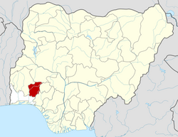
Ifedayo
Location in Nigeria
Coordinates: 7°57′N4°59′E / 7.950°N 4.983°E / 7.950; 4.983
CountryFlag of Nigeria.svg  Nigeria
State Osun State
Government
  Executive Chairman of the Local Government AreaAbiodun Samuel Idowu
Area
  Total128 km2 (49 sq mi)
Population
 (2006 census)
  Total37,058
Time zone UTC+1 (WAT)
3-digit postal code prefix
234
ISO 3166 code NG.OS.IF
Ifedayo

Ifedayo is one of the 30 local government areas of Osun State in southwestern Nigeria. It is one of the most recent local government areas to be created.

Contents

Its headquarters are in the town of Oke-Ila Orangun.

It has an area of 128 km2 and a population of 37,058 at the 2006 census.

The postal code of the area is 234. [1]

The people of Ifedayo consist of the Igbomina (or Ogbonna) sub-ethnic group of the Yoruba . There are several other small towns and villages in the local government area, most of which lie west of Oke-Ila Orangun

Traditional Institution

Notable paramount rulers in ifedayo Local Government include; The Orangun of Oke-Ila, HRH Oba Adedokun Omoniyi Abolarin; The Asaooni of Ora-Igbomina, Oba Tinuoye Atolagbe and the Akesin of Ora-Igbomina, Oba Samuel Oladoye Idowu.

Tourism

Ayinkunugba Waterfalls

Ayinkunugba Waterfalls is located in Oke-Ila Orangun Ifedayo local government. The waterfalls is over 80m high and it is the opposite of Olumirin Waterfall where you climb to appreciate it, but in Ayinkunugba, people will descend to discover the wonderful work of nature that is in the beautiful landscape of mountains, caves and trees.

Ayinkunugba Waterfalls was discovered by a hunter who shot a strange animal called Kunugba. The shot animal rolled down and the hunter searched but could not find it, instead, discovered waterfalls and named it: Ayinkunugba (Where an animal Nugba, rolled and died).

Notable indigenes

Related Research Articles

Osogbo is a town in Nigeria. It became the capital city of Osun State in 1991. Osogbo city seats the Headquarters of both Osogbo Local Government Area and Olorunda Local Government Area. It is some 88 kilometers by road northeast of Ibadan. It is also 108 kilometres (67 mi) by road south of Ilorin and 108 kilometres (67 mi) northwest of Akure. Osogbo shares boundaries with Ikirun, Ilesa, Ede, Egbedore, Ogbomosho and Iragbiji and it is easily accessible from any part of the state because of its central nature. It is about 48 km from Ife, 32 km from Ilesa, 46 km from Iwo, 48 km from Ikire and 46 km from Ila-Orangun; The city had a population of about 500,000 people and an approximate land area of 2875 km2 the postal code of the area is 230.

<span class="mw-page-title-main">Osun State</span> State of Nigeria

Osun State, occasionally known as the State of Osun by the state government, is a state in southwestern Nigeria; bounded to the east by Ekiti and Ondo states, to the north by Kwara State, to the south by Ogun State and to the west by Oyo State. Named for the River Osun—a vital river which flows through the state—the state was formed from the southeast of Oyo State on 27 August 1991 and has its capital as the city of Osogbo.

The Ìgbómìnà are a subgroup of the Yoruba ethnic group, which originates from the north central and southwest Nigeria. They speak a dialect also called Ìgbómìnà or Igbonna, classified among the Central Yoruba of the three major Yoruba dialectical areas. The Ìgbómìnà spread across what is now southern Kwara State and northern Osun State. Peripheral areas of the dialectical region have some similarities to the adjoining Ekiti, Ijesha and Oyo dialects.

Òkè-Ìlá Òràngún is an ancient city in southwestern Nigeria that was capital of the middle-age Igbomina-Yoruba city-state of the same name.

Orangun or Ọ̀ràngún of Ìlá is the title of the paramount ruler of one of the ancient Igbomina kingdoms, a sub group of the Yoruba people with its seat and capital located in Ila Orangun, central Yorubaland, presently in southwestern Nigeria.

The Omi-Ọṣun ruins are the remains of an ancient settlement of the Òkè-Ìlá Òràngún kingdom, located along the Omi-Ọsun river in southwestern Nigeria. The ruins consist of remnants of ancient walls, potsherds, and other relics. Much of the site complex is currently overgrown with thicket, but large portions are being used as farmland. Efforts have been made since the late 1970s to persuade the paramount ruler and the local population to protect the remaining ruins from destruction by farming activity, building, and road construction. These efforts received an authoritatitive boost when the main advocate of the conservation of the ruins, a geologist/geophysicist with archaeological interests, was installed into the royal dynastic position of the Oba'lumo, which provided him with increased access to the royal councils of the Orangun, the paramount king of the region.

<span class="mw-page-title-main">Ila Orangun</span> Town in Osun State, Nigeria

Oba-Igbomina, is an ancient Igbomina town in northeastern Isin Local Government Area of Kwara State. It is one of the five related Yoruba towns named "Oba", the others being

Ìsèdó is an ancient Igbomina kingdom in northeastern Yorubaland of Nigeria. Ìsẹ̀dó was founded as a new city-state several centuries ago by Ọba'lumọ, a Prince of the ancient Oba civilization. Ìsẹ̀dó is fully known and called "Ìsẹ̀dó-Olúmọ̀" using its founder-king's name as an identifier suffix. Ọba'lumọ, emigrated from the ancient Ọ̀bà civilization in northeastern Yorubaland.

The Obalúmo is a royal personage, a traditional monarch amongst the Igbomina clan of the Yorubas of West Africa. The earliest manifestation of his title dates back to the 12th century at the latest, making him a ruler of relative significance in the intricate chiefly hierarchy of the tribe.

Ora-Igbomina is an ancient Igbomina town in Ifedayo Local Government Area, Osun State, Nigeria. With Oke-Ila Orangun, it constitutes the two major towns in the local government area. The conjoining boundary town among Osun, Ekiti and Kwara States, this historical town was the first town to accept Christianity(ref.: and invariably Western education in Igbominaland. Christianity was brought to Ora in 1895 by CMS missionaries led by a son of the soil - a returnee from the slave trade named Pa Olasehinde. St. Stephen Anglican Church was established in 1895. The first primary school in Igbominaland - stretching from present-day Osun to Kwara States - St. Stephen's Anglican Primary School was established in 1912. Ora is referred to as "The Cradle of Education and Christianity in Igbomina Land, and by extension to parts of Moba Division of present-day Ekiti State and also in the whole of the old Osun North East Division of the old Western Region, which covers almost half of the present Osun State.

<span class="mw-page-title-main">Ijesha</span>

The Ijesha are a sub-ethnicity of the Yorubas of West Africa. Ilesha is the largest town and historic cultural capital of the Ijesha people, and is home to a kingdom of the same name, ruled by an Oba locally styled as the Owa Obokun Adimula. The present ruling family of Ijesha is the Aromolaran family with the current reigning Owa Obokun being Oba Gabriel Adekunle Aromolaran.

The Rev. Dr. Solomon Adeniyi Babalola was a Nigerian Baptist pastor who lived and served in Nigeria, Ghana, Canada, and the United States. Born in Oke-Ila, Nigeria, he graduated from his initial pastoral training in December 1949 from the three-year theology course of the Nigerian Baptist Theological Seminary, Ogbomosho. He is reputed to be one of the two youngest Nigerian nationals ever recruited into the ministry by American missionaries, during a late-1940s drive led by Seminary President Dr. J.C. Pool, assisted by indigenous pastors. Babalola was consecrated as a Baptist trained pastor at the age of 20.

Isin is a Local Government Area in Kwara State, Nigeria. Isin Local Government Area of Kwara State was created from the old Irepodun Local Government Area in 1996 with the headquarters at Owu-Isin. It has an area of 633 km² and a population of 59,738 at the 2006 census.

Oke Ero is a Local Government Area in Kwara State, Nigeria. Its headquarters are in the town of Iloffa. Other Major towns in Oke Ero are Odo-Owa, Idofin, Ekan Nla, Ayedun,Erin Mope, Egosi, Imode, Idofin Odo-Ase, Kajola and Ilale. The first executive chairman of Oke-Ero is the late Otunba Moses Afolayan, while the second was Barrister Kayode Towoju.

Ila is a local government area in Osun State, Nigeria. Its headquarters are in the town of Ila Orangun.

Omupo or Omu-ipo is an ancient Igbomina-Yoruba town situated in the southeastern part of Kwara State. It is one of the prominent towns in Ifelodun Local Government Area of the State. It is the headquarters of 34 communities of Omupo District, the headquarters of Omupo/Idofian Area Council of Ifelodun Local Government. Omupo Constituency was also created in 1979 for a representative to the Kwara State House of Assembly.

<span class="mw-page-title-main">Ajasse Ipo</span> Town in Kwara State, Nigeria

Ajasse Ipo is an ancient town in Igbomina-Yoruba land of Kwara State. Ajasse Ipo is sometimes spelt as Ajase-Ipo and is also known as Ajasse or Ajasepo. It is one of the prominent towns in Irepodun Local Government Area of Kwara State. Ajasse Ipo is situated in the northeastern part of Yoruba land in northcentral Nigeria and consists of other different villages such as Eleyoka, Amberi, Falokun, Araromi etc. The present ruler of Ajasse Ipo also referred to as Olupo, is Oba Ismail Atoloye Alebiosu.

Olusola AdeyeyeListen is a Nigerian biologist and politician who was elected Senator for the Osun Central constituency of Osun State, Nigeria in the April 2011 federal elections. He ran on the Action Congress of Nigeria (ACN) platform. He also got re-elected into the Nigerian senate under the platform of the All Progressive Congress (APC) in 2015.

Ilala is an ancient town in Irepodun LGA, Kwara State. It is situated in the northeastern region of Kwara State and ruled by a monarch usually referred to as Aala of Ilala. The present Aala of Ilala is HRH, Oba AbdulFatai Oladega Talabi.

References

  1. "Post Offices- with map of LGA". NIPOST. Archived from the original on 2009-10-07. Retrieved 2009-10-20.