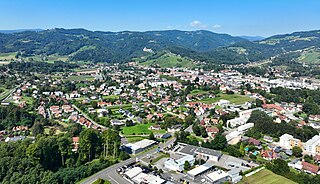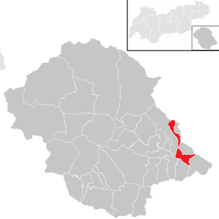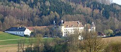
Kapelln is a market municipality in the Sankt Pölten-Land district, Lower Austria, Austria. 10.29% of the municipality are forested. Kapelln is subdivided into the Katastralgemeinden Etzersdorf, Kapelln, Katzenberg, Mitterau, Mitterkilling, Oberkilling, Obermiesting, Pönning, Panzing, Rapoltendorf, Rassing, Thalheim, Unterau, Unterkilling and Untermiesting. There are 102 agricultural companies, and 586 jobs.

Breitenstein is a small town in the Austrian state of Lower Austria. It is one of the towns found on the Semmering Railway line which is a UNESCO World Heritage Site. Translated from German the name means "Broad Stone" due to its large rock faces.

Admont is a town in the Austrian state of Styria. It is historically most notable for Admont Abbey, a monastery founded in 1074.

Birkfeld is a market town in the district of Weiz in the Austrian state of Styria.

Deutschlandsberg is a town in Deutschlandsberg district of Styria, Austria. It is located in southern Austria, near the border with Slovenia. It is approximately 35 km from Graz. Popular tourist attractions include the Deutschlandsberg Castle.

Sankt Anton im Montafon is a town in the Montafon valley in the district of Bludenz in the Austrian state of Vorarlberg.

Vösendorf is a town in the district of Mödling in the Austrian state of Lower Austria.

Fritzens is a municipality in the district Innsbruck country in Tyrol (Austria). It lies 16 km east of Innsbruck on the left side of the Inn River. The Iron Age Fritzens-Sanzeno culture is named for archaeological finds from the village.
Leogang is a municipality in the district of Zell am See, in the state of Salzburg in Austria. It is a famous winter sports and summer mountain hiking resort.

Assling is a municipality in the district of Lienz in the Austrian state of Tyrol.

Dölsach is a municipality in the district of Lienz in the Austrian state of Tyrol.

Achenkirch is a municipality in the Schwaz district in the Austrian state of Tyrol. It is located at the northern end of Lake Achensee.

Vomp is a municipality in the Schwaz district in the Austrian state of Tyrol.

Mils is a municipality in the district Innsbruck-Land of Tyrol, Austria. It is located 12 km east of Innsbruck. The area is restricted by the Weißenbach in the west and the Inn in the south. The location was mentioned in documents in 930 for the first time. In the last 40 years Mils grew enormously thanks to its sunny location.

Trieben is a town in Styria in central Austria, in the Palten River Valley. It is a quaint town with a Globe sculpture in the Main Square.

Nesselwängle is a municipality in the district of Reutte in the Austrian state of Tyrol.
Wartberg ob der Aist is a municipality in the district of Freistadt in the Austrian state of Upper Austria.

Reichersberg is a municipality in the district of Ried im Innkreis in the Austrian state of Upper Austria.

Walding is a municipality in the district of Urfahr-Umgebung in the Austrian state of Upper Austria.

Sankt Margarethen an der Raab is a municipality in the district of Weiz in the Austrian state of Styria.


