Thalheim bei Wels

Last updated
Thalheim bei Wels
Thalheim bei Wels Wallfahrtskirche Maria Schauersberg 2005-08-12 3169.jpg
AUT Thalheim bei Wels COA.png
Coat of arms
Austria adm location map.svg
Red pog.svg
Thalheim bei Wels
Location within Austria
Coordinates: 48°09′05″N14°02′18″E / 48.15139°N 14.03833°E / 48.15139; 14.03833 Coordinates: 48°09′05″N14°02′18″E / 48.15139°N 14.03833°E / 48.15139; 14.03833
Country Austria
State Upper Austria
District Wels-Land
Government
   Mayor Andreas Stockinger (ÖVP)
Area
[1]
  Total16.34 km2 (6.31 sq mi)
Elevation
369 m (1,211 ft)
Population
 (2018-01-01) [2]
  Total5,482
  Density340/km2 (870/sq mi)
Time zone UTC+1 (CET)
  Summer (DST) UTC+2 (CEST)
Postal code
4600
Area code 07242
Vehicle registration WL
Website www.thalheim.ooe.gv.at

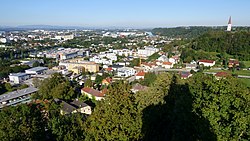
Thalheim bei Wels is a town in the Wels-Land district in the Austrian state of Upper Austria.

Town settlement that is bigger than a village but smaller than a city

A town is a human settlement. Towns are generally larger than villages but smaller than cities, though the criteria to distinguish them vary considerably between different parts of the world.

Austria Federal republic in Central Europe

Austria, officially the Republic of Austria, is a country in Central Europe comprising nine federated states. Its capital, largest city and one of nine states is Vienna. Austria has an area of 83,879 km2 (32,386 sq mi), a population of nearly nine million people and a nominal GDP of $477 billion. It is bordered by the Czech Republic and Germany to the north, Hungary and Slovakia to the east, Slovenia and Italy to the south, and Switzerland and Liechtenstein to the west. The terrain is landlocked and highly mountainous, lying within the Alps; only 32% of the country is below 500 m (1,640 ft), and its highest point is 3,798 m (12,461 ft). The majority of the population speaks local Bavarian dialects as their native language, and German in its standard form is the country's official language. Other regional languages are Hungarian, Burgenland Croatian, and Slovene.

Upper Austria State of Austria

Upper Austria is one of the nine states or Bundesländer of Austria. Its capital is Linz. Upper Austria borders on Germany and the Czech Republic, as well as on the other Austrian states of Lower Austria, Styria, and Salzburg. With an area of 11,982 km2 (4,626 sq mi) and 1.437 million inhabitants, Upper Austria is the fourth-largest Austrian state by land area and the third-largest by population.

Contents

Geography

It is situated on the right bank of the river Traun, opposite the city of Wels. About 11.6% of the municipality is forest, 69% is farmland.

Traun (river) river in Austria

Traun is a river in the Austrian state of Upper Austria. Its source is in the Totes Gebirge mountain range in Styria. It flows through the Salzkammergut area and the lakes Hallstätter See and Traunsee. The Traun is a right tributary of the Danube, which it meets near the City of Linz. Other towns along the river are Bad Aussee, Bad Ischl, Gmunden, Wels and Traun.

Wels City in Upper Austria, Austria

Wels is a city in Upper Austria, on the Traun River near Linz. It is the county seat of Wels-Land, and with a population of approximately 60,000, the eighth largest city in Austria.

Subdivisions

Population

Historical population
YearPop.±%
19914,525    
20014,971+9.9%
20135,470+10.0%
360deg airborne panorama, shot near look-out Marienwarte
show as 360deg surround photography Thalheim bei Wels - Marienwarte.jpg
360° airborne panorama, shot near look-out Marienwarte
show as 360° surround photography

Sights

Alps Major mountain range system in Central Europe

The Alps are the highest and most extensive mountain range system that lies entirely in Europe, separating Southern from Central and Western Europe and stretching approximately 1,200 kilometres (750 mi) across eight Alpine countries : France, Switzerland, Monaco, Italy, Liechtenstein, Austria, Germany, and Slovenia. The mountains were formed over tens of millions of years as the African and Eurasian tectonic plates collided. Extreme shortening caused by the event resulted in marine sedimentary rocks rising by thrusting and folding into high mountain peaks such as Mont Blanc and the Matterhorn. Mont Blanc spans the French–Italian border, and at 4,810 m (15,781 ft) is the highest mountain in the Alps. The Alpine region area contains about a hundred peaks higher than 4,000 metres (13,000 ft).

Personalities

Related Research Articles

Kapelln Place in Lower Austria, Austria

Kapelln is a market municipality in the Sankt Pölten-Land district, Lower Austria, Austria. 10.29% of the municipality are forested. Kapelln is subdivided into the Katastralgemeinden Etzersdorf, Kapelln, Katzenberg, Mitterau, Mitterkilling, Oberkilling, Obermiesting, Pönning, Panzing, Rapoltendorf, Rassing, Thalheim, Unterau, Unterkilling and Untermiesting. There are 102 agricultural companies, and 586 jobs.

Schleißheim Place in Upper Austria, Austria

Schleißheim is a municipality in the district Wels-Land in the Austrian state of Upper Austria.

Stadl-Paura Place in Upper Austria, Austria

Stadl-Paura is a municipality in the Austrian state of Upper Austria located in the district Wels-Land. About half of it lies in the Hausruckviertel, the other half in the Traunviertel. Despite this fact the whole district Wels-Land is officially seen as a part of the Hausruckviertel.

Offenhausen, Austria Place in Upper Austria, Austria

Offenhausen is a municipality in the Austrian state of Upper Austria in the district Wels-Land. It gained the official right to hold markets in 1534 from King Ferdinand I.

Neuhofen an der Krems Place in Upper Austria, Austria

Neuhofen an der Krems is a municipality in the district Linz-Land in the Austrian state of Upper Austria.

Aichkirchen, Austria Place in Upper Austria, Austria

Aichkirchen is a municipality in the district of Wels-Land in the Austrian state of Upper Austria.

Bachmanning Place in Upper Austria, Austria

Bachmanning is a municipality in the district of Wels-Land in the Austrian state of Upper Austria.

Buchkirchen Place in Upper Austria, Austria

Buchkirchen is a municipality in the district of Wels-Land in the Austrian state of Upper Austria.

Eberstalzell Place in Upper Austria, Austria

Eberstalzell is a municipality in the district of Wels-Land in the Austrian state of Upper Austria.

Edt bei Lambach Place in Upper Austria, Austria

Edt bei Lambach is a municipality in the district of Wels-Land in the Austrian state of Upper Austria.

Holzhausen, Austria Place in Upper Austria, Austria

Holzhausen is a municipality in the district of Wels-Land in the Austrian state of Upper Austria.

Krenglbach Place in Upper Austria, Austria

Krenglbach is a municipality in the district of Wels-Land in the Austrian state of Upper Austria.

Neukirchen bei Lambach Place in Upper Austria, Austria

Neukirchen bei Lambach is a municipality in the district of Wels-Land in the Austrian state of Upper Austria.

Pennewang Place in Upper Austria, Austria

Pennewang is a municipality in the district of Wels-Land in the Austrian state of Upper Austria.

Pichl bei Wels Place in Upper Austria, Austria

Pichl bei Wels is a municipality in the district of Wels-Land in the Austrian state of Upper Austria.

Sattledt Place in Upper Austria, Austria

Sattledt is a municipality in the district of Wels-Land in the Austrian state of Upper Austria.

Sipbachzell Place in Upper Austria, Austria

Sipbachzell is a municipality in the district of Wels-Land in the Austrian state of Upper Austria.

Steinerkirchen an der Traun Place in Upper Austria, Austria

Steinerkirchen an der Traun is a municipality in the district of Wels-Land in the Austrian state of Upper Austria.

Weißkirchen an der Traun Place in Upper Austria, Austria

Weißkirchen an der Traun is a municipality in the district of Wels-Land in the Austrian state of Upper Austria.

Steinhaus, Austria Place in Upper Austria, Austria

Steinhaus is a municipality in the district of Wels-Land in the Austrian state of Upper Austria.

References

  1. "Dauersiedlungsraum der Gemeinden Politischen Bezirke und Bundesländer - Gebietsstand 1.1.2018". Statistics Austria. Retrieved 10 March 2019.
  2. "Einwohnerzahl 1.1.2018 nach Gemeinden mit Status, Gebietsstand 1.1.2018". Statistics Austria. Retrieved 9 March 2019.