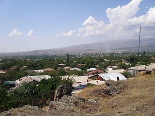
Oshakan is a major village in the Aragatsotn Province of Armenia located 8 kilometers southwest from Ashtarak. It is well known to historians and pilgrims of the Armenian Apostolic Church as the site of the grave of Mesrop Mashtots, the inventor of the Armenian alphabet.

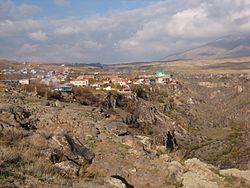
Kosh is a village in the Ashtarak district, Aragatsotn province, Armenia, about 18 km south-west of the district centre Ashtarak. The town is attested as Kvash in early Christian times. In the town are ruins of a 13th-century church - Saint Grigor - and a castle which has yielded Hellenistic pottery remains. There are numerous remains from early Iron Age residential ruins and buildings of large basalt stone blocks.

Arteni is a town in the Aragatsotn province of Armenia. The town contains a wine factory.
Kasagh, is a major village in the Kotayk Province of Armenia.
Voskevaz is a village in the Aragatsotn province of Armenia. Not far from the center of the village is the church of Surp Hovhannes, built between the 7th and 12th centuries. The village is home to the Hayasy brewery.
Agarakavan is a village in the Aragatsotn Province of Armenia. It was populated by Armenian Genocide survivors from Van in 1920.
Aghdzk is a village on the slopes of Mount Aragats in the Aragatsotn Province of Armenia. It is home to the Arshakid Mausoleum, a large grave monument complex and basilica of the 4th to 5th centuries. King Shapur II of Persia exhumed the bones of the Armenian kings and took them to Persia symbolically taking Armenia's power. When Sparapet Vassak Mamikonian defeated the Persians and reclaimed the bones of the Arshakuni monarchs, he buried them at Aghdzk. Remains of the monuments and the basilica may still to be seen.
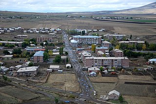
Aragats ; known as Ghaznafar until 1948, is a village in the eastern part of the Aragatsotn Province of Armenia.
Ashnak is a village in the Aragatsotn Province of Armenia. The village is known from the 5th century, but was relocated to its present site in 1830. The town's environs include the ruins of a 10th-century chapel, a 5th-century church, and ancient fort. Prior to the breakup of the Soviet Union, Ashnak had a folk dance troupe that toured internationally.
Hnaberd is a town in the Aragatsotn Province of Armenia. The town has a 5th-century church. There is a large Urartian fortress nearby.
Katnaghbyur is a town in the Aragatsotn Province of Armenia. The town has the ruins of a 5th-century church.

Kuchak formerly known as Alikuchak, is a village in the Aragatsotn Province of Armenia. It was founded in 1829-30 and named after Nahapet Kuchak, a 16th-century Armenian poet.
Melikgyugh is a town in the Aragatsotn Province of Armenia.

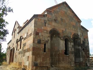
Mughni is a village in the Aragatsotn Province of Armenia. It is located just to the north of Ashtarak town and belongs to its municipality. Until the Russian conquest, it was the southernmost town in the district of Aparan. Mughni is home to the 14th-century Saint Gevork Monastery, which was formerly a popular pilgrimage site and the seat of an archbishop. The dome of the church was rebuilt in the 1660s.
Nerkin Bazmaberd is a town in the Aragatsotn Province of Armenia. The population descends from refugees from Western Armenia in 1915.
Saghmosavan is a town in the Aragatsotn Province of Armenia. The town is the site of the Saghmosavank Monastery with Saint Sion church, built in 1215.
Sis is a town in the Ararat Province of Armenia. The Sis territorial union refers to the seat of the archbishop of Sis, the capital of Armenian Cilicia.
Tsaghkahovit, known as Haji Khalil until 1946, is a village in the Aragatsotn Province of Armenia. There are many Late Bronze Age remains which are in the process of being excavated.
Ujan is a town in the Aragatsotn Province of Armenia.
Sasunik ; is a village in the Aragatsotn Province of Armenia. It was founded as a collective farm in 1955, and villagers were resettled from the old village of Sasunik in 1960. The community of Sasunik also includes the village of Karin.