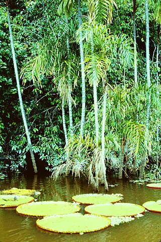
A biotope is an area of uniform environmental conditions providing a living place for a specific assemblage of plants and animals. Biotope is almost synonymous with the term "habitat", which is more commonly used in English-speaking countries. However, in some countries these two terms are distinguished: the subject of a habitat is a population, the subject of a biotope is a biocoenosis or "biological community".

Peat is an accumulation of partially decayed vegetation or organic matter. It is unique to natural areas called peatlands, bogs, mires, moors, or muskegs. Sphagnum moss, also called peat moss, is one of the most common components in peat, although many other plants can contribute. The biological features of sphagnum mosses act to create a habitat aiding peat formation, a phenomenon termed 'habitat manipulation'. Soils consisting primarily of peat are known as histosols. Peat forms in wetland conditions, where flooding or stagnant water obstructs the flow of oxygen from the atmosphere, slowing the rate of decomposition. Peat properties such as organic matter content and saturated hydraulic conductivity can exhibit high spatial heterogeneity.

The Thousand Islands – Frontenac Arch region or the Frontenac Axis is an exposed strip of Precambrian rock in Canada and the United States that links the Canadian Shield from Algonquin Park with the Adirondack Mountain region in New York, an extension of the Laurentian mountains of Québec. The Algonquin to Adirondacks region, which includes the Frontenac Axis or Arch, is a critical linkage for biodiversity and resilience, and one with important conservation potential. The axis separates the St. Lawrence Lowlands and the Great Lakes Lowlands. It has many distinctive plant and animal species. It is one of four ecoregions of the Mixedwood Plains.

Ecological engineering uses ecology and engineering to predict, design, construct or restore, and manage ecosystems that integrate "human society with its natural environment for the benefit of both".

The University of Wisconsin–Madison Arboretum is a teaching and research facility of the University of Wisconsin–Madison and the site of historic research in ecological restoration. In addition to its 1,260 acres (5 km2) in Madison, Wisconsin, the Arboretum also manages 520 acres (210 ha) of remnant forests and prairies throughout Wisconsin. It was designated a National Historic Landmark in 2021, in recognition for its role as a pioneer in the field of ecological restoration.
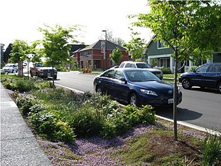
Green infrastructure or blue-green infrastructure refers to a network that provides the “ingredients” for solving urban and climatic challenges by building with nature. The main components of this approach include stormwater management, climate adaptation, the reduction of heat stress, increasing biodiversity, food production, better air quality, sustainable energy production, clean water, and healthy soils, as well as more anthropocentric functions, such as increased quality of life through recreation and the provision of shade and shelter in and around towns and cities. Green infrastructure also serves to provide an ecological framework for social, economic, and environmental health of the surroundings. More recently scholars and activists have also called for green infrastructure that promotes social inclusion and equality rather than reinforcing pre-existing structures of unequal access to nature-based services.

Seoul Forest is a large park in Seongdong-gu, Seoul, South Korea. It is open year-round, and admission is free. Seoul Forest opened in June 2005. The city government spent 235.2 billion won in development. It is the third largest park in Seoul city. Seoul Forest is a massive park dotted with over 400,000 trees and 100 different animals. This nature park is located in Seongsu-dong and covers an area of 1,200 ha The area that was once a royal hunting forest, became Seoul's first water purification plant in 1908, and later used for both racecourse and golf facilities. Now, it has been transformed into a park with a dense canopy of trees and a lake, where citizen can breathe the invigorating fresh air offered by nature.

A pond is a small, still, land-based body of water formed by pooling inside a depression, either naturally or artificially. A pond is smaller than a lake and there are no official criteria distinguishing the two, although defining a pond to be less than 5 hectares in area, less than 5 metres (16 ft) in depth and with less than 30% with emergent vegetation helps in distinguishing the ecology of ponds from those of lakes and wetlands. Ponds can be created by a wide variety of natural processes, or they can simply be isolated depressions filled by runoff, groundwater, or precipitation, or all three of these. They can be further divided into four zones: vegetation zone, open water, bottom mud and surface film. The size and depth of ponds often varies greatly with the time of year; many ponds are produced by spring flooding from rivers. Ponds may be freshwater or brackish in nature. 'Ponds' consisting of saltwater, with a direct connection to the sea to maintain full salinity, are normally regarded as part of the marine environment. These bodies of water do not support fresh or brackish water-based organisms, and are not considered to be ponds.

Xeriscaping is the process of landscaping, or gardening, that reduces or eliminates the need for irrigation. It is promoted in regions that do not have accessible, plentiful, or reliable supplies of fresh water and has gained acceptance in other regions as access to irrigation water has become limited, though it is not limited to such climates. Xeriscaping may be an alternative to various types of traditional gardening.
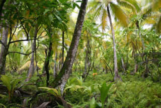
Plant ecology is a subdiscipline of ecology that studies the distribution and abundance of plants, the effects of environmental factors upon the abundance of plants, and the interactions among plants and between plants and other organisms. Examples of these are the distribution of temperate deciduous forests in North America, the effects of drought or flooding upon plant survival, and competition among desert plants for water, or effects of herds of grazing animals upon the composition of grasslands.

Desert greening is the process of afforestation or revegetation of deserts for ecological restoration (biodiversity), sustainable farming and forestry, but also for reclamation of natural water systems and other ecological systems that support life. The term "desert greening" is intended to apply to both cold and hot arid and semi-arid deserts. It does not apply to ice capped or permafrost regions. Desert greening has the potential to help solve global water, energy, and food crises. It pertains to roughly 32 million square kilometres of land.

A traditional Spanish garden is a style of garden or designed landscape developed in historic Spain. Especially in the USA, the term tends to be used of a garden design style with a formal arrangement that evokes, usually not very precisely, the sort of plan and planting developed in southern Spain, incorporating principles and elements from precedents in ancient Persian gardens, Roman gardens and Islamic gardens, and the great Moorish gardens of the Al-Andalus era on the Iberian Peninsula.
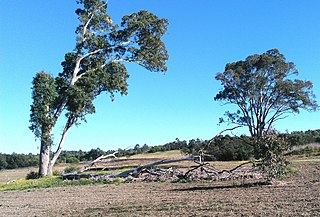
The Western Sydney Parklands is an urban park system and a nature reserve located in Sydney, New South Wales, Australia. The NSW government has spent around $400 million for the park. The park is governed by the NSW National Parks and Wildlife Service and is listed under the National Parks and Wildlife Act 1974. The Parklands begin in the north in the City of Blacktown, cross the City of Fairfield, and end in the City of Liverpool.

Western Sydney Regional Park is a large urban park and a nature reserve situated in Western Sydney, Australia within the suburbs of Horsley Park and Abbotsbury. A precinct of Western Sydney Parklands, a park system, and situated within the heart of the Cumberland Plain Woodland, the regional park features several picnic areas, recreational facilities, equestrian trails, and walking paths within the Australian bush.

Climate-friendly gardening is a form of gardening that can reduce emissions of greenhouse gases from gardens and encourage the absorption of carbon dioxide by soils and plants in order to aid the reduction of global warming. To be a climate-friendly gardener means considering both what happens in a garden and the materials brought into it and the impact they have on land use and climate. It can also include garden features or activities in the garden that help to reduce greenhouse gas emissions elsewhere.

Divjakë-Karavasta National Park is a national park in western Albania, sprawling across the Myzeqe Plain in the direct proximity to the Adriatic Sea. The park spans a territory of 222.3 square kilometres (22,230 ha) containing remarkable features such as wetlands, salt marshes, coastal meadows, floodplains, woodlands, reed beds, forests and estuaries. Because of the park's important and great availability of bird and plant species, it has been identified as an important Bird and Plant Area of international importance.

The Botany Water Reserves are a heritage-listed former water supply system and now parkland and golf course at 1024 Botany Road, Mascot, Bayside Council, Sydney, New South Wales, Australia. It was designed by City Engineers, W. B. Rider, E. Bell (1856–1871), and Francis Bell (1871–1878). It is also known as Botany Dams, Botany Swamps, Botany Wetlands, Mill Stream, Bridge Pond, Lakes Golf Course, Eastlakes Golf Course, Bonnie Doon Golf Course, and Astrolabe Park. The property is owned by Sydney Water, an agency of the Government of New South Wales. It was added to the New South Wales State Heritage Register on 18 November 1999.
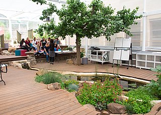
Biophilic design is a concept used within the building industry to increase occupant connectivity to the natural environment through the use of direct nature, indirect nature, and space and place conditions. Used at both the building and city-scale, it is argued that this idea has health, environmental, and economic benefits for building occupants and urban environments, with few drawbacks. Although its name was coined in recent history, indicators of biophilic design have been seen in architecture from as far back as the Hanging Gardens of Babylon.
Rendinghu Park, is a European-style garden in Beijing, China, located at No. 25, Liupu Kang Street, Xicheng District, on the south side of Huangsi Street. The total area is 9.2 hectares, including 1 hectare of water area. Focusing on modern gardens, the southern half of the park uses grass, water features, sculptures, flower stands, and landscape walls to create a garden environment with the charm of European regular courtyards.


