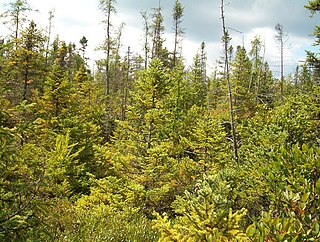
The Tannersville Cranberry Bog or Cranberry Swamp is a sphagnum bog on the Cranberry Creek in Tannersville, Pennsylvania. It is the southernmost boreal bog east of the Mississippi River, containing many black spruce and tamarack trees at the southern limit of their ranges. Technically, it can be classed as an acid fen, as it receives some groundwater flow. The site was designated a National Natural Landmark in December 1974. It was purchased by The Nature Conservancy and the Conservation and Research Foundation in 1957. Like many bogs, its terrain presents an image of solidity, but a liquid mass of decaying peat lies beneath a six-inch (152 mm) layer of sphagnum and a network of supporting tree roots. However, this bog may be viewed from a floating walkway.

Thirty-seven species of mammals have been identified at Indiana Dunes National Park. Four other species are thought to inhabit the park, but have not been documented: the northern long-eared myotis, the Indiana bat, the hoary bat, and the southern bog lemming

Coniferous swamps are forested wetlands in which the dominant trees are lowland conifers such as northern white cedar. The soil in these swamp areas is typically saturated for most of the growing season and is occasionally inundated by seasonal storms or by winter snow melt.

Bayshore Blufflands State Natural Area is a Wisconsin Department of Natural Resources-designated State Natural Area of significant note for its grand scenery, unusual geology, rare plant and animal species. Containing more than 7 miles (11 km) of the Niagara Escarpment, the Bayshore Blufflands is an ecologically complex site with a diversity of plant communities both above and below the escarpment and a series of seeps and springs at the base of the bluff's talus slopes.
Westchester County, New York is located in southern New York, sharing its southern boundary with New York City and its northern border with Putnam County. It is bordered on the west side by the Hudson River and on the east side by the Long Island Sound and Fairfield County, Connecticut. The county has a total area of 500 square miles, of which 430 square miles is land and 69 square miles (14%) is water. It is an area rich in biodiversity with many parks and preserves. Literary environmental writer Alex Shoumatoff hailed Westchester County as the "most richly diversified deciduous forest in the world" in a 1978 The New Yorker profile, at the time estimating that it contained 4,200 species of plants.
The Espy Bog is wetland complex in Columbia County, Pennsylvania, in the United States. It is situated near Bloomsburg and Espy. The wetlands contain a lake, as well as forested swamps, shrub swamps, and graminoid openings. The lake in the wetland complex may be manmade. The predominant soil in the area is known as mucky peat. The wetland complex has a high level of plant and animal biodiversity, including birds, turtles, fish, trees, shrubs, and ferns.
Riverdale Park is a park along the Hudson River in Riverdale, The Bronx, New York City. It is approximately 1.5 miles (2.4 km) long and one block wide. It averages 9 meters above sea level. It is located along Palisade Avenue and entered at Dodge Lane. The northern border is 254th Street and the park extends as far south as 232nd Street. It is adjacent to the grounds of Wave Hill.


