Opeongo River

Last updated
Opeongo River
Opeongo River.jpg
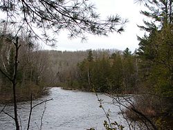
Opeongo River near the confluence with the Aylen River
Canada Southern Ontario relief location map.jpg
Red pog.svg
Location of the mouth of the Opeongo River in southern Ontario
Location
Country Canada
Ontario Ontario
Region Northeastern Ontario
District Nipissing
Physical characteristics
Source Opeongo Lake
  locationPreston Township, Unorganized South Nipissing District; in Algonquin Provincial Park
  coordinates 45°41′55″N78°16′28″W / 45.69861°N 78.27444°W / 45.69861; -78.27444
  elevation403 m (1,322 ft)
Mouth Madawaska River
  location
East of Madawaska village, South Algonquin Township
  coordinates
45°30′22″N77°56′45″W / 45.50611°N 77.94583°W / 45.50611; -77.94583 Coordinates: 45°30′22″N77°56′45″W / 45.50611°N 77.94583°W / 45.50611; -77.94583
  elevation
311 m (1,020 ft)
Basin features
River system Saint Lawrence River drainage basin

The Opeongo River is a river in the Saint Lawrence River drainage basin in Nipissing District in northeastern Ontario, Canada. [1] [2] The river is entirely within Algonquin Provincial Park and Opeongo River Provincial Park, except for a small portion around Victoria Lake, and is a left tributary of the Madawaska River.

Contents

Course

The river begins in Algonquin Provincial Park at the outflow from Annie Bay on the East Arm of Opeongo Lake in geographic Preston Township, in the Unorganized South Part of Nipissing District, controlled by the Opeongo Lake Dam and flows southeast to Booth Lake. It exits the lake east controlled by the Booth Lake Dam, enters geographic Clancy Township, exits Algonquin Provincial Park into Opeongo River Provincial Park [3] and reaches Victoria Lake. The river leaves the lake at the northeast over a dam and continues southeast, passes from Unorganized South Nipissing District into the geographic Dickens Township in the municipality of South Algonquin, passes through a series of rapids, takes in the left tributary Aylen River, turns southwest, and empties into Bark Lake on the Madawaska River, at the Ontario Highway 60 bridge and east of the community of Madawaska. The Madawaska River flows via the Ottawa River to the Saint Lawrence River.

Recreation

The river is used for recreational canoeing and kayaking.

Tributaries

See also

Related Research Articles

Madawaska River (Ontario)

The Madawaska River is a river in the Saint Lawrence River drainage basin in Ontario, Canada. The river is 230 km (143 mi) long and drains an area of 8,470 km2 (3,270 sq mi). Its name comes from an Algonquian band of the region known as "Matouweskarini", meaning "people of the shallows".

York River (Ontario) River in Ontario, Canada

The York River is a river in Renfrew County, Hastings County and Haliburton County in Ontario, Canada. The river is in the Saint Lawrence River drainage basin, and flows from the southern extension of Algonquin Provincial Park to the Madawaska River.

Indian River (Muskrat River watershed)

The Indian River is a river in Renfrew County and Nipissing District in Eastern and Northeastern Ontario, Canada. It is in the Saint Lawrence River drainage basin, and is a left tributary of the Muskrat River.

Petawawa River

The Petawawa River is a river in the Saint Lawrence River drainage basin in Nipissing District and Renfrew County in eastern and northeastern Ontario, Canada. The river flows from Algonquin Provincial Park to the Ottawa River at the town of Petawawa, and is only one of two major tributaries of the Ottawa River to flow completely free. The river's name comes from the Algonquian for "where one hears a noise like this", which refers to its many rapids.

Bonnechere River

The Bonnechere River is a river in the Saint Lawrence River drainage basin in Nipissing District and Renfrew County in eastern and northeastern Ontario, Canada. The river flows from Algonquin Provincial Park to the Ottawa River east and north of the town of Renfrew. The river's name is thought to come from the French "bonne chère" meaning "good cheer".

Opeongo Lake

Opeongo Lake is a lake in the Saint Lawrence River drainage basin in the geographic townships of Bower, Dickson, Preston and Sproule in the Unorganized South Part of Nipissing District in Northeastern Ontario, Canada. It is the largest lake in Algonquin Provincial Park and the source of the Opeongo River. The lake's name comes from the Algonquian word opeauwingauk meaning "sandy narrows".

Barron River (Ontario)

The Barron River is a river in the Saint Lawrence River drainage basin in Nipissing District and Renfrew County, Ontario, Canada. It flows from Clemow Lake in northern Algonquin Provincial Park and joins the Petawawa River, whose southern branch it forms, in the municipality of Laurentian Hills, near the municipality of Petawawa.

Cedar Lake (Nipissing District)

Cedar Lake is a lake in the geographic townships of Boyd, Deacon and Lister in the Unorganized south part of Nipissing District in northeastern Ontario, Canada. The lake is in the Saint Lawrence River drainage basin and is entirely within Algonquin Provincial Park; it is a popular entry point for canoe trips into the interior of the park as the community of Brent, located on the lake, is connected by Brent Road to Ontario Highway 17. Other places on the lake are Acanthus and Government Park.

Opeongo River Provincial Park

Opeongo River Provincial Park is a non-operating waterway park in Nipissing District in northeastern Ontario, Canada. It incorporates those portions of the Opeongo River from its exit from Algonquin Provincial Park to the river's mouth at the Madawaska River, except for a small portion around Victoria Lake. The park has two access points: from Ontario Highway 60 west of the community of Madawaska; and the Shall Lake access point, north of Victoria Lake, in Algonquin Provincial Park.

South Algonquin Township municipality in Ontario, Canada

South Algonquin is a township municipality in Nipissing District, Ontario, Canada. Located south of Algonquin Provincial Park, it is the sole populated portion of the district that lies south of the traditional dividing line between Northern Ontario and Southern Ontario and is closer connected to Renfrew County as opposed to the core portions of Nipissing District.

Source Lake (Nipissing District) lake in Ontario, Canada

Source Lake is a small lake in geographic Canisbay and Peck townships in the Unorganized South part of Nipissing District in Northeastern Ontario, Canada. It lies in southern Algonquin Provincial Park and is part of the Saint Lawrence River drainage basin. The river is the source of the Madawaska River, which flows via the Ottawa River to the Saint Lawrence River.

Odenback, Ontario Place in Ontario, Canada

Odenback is an unincorporated place and former railway point in geographic Deacon Township in the Unorganized South Part of Nipissing District in northeastern Ontario, Canada. Odenback is located within Algonquin Provincial Park on Radiant Lake at the confluence of the tributary Little Madawaska River with the Petawawa River.

Grand Lake (Nipissing District)

Grand Lake is a lake in the Ottawa River drainage basin in the geographic townships of Barron and Stratton in the Unorganized South Part of Nipissing District in Northeastern Ontario, Canada.

Crow River (Ontario)

The Crow River is a river in the Saint Lawrence River drainage basin in the Unorganized South Part of Nipissing District in northeastern Ontario, Canada. The river lies entirely within Algonquin Provincial Park and is a right tributary of the Petawawa River.

Little Madawaska River (Ontario)

The Little Madawaska River is a river in the Saint Lawrence River drainage basin in the Unorganized South Part of Nipissing District in northeastern Ontario, Canada. The river is entirely within Algonquin Provincial Park, and is a right tributary of the Petawawa River and not a tributary of the nearby Madawaska River.

Nipissing River

The Nipissing River is a river in the Saint Lawrence River drainage basin in the Unorganized South Part of Nipissing District in northeastern Ontario, Canada. The river is entirely within Algonquin Provincial Park, and is a left tributary of the Petawawa River.

Tim River

The Tim River is a river in the Saint Lawrence River drainage basin in the Unorganized South Part of Nipissing District in northeastern Ontario, Canada. The river is entirely within Algonquin Provincial Park, and is a left tributary of the Petawawa River.

Big East River river in Canada

The Big East River is a river in Muskoka District and Nipissing District in Northeastern Ontario, Canada. The river is in the Great Lakes Basin, is a left tributary of the Muskoka River, and flows from Algonquin Provincial Park to Huntsville.

Rabbit Lake (Aylen River)

Rabbit Lake is a small lake in the municipality of South Algonquin in Nipissing District, Ontario, Canada. It is part of the Saint Lawrence River drainage basin and lies in geographic Dickens Township. The lake empties via an unnamed creek to Aylen Lake, which flows via the Aylen River, Opeongo River, Madawaska River and Ottawa River to the Saint Lawrence River.

Owaissa Lake (Algonquin Provincial Park)

Owaissa Lake is a lake in geographic Preston Township, Nipissing District in Northeastern Ontario, Canada. It is in Algonquin Provincial Park and is part of the Saint Lawrence River drainage basin.

References

  1. "Opeongo River". Geographical Names Data Base . Natural Resources Canada . Retrieved 2011-08-08.
  2. "Opeongo River". Atlas of Canada . Natural Resources Canada. 2010-02-04. Retrieved 2011-08-08. Shows the river course.
  3. "Opeongo River". Ontario Parks. 2002-11-08. Retrieved 2011-08-08.

Other map sources: