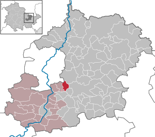
Oppurg

Last updated
Oppurg
Wappen Oppurg.png
Location of Oppurg within Saale-Orla-Kreis district
Oppurg in SOK.pngGerodaKeilaHirschbergMoxaPaskaSchöndorfTannaWilhelmsdorf
Germany adm location map.svg
Red pog.svg
Oppurg
Thuringia location map.svg
Red pog.svg
Oppurg
Coordinates: 50°43′N11°39′E / 50.717°N 11.650°E / 50.717; 11.650 Coordinates: 50°43′N11°39′E / 50.717°N 11.650°E / 50.717; 11.650
Country Germany
State Thuringia
District Saale-Orla-Kreis
Municipal assoc. Oppurg
Government
   Mayor (202228) Heiko Schoberth [1] (CDU)
Area
  Total15.76 km2 (6.08 sq mi)
Elevation
230 m (750 ft)
Population
 (2021-12-31) [2]
  Total1,116
  Density71/km2 (180/sq mi)
Time zone UTC+01:00 (CET)
  Summer (DST) UTC+02:00 (CEST)
Postal codes
07381
Dialling codes 03647
Vehicle registration SOK
Website www.vg-oppurg.de
Schloss Oppurg Schloss Oppurg1.JPG
Schloss Oppurg

Oppurg is a municipality in the district of Saale-Orla-Kreis, in Thuringia, Germany.

The main attraction is Schloss Oppurg, an 18th century mansion which once belonged to Hoym and Hohenlohe families. The princes of Hohenlohe-Oehringen owned the castle up to 1945. Today, it is a hotel.

Related Research Articles

<span class="mw-page-title-main">Wehnde</span> Municipality in Thuringia, Germany

Wehnde is a municipality in the district of Eichsfeld in Thuringia, Germany.

<span class="mw-page-title-main">Eichstruth</span> Municipality in Thuringia, Germany

Eichstruth is a municipality in the district of Eichsfeld in Thuringia, Germany. By area, it is the smallest municipality in what was East Germany, although there are 35 rural municipalities ("Gemeinden") and one city ("Stadt"), Arnis, in what was West Germany that have lesser or equal area.

<span class="mw-page-title-main">Großbartloff</span> Municipality in Thuringia, Germany

Großbartloff is a municipality in the district of Eichsfeld in Thuringia, Germany.

<span class="mw-page-title-main">Ohrdruf</span> Town in Thuringia, Germany

Ohrdruf is a small town in the district of Gotha in the German state of Thuringia. It lies some 30 km southwest of Erfurt at the foot of the northern slope of the Thuringian Forest. The former municipalities Crawinkel, Gräfenhain and Wölfis were merged into Ohrdruf in January 2019.

<span class="mw-page-title-main">Hartmannsdorf, Saale-Holzland</span> Municipality in Thuringia, Germany

Hartmannsdorf is a municipality in the district Saale-Holzland, in Thuringia, Germany.

<span class="mw-page-title-main">Karlsdorf</span> Municipality in Thuringia, Germany

Karlsdorf is a municipality in the district Saale-Holzland, in Thuringia, Germany.

<span class="mw-page-title-main">Möckern, Thuringia</span> Municipality in Thuringia, Germany

Möckern is a municipality in the district Saale-Holzland, in Thuringia, Germany.

<span class="mw-page-title-main">Petersberg, Thuringia</span> Municipality in Thuringia, Germany

Petersberg is a municipality in the district Saale-Holzland, in Thuringia, Germany.

<span class="mw-page-title-main">Poxdorf, Thuringia</span> Municipality in Thuringia, Germany

Poxdorf is a municipality in the district Saale-Holzland, in Thuringia, Germany.

<span class="mw-page-title-main">Rausdorf, Thuringia</span> Municipality in Thuringia, Germany

Rausdorf is a municipality in the district Saale-Holzland, in Thuringia, Germany.

<span class="mw-page-title-main">Sankt Gangloff</span> Municipality in Thuringia, Germany

Sankt Gangloff or St. Gangloff is a municipality in the district Saale-Holzland, in Thuringia, Germany.

<span class="mw-page-title-main">Tautendorf</span> Municipality in Thuringia, Germany

Tautendorf is a municipality in the district Saale-Holzland, in Thuringia, Germany.

<span class="mw-page-title-main">Waldeck, Thuringia</span> Municipality in Thuringia, Germany

Waldeck is a municipality in the district of Saale-Holzland, in Thuringia, Germany.

<span class="mw-page-title-main">Waltersdorf, Thuringia</span> Municipality in Thuringia, Germany

Waltersdorf is a municipality in the district Saale-Holzland, in Thuringia, Germany.

<span class="mw-page-title-main">Wilhelmsdorf, Thuringia</span> Municipality in Thuringia, Germany

Wilhelmsdorf is a municipality in the district Saale-Orla-Kreis, in Thuringia, Germany.

<span class="mw-page-title-main">Gneus</span> Municipality in Thuringia, Germany

Gneus is a municipality in the district Saale-Holzland, in Thuringia, Germany.

<span class="mw-page-title-main">Golmsdorf</span> Municipality in Thuringia, Germany

Golmsdorf is a municipality in the district Saale-Holzland, in Thuringia, Germany.

<span class="mw-page-title-main">Schlöben</span> Municipality in Thuringia, Germany

Schlöben is a municipality in the district Saale-Holzland, in Thuringia, Germany.

<span class="mw-page-title-main">Lausnitz</span> Municipality in Thuringia, Germany

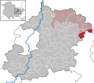
Lausnitz is a municipality in the district Saale-Orla-Kreis, in Thuringia, Germany. It lies 4 km west of Neustadt an der Orla.

Saale-Orla-Kreis II is an electoral constituency represented in the Landtag of Thuringia. It elects one member via first-past-the-post voting. Under the current constituency numbering system, it is designated as constituency 34. It covers the northern part of Saale-Orla-Kreis.
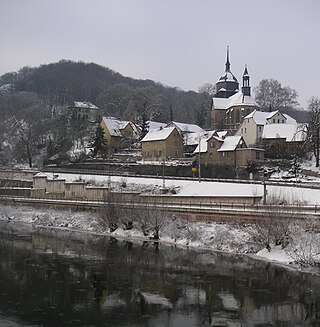
References

  1. Gewählte Bürgermeister - aktuelle Landesübersicht, Freistaat Thüringen, accessed 10 November 2022.
  2. "Bevölkerung der Gemeinden, erfüllenden Gemeinden und Verwaltungsgemeinschaften in Thüringen Gebietsstand: 31.12.2021" (in German). Thüringer Landesamt für Statistik. June 2022.