Bad Langensalza is a spa town of 17,500 inhabitants in the Unstrut-Hainich district, Thuringia, central Germany.

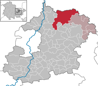
Dingelstädt is a town in the district of Eichsfeld in Thuringia, Germany. It is situated on the upper course of the river Unstrut, 8 km (5 mi) south of Leinefelde-Worbis and 15 km (9 mi) northwest of Mühlhausen. The former municipalities Helmsdorf, Kefferhausen, Kreuzebra and Silberhausen were merged into Dingelstädt in January 2019. In January 2023 Dingelstädt absorbed the villages Bickenriede and Zella from the former municipality Anrode, and Beberstedt and Hüpstedt from the former municipality Dünwald. In January 2024 it absorbed the village Struth from the former municipality Rodeberg.
Geisleden is a municipality in the district of Eichsfeld in Thuringia, Germany. It is located about 4 kilometres (2.5 mi) southeast of Heiligenstadt in the valley formed by the river Geislede. Other neighboring towns are Westhausen in the north, Kreuzebra to the east, and Heuthen toward the southeast.

Greiz is a town in the state of Thuringia, Germany, and is the capital of the district of Greiz. Greiz is situated in eastern Thuringia, 100 kilometres east of the state capital Erfurt, on the White Elster river.

Hildburghausen is a town in Thuringia in central Germany, capital of the Hildburghausen district.

Bad Lobenstein is a spa town in the Saale-Orla-Kreis district, in Thuringia, Germany with a population of about 6,000 inhabitants. Until 2005, the town was named Lobenstein.

Bad Salzungen is a town in Thuringia, Germany. It is the capital of the Wartburgkreis district.
Eisenberg is a town in Thuringia, Germany. It is the capital of the district Saale-Holzland.

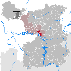
Bürgel is a town in the Saale-Holzland district, in Thuringia, Germany. It is situated 12 km east of Jena. It contains the Benedictine monastery of Bürgel Abbey.

Königsee is a town and a municipality in the district of Saalfeld-Rudolstadt, in Thuringia, Germany. It is situated 12 kilometres (7.5 mi) east of Ilmenau, and 35 kilometres (22 mi) south of Erfurt. The present municipality was formed on 31 December 2012 by the merger of the former municipalities Königsee and Rottenbach, under the name Königsee-Rottenbach. On 1 January 2019 the former municipalities Dröbischau and Oberhain were absorbed, and the name was changed to Königsee.

Leutenberg is a town in the district of Saalfeld-Rudolstadt, in Thuringia, Germany. It is situated in the Thuringian Forest, 18 km (11 mi) southeast of Saalfeld.

Magdala is a town in the Weimarer Land district, in Thuringia, Germany. It is situated 10 kilometres west of Jena, and 12 kilometres southeast of Weimar.

Orlamünde is a small town in the Saale-Holzland district, in Thuringia, Germany. It is part of the Verwaltungsgemeinschaft Südliches Saaletal.

Rastenberg is a town in the district of Sömmerda, in Thuringia, Germany. It is situated 22 km east of Sömmerda, and 23 km northeast of Weimar.

Ronneburg is a town in the district of Greiz, in Thuringia, Germany. It is situated 7 km east of Gera.
Schkölen is a town in the Saale-Holzland district, in Thuringia, Germany. It is situated 12 km south of Naumburg. The village Zschorgula is part of the municipality.
Ziegenrück is a town in the Saale-Orla-Kreis district, in southern Thuringia, Germany. It is situated on the river Saale, 22 km east of Saalfeld, and 35 km south of Jena.

Albersdorf is a municipality in the Saale-Holzland district of Thuringia, Germany. As of 2018, the population is 288.

Mittelpöllnitz is a municipality in the district Saale-Orla-Kreis, in Thuringia, Germany. The town is a member of the municipal association Triptis.

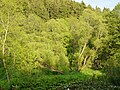
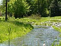
The Sormitz is a tributary or affluent of the Loquitz in Thuringia, Germany and is 29.2 km in length.