Manistee County is a county located in the U.S. state of Michigan. As of the 2020 census, the population was 25,032. The county seat is Manistee. The county is named for the Manistee River. Manistee County is part of Northern Michigan and has a shoreline on Lake Michigan.

White County is a county in the U.S. state of Indiana. As of the 2020 United States Census, the population was 24,688. The county seat is Monticello.

Union County is a county in the U.S. state of Indiana. As of the 2020 United States census, the population was 7,087. The county seat is Liberty.
Starke County is a county in the U.S. state of Indiana. As of the 2020 United States Census, its population was 23,371. The county seat is Knox.

Porter County is a county in the U.S. state of Indiana. As of 2020, the population was 173,215, making it the 10th most populous county in Indiana. The county seat is Valparaiso. The county is part of Northwest Indiana, as well as the Chicago metropolitan area. Porter County is the site of much of the Indiana Dunes, an area of ecological significance. The Hour Glass Museum in Ogden Dunes documents the region's ecological significance.
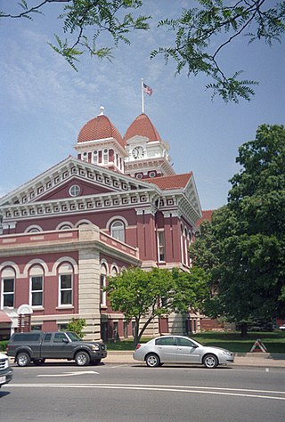
Lake County is a county located in the U.S. state of Indiana. In 2020, its population was 498,700, making it Indiana's second-most populous county. The county seat is Crown Point. The county is part of Northwest Indiana and the Chicago metropolitan area, and contains a mix of urban, suburban and rural areas. It is bordered on the north by Lake Michigan and contains a portion of the Indiana Dunes. It includes Marktown, Clayton Mark's planned worker community in East Chicago.

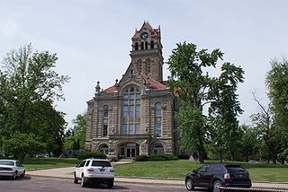
Franklin County is a county on the eastern border of the U.S. state of Indiana. In the 2020 United States Census, the county population was 22,785. The county seat is the town of Brookville. Franklin County is part of the Cincinnati, OH–KY–IN Metropolitan Statistical Area. The only incorporated city in Franklin County is Batesville, which lies mostly in adjoining Ripley County.

Highland is a town in Lake County, Indiana, United States. The population was 23,984 at the 2020 census. The town was incorporated on April 4, 1910. It is a part of the Chicago metropolitan area and North Township, and is surrounded by Hammond to the north, Munster to the west, Schererville to the south and Griffith to the east.

The Louisville metropolitan area is the 43rd largest metropolitan statistical area (MSA) in the United States. It had a population of 1,395,855 in 2020 according to the latest official census, and its principal city is Louisville, Kentucky.

The 9th congressional district of Illinois covers parts of Cook, Lake, and McHenry counties as of the 2021 redistricting which followed the 2020 census. It includes all or parts of Chicago, Evanston, Glenview, Skokie, Morton Grove, Niles, Northfield, Prospect Heights, Wilmette, Buffalo Grove, Hawthorn Woods, Wauconda, Island Lake, Long Grove, Lake Barrington, Algonquin Township, Cary, Crystal Lake, Lake in the Hills, Lakewood, Oakwood Hills, Trout Valley, Algonquin, Port Barrington, Barrington Hills, and Fox River Grove. It is anchored in Chicago's North Side, along Lake Michigan, and covers many of Chicago's northern suburbs. Democrat Jan Schakowsky has represented the district since January 1999.

Orchard is an unincorporated town, a post office, and a census-designated place (CDP) located in and governed by Morgan County, Colorado, United States. The CDP is a part of the Fort Morgan, CO Micropolitan Statistical Area. The Orchard post office has the ZIP Code 80649. As of the 2020 census, the population of the Orchard CDP was 76.

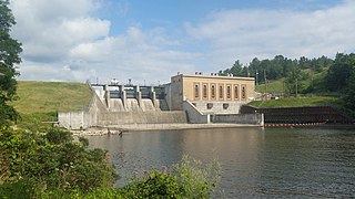
Montgomery Township is the largest of the ten townships in Gibson County, Indiana as well as one of the largest townships by area in Southwestern Indiana, USA. At the 2010 census, its population was 3,996 and it contained 1,645 housing units, 75% of which were in areas adjacent to Owensville. Montgomery Township is served by the South Gibson School Corporation. Gibson Generating Station and Gibson Lake are located at the northern end of Montgomery Township.

Point Township is one of ten townships in Posey County, Indiana. As of the 2000 census, its population was 497. The lowest, the southernmost, and the westernmost points in Indiana are all located along the township's boundaries.

Porter Township is one of twelve townships in Porter County, Indiana. As of the 2010 census, its population was 9,367.

Blooming Grove Township is one of thirteen townships in Franklin County, Indiana. As of the 2010 census, its population was 1,154.

Laurel Township is one of thirteen townships in Franklin County, Indiana. As of the 2010 census, its population was 1,634.
Millgrove Township is one of twelve townships in Steuben County, Indiana, United States. As of the 2010 census, its population was 1,577 and it contained 990 housing units.

Abington Township is one of fifteen townships in Wayne County, Indiana, United States. As of the 2010 census, its population was 853 and it contained 366 housing units.
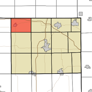
Southeast Grove is an unincorporated community in Eagle Creek Township, Lake County, Indiana.

The Peoria Metropolitan Statistical Area, as defined by the United States Census Bureau, is an area consisting of six counties in Central Illinois, anchored by the city of Peoria. As of the 2020 census, the area had a population of 402,391. The City of Peoria, according to the 2020 US Census Bureau, has 113,150 people.


