San Bernardino County, officially the County of San Bernardino and sometimes abbreviated as S.B. County, is a county located in the southern portion of the U.S. state of California, and is located within the Inland Empire area. As of the 2020 U.S. Census, the population was 2,181,654, making it the fifth-most populous county in California and the 14th-most populous in the United States. The county seat is San Bernardino.

Hesperia is a city in San Bernardino County, California, United States. It is located 35 miles (56 km) north of downtown San Bernardino in Victor Valley and surrounded by the Mojave Desert. Because of its relatively high elevation and the unique and moderate weather patterns of the region, Hesperia is part of what is locally called the High Desert. The name "Hesperia" means "western land". The 2019 census report estimates that the city has a population of 95,750.

The San Bernardino Mountains are a high and rugged mountain range in Southern California in the United States. Situated north and northeast of San Bernardino and spanning two California counties, the range tops out at 11,503 feet (3,506 m) at San Gorgonio Mountain – the tallest peak in Southern California. The San Bernardinos form a significant region of wilderness and are popular for hiking and skiing.

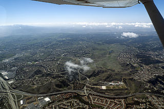
The Chino Hills are a mountain range on the border of Orange, Los Angeles, and San Bernardino counties, California, with a small portion in Riverside County. The Chino Hills State Park preserves open space and habitat in them.

Arrowhead Springs is a highly mountainous neighborhood in the 81-square-mile (210 km2) municipality of San Bernardino, California, officially annexed to the city on November 19, 2009. The neighborhood lies below the Arrowhead geological monument, which is California Historical Landmark #977.

The Victor Valley is a valley in the Mojave Desert and subregion of the Inland Empire, in San Bernardino County in Southern California.

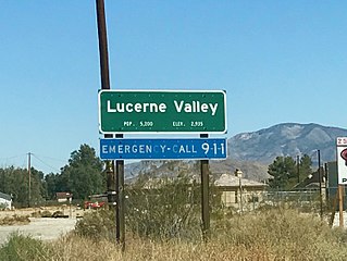
Lucerne Valley is a census-designated place (CDP) and valley landform in the southern Mojave Desert, in western San Bernardino County, California.

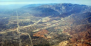
The San Bernardino Valley is a valley in Southern California located at the south base of the Transverse Ranges. It is bordered on the north by the eastern San Gabriel Mountains and the San Bernardino Mountains; on the east by the San Jacinto Mountains; on the south by the Temescal Mountains and Santa Ana Mountains; and on the west by the Pomona Valley. Elevation varies from 590 feet (180 m) on valley floors near Chino to 1,380 feet (420 m) near San Bernardino and Redlands. The valley floor is home to over 80% of the more than 4 million people in the Inland Empire region.

The New York Mountains are a small mountain range found in northeastern San Bernardino County in California, USA. The range's northeastern area lies in southeastern Nevada. The range lies just south of the small community of Ivanpah, and north of the Lanfair Valley. The mountains are part of the mountain ranges, cones, mountains, and landforms in the Mojave National Preserve. The mountains reach an elevation of 7,533 feet (2,296 m), and run in a mostly southwest-northeasterly direction between the Providence Mountains and the McCullough Range approximately five miles into Nevada and border the northwest corner of the Piute Valley of Nevada-California.

The Vallecito Mountains are located in the Colorado Desert, in eastern San Diego County, Southern California. They are about 28 miles (45 km) north of the U.S. border with Mexico.

The Ord Mountains are located in the Mojave Desert of southern California, USA. The range lies in a generally east–west direction, and reaches an elevation of 6,309 feet (1,923 m) above sea level at Ord Mountain. The area is administered by the Bureau of Land Management. The Ord Mountain Trail goes through one section of the mountains.

Lytle Creek, California, is an approximately 18-mile-long (29 km) stream in southwestern San Bernardino County near the city of San Bernardino. It is a tributary of Warm Creek, a tributary of the Santa Ana River. The Mormon settlers of San Bernardino named the stream "Lytle Creek" after their leader, Captain Andrew Lytle. The Tongva village of Wa’aachnga was located along Lytle Creek.

High Desert is a vernacular region with non-discrete boundaries covering areas of the western Mojave Desert in Southern California. The region encompasses various terrain with elevations generally between 2,000 and 4,000 ft above sea level, and is located just north of the San Gabriel, San Bernardino, and Little San Bernardino Mountains.

The Providence Mountains State Recreation Area is located in the Providence Mountains, within the Mojave National Preserve in San Bernardino County, California. It is also home to the Mitchell Caverns Natural Preserve.

California's 33rd State Assembly district is one of 80 California State Assembly districts. It is currently represented by Republican Devon Mathis.

The Temescal Mountains, also known as the Sierra Temescal, are one of the northernmost mountain ranges of the Peninsular Ranges in western Riverside County, in Southern California in the United States. They extend for approximately 25 mi (40 km) southeast of the Santa Ana River east of the Elsinore Fault Zone to the Temecula Basin and form the western edge of the Perris Block.
Gavilan Hills, sometimes called the Gavilan Mountains, are a range of the Temescal Mountains, in Riverside County, California. The name given them came from local New Mexican and Californio miners of the mountains and Gavilan Plateau. In Spanish Gavilan, means "sparrow hawk".

Deep Creek is a tributary of the Mojave River, 23.4 miles (37.7 km) long, in San Bernardino County, California.

The Granite Mountains are an east-west mountain range in the Mojave Desert, in northern San Bernardino County, California. They are within Fort Irwin National Training Center, 10 miles north of Fort Irwin.

The Granite Mountains are a mountain range in San Bernardino County, California, United States. They are east of Victorville and Apple Valley, west of Lucerne Valley, and are one of four mountain ranges in the Mojave Desert to share this name. The range is about 8 miles east to west, and 8.4 miles north to south.


