Ordnance Gazetteer of Scotland: A Graphic and Accurate Description of Every Place in Scotland

Last updated
Ordnance Gazetteer of Scotland: A Graphic and Accurate Description of Every Place in Scotland
Ordnance Gazetteer of Scotland.png
The book's title page
Author Francis Hindes Groome
CountryUnited Kingdom
LanguageEnglish
GenreHistory
PublisherT. C. and E. C. Jack
Publication date
1901(123 years ago) (1901)
Media type Hardback book
Pages1762 [1]
OCLC 1050257987

Ordnance Gazetteer of Scotland: A Graphic and Accurate Description of Every Place in Scotland is a book by Francis Hindes Groome. It was published in 1901, by T. C. and E. C. Jack of Edinburgh, combining six volumes (titled Ordnance Gazetteer of Scotland: A Survey of Scottish Topography, Statistical, Biographical, and Historical) written between 1884 and 1885, along with initial revisions made in 1895 and subsequent smaller revisions. [2] It has entries for all of Scotland's cities, towns, villages and hamlets, beginning with Aven in today's Aberdeenshire and concluding with Zetland, the former name of Shetland. It also includes tourist attractions, historical sites and the histories of family names and clans.

In the book's closing 130-page "general survey" chapter, its sections are written by various notable contributors: [3]

Subtitled a "new edition", the book includes a 1901 United Kingdom census appendix and a map of Scotland by Collins Bartholomew. [3]

Today, the book is available in full at the A Gazetteer for Scotland website. [4] It also appears as part of The Gazetteer for Scotland, [5] produced by the University of Edinburgh, Scotland, and is directly searchable within "A Vision of Britain through Time". [6]

The original six volumes were published by Thomas C. Jack, of Edinburgh, London and Glasgow. [7] They are archived at the National Library of Scotland. [8]

Composition

Upon the publication of the final volume of the initial survey in 1885, geographer John Scott Keltie wrote: [3]

Most articles seem to us to have been written or revised on the spot, the only method by which accuracy can be secured. In some cases, however, we have noticed statements that could not have been made had this plan been invariably adopted.

John Scott Keltie, Proceedings of the Royal Geographical Society and Monthly Record of Geography, Volume 7, New Geographical Publications, p. 616

Related Research Articles

<span class="mw-page-title-main">Francis Hindes Groome</span> English writer on the Romani people

Francis Hindes Groome was a writer and foremost commentator of his time on the Romani people, their language, life, history, customs, beliefs, and lore.

<span class="mw-page-title-main">Denny, Falkirk</span> Human settlement in Scotland

Denny is a town in the Falkirk council area of Scotland. Historically in Stirlingshire, it is situated 7 miles west of Falkirk, and 6 miles (10 km) northeast of Cumbernauld, adjacent to both the M80 and M876 motorways. At the 2011 census, Denny had a resident population of 8,300.

<span class="mw-page-title-main">Sorn, East Ayrshire</span> Human settlement in Scotland

Sorn is a small village in East Ayrshire, Scotland. It is situated on the River Ayr. It has a population of roughly 350. Its neighbouring village is Catrine. Sorn Castle lies just outside the village.

Fenwick is a village in East Ayrshire, Scotland. In 2019, its population was estimated to be 989. Fenwick is the terminus of the M77 following its extension which was opened in April 2005, at the beginning of the Kilmarnock bypass.

<span class="mw-page-title-main">Oldhamstocks</span> Human settlement in Scotland

Oldhamstocks or Aldhamstocks is a civil parish and small village in the east of East Lothian, Scotland, adjacent to the Scottish Borders and overlooking the North Sea. It is located 6 miles (10 km) south-east of Dunbar and has a population of 193. The church was consecrated by Bishop David de Bernham, 19 October 1242. Its chancel is a fine example of late Gothic — probably fifteenth-century work.

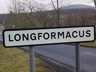
<span class="mw-page-title-main">Longformacus</span> Village in Scottish Borders, Scotland

Longformacus is a small village in Berwickshire in the Scottish Borders area of Scotland. It is around 10 kilometres (6.2 mi) north-west of Duns, in the Lammermuir Hills. The Dye Water runs through the village, flowing east towards its confluence with the Whiteadder Water nearby.

<span class="mw-page-title-main">Chryston</span> Human settlement in Scotland

Chryston is a village in North Lanarkshire, around 7 miles (11 km) east of Glasgow, in Scotland. It lies north of its sister village, Muirhead, which is on the A80. The village has around double Muirhead's population, although the exact boundary between the two modern villages is difficult to find.

<span class="mw-page-title-main">John Horne</span> Scottish geologist

John Horne PRSE FRS FRSE FEGS LLD was a Scottish geologist. He served as president of the Royal Society of Edinburgh from 1915 to 1919.

<span class="mw-page-title-main">Forgandenny</span> Human settlement in Scotland

Forgandenny is a small village in Perth and Kinross, Scotland, located four miles south of Perth. Perth is a 20-minute bus ride from Forgandenny, and there is a regular Stagecoach service. It is 45 minutes from Edinburgh and one hour from Glasgow. There is a daily train service from Perth to London King's Cross.

<span class="mw-page-title-main">Netherley House</span>

Netherley House is a mansion built by Alexander Silver in the late 18th century in Netherley, Aberdeenshire, Scotland. It is situated near the northerly flowing drainage of Crynoch Burn. The home was sold to Horatio Ross by James Silver, son of George Silver in 1853 for 33,000 pounds sterling.. It subsequently came into the possession of the descendants of General Nathaniel Forbes of Auchernach, who held it until 1901.

Cullicudden is an ancient village located close to the southeast shore of the Cromarty Firth, 2 miles northeast of Dingwall, on the west shore of the Black Isle in Ross-shire, Scottish Highlands and is in the Scottish council area of Highland.

<span class="mw-page-title-main">Caputh, Perth and Kinross</span> Parish and village in Scotland

Caputh is a parish and village in Perth and Kinross, Scotland. It lies on the A984 Coupar Angus-to-Dunkeld road, about 6 miles southeast of Dunkeld and 8 miles west of Coupar Angus.

<span class="mw-page-title-main">South Inch</span> Park in Perth, Scotland

South Inch is a large public park in Perth, Scotland. About 31 hectares in size, it is one of two "Inches" in Perth, the other being the larger, 57-hectare North Inch, located half a mile across the city. The Inches were granted to the city, when it was a royal burgh, by King Robert II in 1374. Both Inches were once islands in the River Tay. The two Inches are connected by Tay Street.

John Merry Ross (1833–1883) was Scottish academic author and teacher. He was an expert on British poetry.

<span class="mw-page-title-main">Ballantine and Gardiner</span>

Ballantine and Gardiner was a Scottish manufacturer of stained-glass windows, one of several names the company worked under.

<span class="mw-page-title-main">Craigie, Perth, Scotland</span> Human settlement in Scotland

Craigie is a residential area of Perth, Scotland, immediately to the south and southwest of the city centre, beyond the South Inch. It is situated in the foothills of the 430 feet (130 m) St Magdalene's Hill, over which the M90 motorway passes, as does the B9112. It is separated from the city by the Highland Main Line.

<span class="mw-page-title-main">Pitcur</span> Human settlement in Scotland

Pitcur is a hamlet at the eastern edge of Perth and Kinross, Scotland, about 2.5 miles (4.0 km) southeast of Coupar Angus.

William Melven was a British historian and author. He wrote, or contributed to, around seventy publications during the late 19th- and early 20th centuries, including Guide to Scotland (1895), A Commercial Gazetteer of the World (1905), John Keltie's A History of the Scottish Highlands: Highland Clans and Highland Regiments (1886) and Ordnance Gazetteer of Scotland (1901) by Francis Hindes Groome.

Thomas Allan Croal was a British historian and author. He wrote, or contributed to, several publications during the late 19th- and early 20th centuries, including A Book About Travelling, Past and Present (1877), Scottish Loch Scenery (1882) and Palaces and Prisons of Mary, Queen of Scots.

Walter Scott Dalgleish was a British historian and author. His publications include Great Speeches from Shakespeare's Plays: with Notes and a Life of Shakespeare (1891), Great Britain and Ireland, 1689–1887 (1895) and Mediaeval England, from the English Settlement to the Reformation (1896).

References

  1. Ordnance gazetteer of Scotland - Open Library
  2. Groome, Francis Hindes (1901). Ordnance gazetteer of Scotland : a graphic and accurate description of every place in Scotland. National Library of Scotland. Edinburgh, T.C. and E.C. Jack.
  3. 1 2 3 Britain), Royal Geographical Society (Great (1885). Proceedings of the Royal Geographical Society and Monthly Record of Geography. Edward Stanford.
  4. "A Gazetteer of Scotland".
  5. "The Gazetteer for Scotland". www.scottish-places.info. Retrieved 2023-02-17.
  6. "Vision of Britain - Expert Search". Archived from the original on 3 December 2008.
  7. Ordnance Gazetteer of Scotland: A Survey of Scottish Topography, Statistical, Biographical, and Historical) - Wikimedia Commons
  8. "Volume 6 - Ordnance gazetteer of Scotland - Gazetteers of Scotland, 1803-1901 - National Library of Scotland". digital.nls.uk. Retrieved 2023-02-17.