Related Research Articles

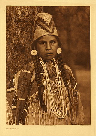
The Klamath people are a Native American tribe of the Plateau culture area in Southern Oregon and Northern California. Today Klamath people are enrolled in the federally recognized tribes:

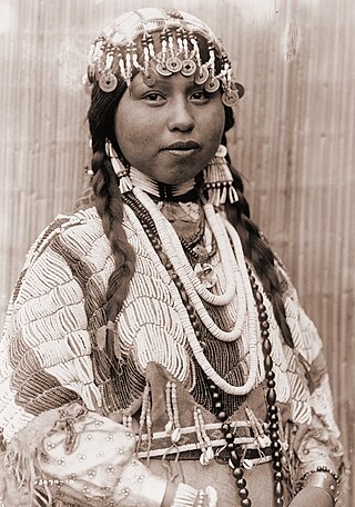
The Nez Perce are an Indigenous people of the Plateau who still live on a fraction of the lands on the southeastern Columbia River Plateau in the Pacific Northwest. This region has been occupied for at least 11,500 years.

The Cayuse are a Native American tribe in what is now the state of Oregon in the United States. The Cayuse tribe shares a reservation and government in northeastern Oregon with the Umatilla and the Walla Walla tribes as part of the Confederated Tribes of the Umatilla Indian Reservation. The reservation is located near Pendleton, Oregon, at the base of the Blue Mountains.

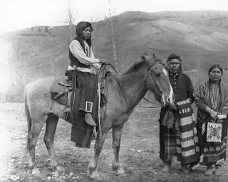
The Modoc are an Indigenous American people who historically lived in the area which is now northeastern California and central Southern Oregon. Currently, they include two federally recognized tribes, the Klamath Tribes in Oregon and the Modoc Tribe of Oklahoma, now known as the Modoc Nation.

The Nez Perce War was an armed conflict in 1877 in the Western United States that pitted several bands of the Nez Perce tribe of Native Americans and their allies, a small band of the Palouse tribe led by Red Echo (Hahtalekin) and Bald Head, against the United States Army. Fought between June and October, the conflict stemmed from the refusal of several bands of the Nez Perce, dubbed "non-treaty Indians," to give up their ancestral lands in the Pacific Northwest and move to an Indian reservation in Idaho Territory. This forced removal was in violation of the 1855 Treaty of Walla Walla, which granted the tribe 7.5 million acres of their ancestral lands and the right to hunt and fish on lands ceded to the U.S. government.

The Kalapuya are a Native American people, which had eight independent groups speaking three mutually intelligible dialects. The Kalapuya tribes' traditional homelands were the Willamette Valley of present-day western Oregon in the United States, an area bounded by the Cascade Range to the east, the Oregon Coast Range at the west, the Columbia River at the north, to the Calapooya Mountains of the Umpqua River at the south.
The Palouse are a Sahaptin tribe recognized in the Treaty of 1855 with the United States along with the Yakama. It was negotiated at the 1855 Walla Walla Council. A variant spelling is Palus. Today they are enrolled in the federally recognized Confederated Tribes and Bands of the Yakama Nation and some are also represented by the Colville Confederated Tribes, the Confederated Tribes of the Umatilla Indian Reservation and Nez Perce Tribe.
The Umatilla are a Sahaptin-speaking Native American tribe who traditionally inhabited the Columbia Plateau region of the northwestern United States, along the Umatilla and Columbia rivers.

The Confederated Tribes of the Umatilla Indian Reservation are the federally recognized confederations of three Sahaptin-speaking Native American tribes who traditionally inhabited the Columbia River Plateau region: the Cayuse, Umatilla, and Walla Walla.
The Molala are a people of the Plateau culture area in the Oregon Cascades and central Oregon, United States. They are one of the Confederated Tribes of the Grand Ronde Community of Oregon, with 141 of the 882 members in the 1950s claiming Molala descent. The Confederated Tribes of Siletz Indians also has Molalla representation among its confederation of Tribes and Bands. The Siletz Reservation was established in 1855, for the Coast, Willamette and Umpqua Tribes. The Molalla are one of the Tribes who signed the 1855 Willamette Valley Treaty.

Alfred Benjamin Meacham (1826–1882) was an American Methodist minister, reformer, author and historian, who served as the U.S. Superintendent of Indian Affairs for Oregon (1869–1872). He became a proponent of American Indian interests in the Northwest, including Northern California. Appointed in 1873 as chairman of the Modoc Peace Commission, he was severely wounded during a surprise attack on April 11 by warriors, but saved from death by Toby Riddle (Winema), a Modoc interpreter.
The Shastan peoples are a group of linguistically related indigenous peoples from the Klamath Mountains. They traditionally inhabited portions of several regional waterways including the Klamath, Salmon, Sacramento and McCloud rivers. Shastan lands presently form portions of the Siskiyou, Klamath and Jackson counties. Scholars have generally divided the Shastan peoples into four languages, although arguments in favor of more or less existing have been made. Speakers of Shasta proper-Kahosadi, Konomihu, Okwanuchu, and Tlohomtah’hello "New River" Shasta resided in settlements typically near a water source. Their villages often had only either one or two families. Larger villages had more families and additional buildings utilised by the community.

The Confederated Tribes of the Grand Ronde Community of Oregon (CTGR) consists of twenty-seven Native American tribes with long historical ties to present-day western Oregon between the western boundary of the Oregon Coast and the eastern boundary of the Cascade Range, and the northern boundary of southwestern Washington and the southern boundary of northern California. The community has an 11,288-acre (45.7 km2) Indian reservation, the Grand Ronde Indian Reservation, which was established in 1856 in Yamhill and Polk counties.
The Rogue River Wars were an armed conflict in 1855–1856 between the U.S. Army, local militias and volunteers, and the Native American tribes commonly grouped under the designation of Rogue River Indians, in the Rogue River Valley area of what today is southern Oregon. The conflict designation usually includes only the hostilities that took place during 1855–1856, but there had been numerous previous skirmishes, as early as the 1830s, between European American settlers and the Native Americans, over territory and resources.

The Modoc Nation is a federally recognized tribe of Modoc people, located in Ottawa County in the northeast corner of Oklahoma and Modoc and Siskiyou counties in northeast California. The smallest tribe in the state, they are descendants of Captain Jack's band of Modoc people, removed in 1873 after the Modoc Wars from their traditional territory in northern California and southern Oregon. They were exiled to the Quapaw Agency in Indian Territory, where they were colocated with the Shawnee people from east of the Mississippi River.
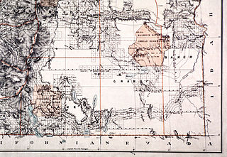
The Malheur Indian Reservation was an American Indian reservation established for the Northern Paiute in eastern Oregon and northern Nevada from 1872 to 1879. The federal government discontinued the reservation after the Bannock War of 1878, under pressure from European-American settlers who wanted the land. This negative recommendation against continuing by its agent William V. Rinehart, led to the internment of more than 500 Paiute on the Yakama Indian Reservation, as well as the reluctance of the Bannock and Paiute to return to the lands after the war.

The Huntington Wagon Road is a historic road in Deschutes County, Oregon, United States.
The Native American peoples of Oregon are the set of Indigenous peoples who have inhabited or who still inhabit the area delineated in today's state of Oregon in the Pacific Northwest region of the United States. While the state of Oregon currently maintains relations with nine federally recognized tribal groups, the state was previously home to a much larger number of autonomous tribal groups, which today either no longer exist or have been absorbed into these larger confederated entities. Six of the nine tribes gained federal recognition in the late 20th century, after undergoing the termination and restoration of their treaty rights starting in the 1950s.
References
- 1 2 3 4 5 6 7 8 9 10 11 "Superintendent of Indian Affairs". Provisional and Territorial Records Guide. Oregon State Archives . Retrieved February 17, 2012.
- ↑ "A Siletz History: Part V - The Early Treaty Making Period of 1851". Confederated Tribes of Siletz Indians of Oregon . Retrieved October 3, 2008.
- ↑ See the records in RG 75 M234 and M2 microfilm correspondence series's for changes in the Indian districts, agencies, and superintendencies.
- ↑ Spores, Ronald (Spring 1993). "Too Small a Place: The Removal of the Willamette Valley Indians, 1850-1856". American Indian Quarterly . University of Nebraska Press. 17 (2): 171–191. doi:10.2307/1185526. JSTOR 1185526.
- 1 2 3 4 5 6 7 8 "Sovereigns of Themselves: A Liberating History of Oregon and Its Coast: Volume VII". Archived from the original on 2006-08-12.
- ↑ Clackamas County History
- ↑ Zimmerman, Brent (27 July 2009). "Mint that never was makes interesting tale". Numismatic News. Retrieved 13 September 2019.
- ↑ "Treaty with the Klamath, etc, 1864" (PDF). U.S. Fish and Wildlife Service. Retrieved 13 September 2019.