Orleans Levee Board

Last updated

From 1890 through 2006, the Orleans Levee Board (OLB) was the body of commissioners that oversaw the Orleans Levee District (OLD) which supervised the levee and floodwall system in Orleans Parish, Louisiana The role of the OLB has changed over time. Prior to Hurricane Betsy in 1965, the OLB developed land and sold it to raise money to build and improve flood protection levees. After Betsy, Congress passed the Flood Control Act of 1965 which directed the Army Corps of Engineers to design and build the hurricane flood protection system enveloping New Orleans. Owing to the 1965 legislation, the OLB's duties were now limited to collecting the 30% cost share for project design and construction, and to maintaining and operating completed flood protection structures.

Contents

In the wake of the 2005 levee failures in Greater New Orleans, two new regional flood protection authorities were created to replace the OLB as well as the East Jefferson Levee Board and the Lake Borgne Levee Board (St. Bernard Parish). Most of the OLD now falls under the jurisdiction of the Southeast Louisiana Flood Protection Authority - East, charged with operation and maintenance of all flood-protection infrastructure for Greater New Orleans on the East Bank of the Mississippi River. The Southeast Louisiana Flood Protection Authority - West possesses the same metro-wide jurisdiction for the West Bank of the Mississippi, and it includes that portion of the Orleans Levee District on the West Bank (i.e., Algiers).

After Katrina, it was widely believed that this different form of levee board governance might be more appropriate for a major marine terminal like New Orleans. Nevertheless, the issue of whether the commissioners of the OLB Engineering Committee acted incompetently or negligently regarding the catastrophic flooding of August 2005 has not been conclusively demonstrated or proven. [1]

History

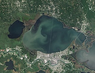
The pre-Katrina Orleans Levee District (OLD), governed by the Orleans Levee Board (OLB), owned considerable assets, mainly real estate, a peculiarity that stems from its history. The Orleans Levee District was created by the Louisiana legislature in 1890 for the purpose of protecting the low-lying city of New Orleans from floods. At that time, communities along the Mississippi River were largely in charge of creating their own levees to protect themselves, as no unified levee system existed. Most neighboring parishes had (and some still have) similar parochial levee boards. In the early twentieth century, the OLD reclaimed a portion of Lake Pontchartrain, a 24-mile wide lake north of New Orleans. The OLD developed the land and sold it to raise money to build and improve levees. Starting in the 1920s, the Board undertook a massive flood-protection initiative involving the construction of a stepped seawall several hundred feet north of a portion of the existing south shore of Lake Pontchartrain. The intervening area was filled to several feet above sea level and was to serve as a "super levee" protecting the city from the Lake's storm surge.

The Lake Vista, Lake Oaks, Lake Terrace, East and West Lakeshore subdivisions and other property between Allen Toussaint Blvd and Lake Pontchartrain are all examples of the OLB's developed properties.

In 1924, the state legislature authorized the OLB to acquire 33,000 acres (130 km2) of land on the east bank of the Mississippi River about 50 miles (80 km) south of New Orleans in order to build the Bohemia Spillway between the River and the Gulf of Mexico. (1924 La. Acts 99). Approximately half of this land was public property transferred from the state; the other half was either expropriated, or purchased under threat of expropriation, from private owners according to a legal finding. (1928 La. Acts 246; 1942 La. Acts 311). [2]

In the aftermath of the Great Mississippi Flood of 1927, the U.S. Congress gave the United States Army Corps of Engineers supervision and control over the design and construction of flood-control infrastructure throughout the Mississippi River Valley.

In 1934, New Orleans Lakefront Airport opened on land dredged from Lake Pontchartrain by the Levee Board, part of a larger "lakefill" land-reclamation project initiated to construct a super levee for the protection of the northern perimeter of the city. The airport was originally named "Shushan Airport" after Orleans Levee Board president Abraham Lazar Shushan; it was renamed "New Orleans Airport" after Shushan's indictment for corruption in the Louisiana Scandals of the late 1930s.

Governor Jimmie Davis, in his second term from 1960 to 1964, named the New Orleans attorney Gerald J. Gallinghouse as the president of the levee board. In that capacity, Gallinghouse delivered more than 300 speeches warning of the need to be prepared for weather disasters, another of which was on its way, Hurricane Betsy. [3]

After extensive flooding during Hurricane Betsy in 1965, Congress ordered the U.S. Army Corps of Engineers henceforth to design and build flood protection in the Lake Pontchartrain and Vicinity Hurricane Protection Project. The OLB became the local sponsor, and its duties regarding flood protection were now limited to collecting 30% cost-share for project design and construction and maintaining the completed structures. Despite Congress's mandate that the Corps now had the authority to design/build flood protection, the OLB still retained extensive assets which had to be managed.

Hurricane Katrina

Debris set on curb from flood-damaged Uptown home includes trashed "Katrina refrigerator" with graffiti labeling it as a "levee board victim." FridgeLeveeBoardVictim.jpg
Debris set on curb from flood-damaged Uptown home includes trashed "Katrina refrigerator" with graffiti labeling it as a "levee board victim."

After Hurricane Katrina, in a context of shock, chaos and confusion, the Orleans Levee Board found itself at the center of the greatest crisis ever to face the city of New Orleans. Multiple levee and floodwall breaches in the Industrial Canal, the 17th Street Canal, and the London Avenue Canal resulted in the flooding of 80% of the city. The flood is believed to have directly caused over 1,400 deaths; destroyed or severely damaged homes, businesses, and property in the majority of the city.

Investigations after the disaster revealed that the design of the levee and floodwall system, designed and built by the U.S. Army Corps of Engineers, had inadequate design and construction specifications.

What is evident from the project record is that the Army Corps recommended raising the canal floodwalls for the 17th Street Canal, but recommended gated structures at the mouths of the Orleans and London Avenue Canals because the latter plan was less expensive. The OLB convinced Congress to pass legislation that required the Corps to raise the floodwalls for all three canals. Furthermore, the Corps, in a separate attempt to limit project costs, initiated a sheet pile load test (E-99 Study), but misinterpreted the results and wrongly concluded that sheet piles needed to be driven to depths of only 17 feet (1 foot 14 0.3048 meters) instead of between 31 and 46 feet. That decision saved approximately $100 million, but significantly reduced overall engineering reliability. [4]

On January 4, 2023, the National Hurricane Center (NHC) updated the Katrina fatality data based on Rappaport (2014). The new toll reduced the number by about one quarter from an estimated 1,833 to 1,392. [5] The Rappaport analysis wrote that the 2005 storm “…stands apart not just for the enormity of the losses, but for the ways in which most of the deaths occurred.” [6] The same NHC report also revised the total damage estimate keeping Hurricane Katrina as the costliest storm ever––$190 billion according to NOAA’s National Centers for Environmental Information. [7]

In September 2022, the Associated Press issued a style guide change to Katrina stating that reporters when writing about the storm in New Orleans should note that “…levee failures played a major role in the devastation in New Orleans. In some stories, that can be as simple as including a phrase about Hurricane Katrina’s catastrophic levee failures and flooding….” [8]

Changes to National and State Policy

After the levee failures, the immediate assumption was that the OLD commissioners were not engaged in flood protection. This was reinforced by corps spokespersons who repeatedly told a story of local levee board officials who "forced" the corps to build the system that failed. [9] As revealed in an August 2015 article [10] in the official journal of the World Water Council, the story is untrue, and responsibility for the levee failures belongs to the corps. Nonetheless, in the context of haste and confusion, seven weeks after the breach event, there were calls for the elimination of the Orleans Levee Board and other local boards. [11]

During a special session of the Louisiana Legislature, a bill submitted by Sen. Walter Boasso (D-Arabi) was passed into law, which consolidated the levee boards of various parishes within Greater New Orleans. The new legislation was intended to (1) remove distractions, (2) replace parochial flood control with regional flood control, and (3) require commissioners to have professional expertise including hydrology, construction engineering and civil engineering.

The law created two new regional levee boards, Southeast Louisiana Flood Protection Authority-East and Southeast Louisiana Flood Protection Authority-West, separated by the Mississippi River. The Orleans Levee Board ceased to exist on January 1, 2007. The new regional flood-protection authorities assumed control of the Board's flood-protection infrastructure. Lakefront Airport, the marinas (except for the city-owned Municipal Yacht Harbor), Lakeshore Drive, and the lakefront park system (except for West End Park, administered by New Orleans' Parks and Parkways Department) are now operated and maintained by the Louisiana State Division of Administration. [12]

Investigative studies completed after the legislation's passage revealed no causal link between the pre-Katrina levee districts and the flooding. [13] The most recent article about the breach event, published in 2015 by Water Policy, the official journal of the World Water Council concluded: "...we have not uncovered any information that would suggest that the members of the OLB who served on the Engineering Committee or the OLD staff engineers behaved irresponsibly or in a manner that did not place the interests of the city residents at the forefront."

The levee breach event was a pivotal moment in American history. The nation took a different path due to the flooding event. The myriad changes to national policy as a result of this lynchpin moment include, but are not limited to, the following: Nationwide assessment of levees, First-ever National Levee Safety Act, National Flood Risk Management Program, Reform of the Army Corps of Engineers and Changes in Levee Building by the Corps.

Since sixty-two percent of American people lives in counties protected by levees, [14] these changes to national policy can be interpreted as making the majority of the national population safer.

See also

Related Research Articles

<span class="mw-page-title-main">Lake Pontchartrain</span> Estuary located in southeastern Louisiana, United States

Lake Pontchartrain is an estuary located in southeastern Louisiana in the United States. It covers an area of 630 square miles (1,600 km2) with an average depth of 12 to 14 feet. Some shipping channels are kept deeper through dredging. It is roughly oval in shape, about 40 miles (64 km) from west to east and 24 miles (39 km) from south to north.

The Mississippi River–Gulf Outlet Canal is a 76 mi (122 km) channel constructed by the United States Army Corps of Engineers at the direction of Congress in the mid-20th century that provided a shorter route between the Gulf of Mexico and New Orleans' inner harbor Industrial Canal via the Intracoastal Waterway. In 2005, the MRGO channeled Hurricane Katrina's storm surge into the heart of Greater New Orleans, contributing significantly to the subsequent multiple engineering failures experienced by the region's hurricane protection network. In the aftermath the channel was closed. A permanent storm surge barrier was constructed in the MRGO in 2009, and the channel has been closed to maritime shipping.

<span class="mw-page-title-main">9th Ward of New Orleans</span> Region in New Orleans, Louisiana

The Ninth Ward or 9th Ward is a distinctive region of New Orleans, Louisiana, which is located in the easternmost downriver portion of the city. It is geographically the largest of the 17 Wards of New Orleans. On the south, the Ninth Ward is bounded by the Mississippi River. On the western or "upriver" side, the Ninth Ward is bounded by Franklin Avenue, then Almonaster Avenue, then People's Avenue. From the north end of People's Avenue the boundary continues on a straight line north to Lake Pontchartrain; this line is the boundary between the Ninth and the city's Eighth Ward. The Lake forms the north and northeastern end of the ward. St. Bernard Parish is the boundary to the southeast, Lake Borgne farther southeast and east, and the end of Orleans Parish to the east at the Rigolets.
<span class="mw-page-title-main">Hurricane preparedness in New Orleans</span>

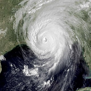
Hurricane preparedness in New Orleans has been an issue since the city's early settlement because of its location.

<span class="mw-page-title-main">Industrial Canal</span>

The Industrial Canal is a 5.5 mile (9 km) waterway in New Orleans, Louisiana, United States. The waterway's proper name, as used by the U.S. Army Corps of Engineers and on NOAA nautical charts, is Inner Harbor Navigation Canal (IHNC). The more common "Industrial Canal" name is used locally, both by commercial mariners and by landside residents.

<span class="mw-page-title-main">17th Street Canal</span> Canal in Louisiana, United States of America

The 17th Street Canal is the largest and most important drainage canal in the city of New Orleans. Operating with Pump Station 6, it moves water into Lake Pontchartrain. The canal, along with the Orleans Canal and the London Avenue Canal, form the New Orleans Outfall Canals. The 17th Street Canal forms a significant portion of the boundary between the city of New Orleans and Metairie, Louisiana. The canal has also been known as the Metairie Outlet Canal and the Upperline Canal.

<span class="mw-page-title-main">London Avenue Canal</span>

The London Avenue Canal is a drainage canal in New Orleans, Louisiana, used for pumping rain water into Lake Pontchartrain. The canal runs through the 7th Ward of New Orleans from the Gentilly area to the Lakefront. It is one of the three main drainage canals responsible for draining rainwater from the main basin of New Orleans. The London Avenue Canal's flood walls built atop earthen levees breached on both sides during Hurricane Katrina in 2005.

<span class="mw-page-title-main">Civil engineering and infrastructure repair in New Orleans after Hurricane Katrina</span> Overview of civil engineering and infrastructure repair post Hurricane Katerina

Though Hurricane Katrina did not deal the city of New Orleans a direct hit on August 29, 2005, the associated storm surge precipitated catastrophic failures of the levees and flood walls. The Mississippi River Gulf Outlet ("MR-GO") breached its levees in approximately 15 places. The major levee breaches in the city include the 17th Street Canal levee, the London Avenue Canal, and the wide, navigable Industrial Canal, which left approximately 80% of the city flooded.

On Monday, August 29, 2005, there were over 50 failures of the levees and flood walls protecting New Orleans, Louisiana, and its suburbs following passage of Hurricane Katrina. The failures caused flooding in 80% of New Orleans and all of St. Bernard Parish. In New Orleans alone, 134,000 housing units — 70% of all occupied units — suffered damage from Hurricane Katrina and the subsequent flooding.

Drainage in New Orleans, Louisiana, has been a major concern since the founding of the city in the early 18th century, remaining an important factor in the history of New Orleans today. The central portion of metropolitan New Orleans is fairly unusual in that it is almost completely surrounded by water: Lake Pontchartrain to the north, Lake Borgne to the east, wetlands to the east and west, and the Mississippi River to the south. Half of the land area between these bodies of water is at or below sea level, and no longer has a natural outlet for flowing surface water. As such, virtually all rainfall occurring within this area must be removed through either evapotranspiration or pumping. Thus, flood threats to metropolitan New Orleans include the Mississippi River, Lake Pontchartrain, canals throughout the city, and natural rainfall. Artificial levees have been built to keep out rising river and lake waters but have had the negative effect of keeping rainfall in, and have failed on numerous occasions.
<span class="mw-page-title-main">Orleans Canal</span>

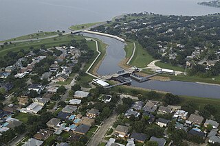
The Orleans Canal is a drainage canal in New Orleans, Louisiana. The canal, along with the 17th Street Canal and the London Avenue Canal, form the New Orleans Outfall Canals. The current version of the canal is about 2 km long, running along the up-river side of City Park, through the Lakeview and Lakeshore neighborhood, and into Lake Pontchartrain. It is part of the system used to pump rain water out of the streets of the city into the Lake. The Canal has also been known as the Orleans Avenue Canal, the Orleans Outfall Canal, the Orleans Tail Race, and early on, the Girod Canal.

<span class="mw-page-title-main">Bonnet Carré Spillway</span> Flood control operation in the Lower Mississippi Valley, US

The Bonnet Carré Spillway is a flood control operation in the Lower Mississippi Valley. Located in St. Charles Parish, Louisiana, about 12 miles (19 km) west of New Orleans, it allows floodwaters from the Mississippi River to flow into Lake Pontchartrain and thence into the Gulf of Mexico. The spillway was constructed between 1929 and 1931, following the Great Mississippi Flood of 1927, and has been designated as a National Historic Civil Engineering Landmark by the American Society of Civil Engineers.

ING 4727

ING 4727 was a barge belonging to Ingram Barge Company that became infamous when it went over or through a levee and landed in a residential neighborhood of New Orleans, Louisiana during Hurricane Katrina.

<span class="mw-page-title-main">Lakeview, New Orleans</span> New Orleans Neighborhood in Louisiana, United States

Lakeview is a neighborhood of the city of New Orleans. A subdistrict of the Lakeview District Area, its boundaries as defined by the City Planning Commission are: Allen Toussaint Boulevard to the north, Orleans Avenue to the east, Florida Boulevard, Canal Boulevard and I-610 to the south and Pontchartrain Boulevard to the west. Lakeview is sometimes used to describe the entire area bounded by Lake Pontchartrain to the north, the Orleans Avenue Canal to the east, City Park Avenue to the south and the 17th Street Canal to the west. This larger definition includes the West End, Lakewood and Navarre neighborhoods, as well as the Lakefront neighborhoods of Lakeshore and Lake Vista.

The Flood Control Act of 1965, Title II of Pub. L. 89–298, was enacted on October 27, 1965, by the 89th Congress and authorized the United States Army Corps of Engineers to design and construct numerous flood control projects including the Lake Pontchartrain and Vicinity, Louisiana Hurricane Protection Project in the New Orleans region of south Louisiana.

The United States Army Corps of Engineers is involved with a wide spectrum of public works projects: environmental protection, water supply, recreation, flood damage and reduction, beach nourishment, homeland security, military construction, and support to other Governmental agencies. Through 19 Flood Control Acts since 1917, Congress has authorized the Corps of Engineers to be involved with flood protection and damage reduction in almost every state of the union.

The United States Army Corps of Engineers is involved with a wide spectrum of public works projects: environmental protection, water supply, recreation, flood damage and reduction, beach nourishment, homeland security, military construction, and support to other Governmental agencies. In nineteen (19) different Flood Control Acts since 1917, the United States Congress has authorized the corps to design and build flood protection projects and one risk reduction system in the Greater New Orleans area and throughout the nation.

<span class="mw-page-title-main">Seabrook Floodgate</span> Bridge in New Orleans, Louisiana

The Inner Harbor Navigation Canal (IHNC) Seabrook Floodgate Structure is a flood barrier in the Industrial Canal in New Orleans, Louisiana. The floodgate is designed to protect the Industrial Canal and the surrounding areas from a storm surge from Lake Pontchartrain. It consists of two 50-foot (15 m) wide vertical lift gates and a 95-foot (29 m) wide sector gate.

<span class="mw-page-title-main">New Orleans Outfall Canals</span>

There are three outfall canals in New Orleans, Louisiana – the 17th Street, Orleans Avenue and London Avenue canals. These canals are a critical element of New Orleans’ flood control system, serving as drainage conduits for much of the city. There are 13 miles (21 km) of levees and floodwalls that line the sides of the canals. The 17th Street Canal is the largest and most important drainage canal and is capable of conveying more water than the Orleans Avenue and London Avenue Canals combined.

<span class="mw-page-title-main">Hurricane & Storm Damage Risk Reduction System</span>

The greater New Orleans Hurricane & Storm Damage Risk Reduction System (HSDRRS) is an infrastructure systems in southern Louisiana which seeks to provide the greater New Orleans area a 100-year level of risk reduction, meaning reduced risk from a storm surge that has a 1% chance of occurring or being exceeded in any given year. In 2019, the Army Corps of Engineers announced that due to increased rate of sea level rise and continued sinking of soil the levee system would no longer offer original planned levels of protection as early as the year 2023.

References

  1. J. David Rogers, G. Paul Kemp (2015). "Interaction between the US Army Corps of Engineers and the Orleans Levee Board preceding the drainage canal wall failures and catastrophic flooding of New Orleans in 2005" (PDF). Water Policy. p. 721. Retrieved 2017-04-24.
  2. "?".
  3. "Gerald Joseph Gallinghouse". New Orleans Times-Picayune . Retrieved June 29, 2013.
  4. J. David Rogers, G. Paul Kemp (2015). "Interaction between the US Army Corps of Engineers and the Orleans Levee Board preceding the drainage canal wall failures and catastrophic flooding of New Orleans in 2005" (PDF). Water Policy. p. 707. Retrieved 2017-04-24.
  5. Knabb, Richard D.; Rhome, Jamie R.; Brown, Daniel P. (January 4, 2023). "Tropical Cyclone Report, Hurricane Katrina 23-30 August 2005" (PDF).
  6. Rappaport, Edward N. (March 1, 2014). "Fatalities in the United States from Atlantic Tropical Cyclones: New Data and Interpretation Vol 95, Issue 3". Bulletin of the American Meteorological Society.
  7. Schleifstein, Mark (January 14, 2023). "How many people died in Hurricane Katrina? Toll reduce 17 years later". The Advocate.
  8. "Hurricane Topical Guide". AP Stylebook The Associated Press. September 27, 2022.
  9. Schleifstein, Mark (August 7, 2015). "Study: Corps decisions, not Orleans Levee Board, doomed canal walls in Katrina". The Times-Picayune. Retrieved 2017-04-24.
  10. J. David Rogers, G. Paul Kemp (2015). "Interaction between the US Army Corps of Engineers and the Orleans Levee Board preceding the drainage canal wall failures and catastrophic flooding of New Orleans in 2005" (PDF). Water Policy. p. 720. Retrieved 2015-10-31.
  11. Press release: Louisiana Republican Legislative Delegation," November 22, 2005. http://levees.org/2/wp-content/uploads/2017/04/LA-Republican-Legislative-Delegation.pdf.
  12. Non-Flood Protection Asset Management Authority
  13. Robertson, Campbell. "Decade After Katrina, Pointing Finger More Firmly at Army Corps". New York Times. 2015-05-23. Retrieved 2021-09-20.
  14. Schleifstein, Mark (August 11, 2020). "Almost 2/3 of Americans live in counties with levees - up from 10 years ago, FEMA data shows". The Times-Picayune. Retrieved 2020-01-10.

Further reading