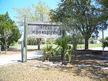
Ortona, Glades County, Florida

Last updated

Lake Wobegon at Indian Mound Park, Ortona, Florida Ortona FL Lake Wobegon01.jpg
Lake Wobegon at Indian Mound Park, Ortona, Florida
Lake Wobegon signage Ortona FL Lake Wobegon sign01.jpg
Lake Wobegon signage
Ortona, Indian Mound Park entrance Ortona FL Indian Mound Park sign01b.jpg
Ortona, Indian Mound Park entrance
Indian Mound Park boardwalk Ortona FL Indian Mound Park bdwk01.jpg
Indian Mound Park boardwalk
Indian Mound Park curving boardwalk Ortona FL Indian Mound Park bdwk02.jpg
Indian Mound Park curving boardwalk
Ortona Indian Mound Park signage noting park was acquired and developed by Glades County, Florida with the assistance of the Florida Department of Natural Resources and the Florida Recreation Development Assistance Program Ortona FL Indian Mound Park sign02.jpg
Ortona Indian Mound Park signage noting park was acquired and developed by Glades County, Florida with the assistance of the Florida Department of Natural Resources and the Florida Recreation Development Assistance Program
Indian Mound Park information kiosk Ortona FL Indian Mound Park info01.jpg
Indian Mound Park information kiosk
Ortona Indian Mound Park signage Ortona FL Indian Mound Park sign01a.jpg
Ortona Indian Mound Park signage
Panorama photograph of Ortona Indian Mound Park Ortona FL Indian Mound Park pano01.jpg
Panorama photograph of Ortona Indian Mound Park

Ortona is an unincorporated area and a populated place in Glades County, Florida. [1]

Contents

One of the area's attractions is the Ortona Indian Mound Park, which preserves part of the Ortona Prehistoric Village, and the hiking trail through that area. [2] The prehistoric mounds, canoe canals and earthworks were constructed by Native Americans across a five-square-mile region along the north side of the Caloosahatchee River. [3] The site is located on SR 78, north of LaBelle. [4] [5]

History

A LaBelle investor and businessman, Jerome G. Attanasio, bought 360 acres of land southwest of Citrus Center. He named the subdivision "Ortona" after the coastal town in Italy, where he was born. [6] Hoping to attract grape growers to his development, Attanasio reported to the Moore Haven Times, in 1924, that he was impressed with the growth of 500 rootstock Carmen Grape on his six acres of land. [6]

The original settlers were "squatters who moved in and out. Members of the Townsend family visited, stayed awhile, then moved on."

After the Depression, all land developers left except Williams, Storter, Hicks, Komer, and Rivers families. [6]

Afterward, settlers moved into Ortona, along the Caloosahatchee River, living in "houses built of cane poles and roofed over with cabbage fan palms," buying five to ten acre tracts of land. [6] Lonnie Williams, with other members of the community, went to Fisheating Creek to collect cane poles to build the Ortona Holiness Church, featuring a "cabbage fan roof." [6] The palm frond roofs lasted up to three years. The community helped each other build their homes. [6]

The settlers lived in a "cluster," fishing, hunting and farming, together. [6] Everyone had access to sugarcane. Though all neighbors helped each other grind sugarcane for syrup; "everyone had a stand of cane," all supplies and tools had to be bought. [6]

Tom and Amanda Williams, grandparents of Vance Storter, brought him to Ortona from Naples at four-years-old. They traveled from Naples to Fort Center after their daughter died of typhoid fever. With hogs bought from the Seminole, they finally moved to Ortona. [6]

The first Ortona school was located by the O'Bannion's saw mill, according to Storter. A larger school was built by the county on two-acres of land "behind Mr. Komer's house to accommodate the increased enrollment." [6]

Teachers were known for "leaving abruptly," according to Marvin Williams, "one with a nervous breakdown." The first consistent teacher was "Mr. Ketring" who "kept the boys at their school work." Focusing on school work was hard for the local students; "with plenty of hunting, fishing and chores, it was difficult to be very concerned about book learning." [6]

Steamboats from Fort Myers came to load "cordwood" supplied by the J.F. "Bud" Cross family after contracting and cutting down woodland areas and delivering the wood to the boats. [6]

Nailed to a tree was a coffee mill, accessible to everyone to grind their coffee beans. Afterward, the area was named Coffee Mill Hammock, including a road by the same name. [6]

Without local fencing laws in the 1920s, cows grazed freely and dairy products were free, "if one had the determination and a drawdy pole." [6]

"The drawdy pole was long with a loop of rope firmly attached to the end. The loop was hooked around the cow's horns, and the pole twisted to tighten the grip of the horns. Finally, the cow could only move in a slight semi-circle, and it could be milked." [6]

There was no supplemental feed; the cows were free-range. Fourteen to twenty cows provided enough milk for a family. There was "sweet milk for drinking, sour milk for bread, butter, and other milk by-products." [6]

Hogs were raised and sold to the locals and hauled to Fort Myers. "At that time, the cattle were too scrawny to be slaughtered, and the price wasn't nearly as good as for hogs." [6]

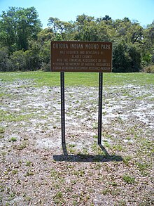
Thirty-two acres of land was used for the Ortona Cemetery in 1921. The first caretaker was Clive Hicks. [6]

A train depot was built after Chihi, a railroad crossing, was finished. The first bridge tender at the railroad was Eugene Walker, who "bought the cane mill from an outlaw for $112" and was still the owner in 1985. [6] The depot was used as a refuge for flooding for those in lower areas around Ortona's ridge. [6]

Owned by Don Melcer, Meadowlark Campground featured a two-story building, with workers living near the camp. Currently, it's called the Meadowlark Shores 55+ RV Park. [6] [7]

Ken Bracken started the River Oaks subdivision located west of Meadowlark Shores. [6]

Turkey Creek was created by Eurgene Walker, the location of O'Bannion's saw mill, which kept a dragline onsite; "a horse couldn't get through the thick brush, but the dragline dug through." [8]

In 1985, Ghands and Baker owned one sandmine while one was leased to E.R. Jahna, though operated by John Bruner. Paul and Wheeler planted 1,000 acres of young citrus groves in 1979. [6]

At the same time, Ortona featured a beauty shop, store and bar for locals and "enthusiastic winter visitors." [6]

Climate

Climate data for Ortona, Florida, 19912020 normals, extremes 2002present
MonthJanFebMarAprMayJunJulAugSepOctNovDecYear
Record high °F (°C)88
(31)
91
(33)
93
(34)
98
(37)
101
(38)
100
(38)
98
(37)
98
(37)
96
(36)
95
(35)
93
(34)
89
(32)
101
(38)
Mean maximum °F (°C)85.8
(29.9)
87.2
(30.7)
88.9
(31.6)
92.7
(33.7)
94.2
(34.6)
96.0
(35.6)
95.5
(35.3)
95.6
(35.3)
94.4
(34.7)
92.6
(33.7)
88.5
(31.4)
86.2
(30.1)
96.8
(36.0)
Average high °F (°C)74.2
(23.4)
77.9
(25.5)
80.4
(26.9)
84.9
(29.4)
88.2
(31.2)
90.1
(32.3)
90.9
(32.7)
91.6
(33.1)
89.5
(31.9)
85.8
(29.9)
80.1
(26.7)
76.7
(24.8)
84.2
(29.0)
Daily mean °F (°C)61.7
(16.5)
64.7
(18.2)
67.5
(19.7)
72.3
(22.4)
76.5
(24.7)
80.0
(26.7)
81.4
(27.4)
82.1
(27.8)
80.4
(26.9)
75.9
(24.4)
69.1
(20.6)
64.6
(18.1)
73.0
(22.8)
Average low °F (°C)49.2
(9.6)
51.5
(10.8)
54.6
(12.6)
59.8
(15.4)
64.7
(18.2)
70.0
(21.1)
72.0
(22.2)
72.5
(22.5)
71.4
(21.9)
66.0
(18.9)
58.2
(14.6)
52.6
(11.4)
61.9
(16.6)
Mean minimum °F (°C)32.1
(0.1)
35.7
(2.1)
39.5
(4.2)
47.9
(8.8)
56.7
(13.7)
66.2
(19.0)
68.3
(20.2)
69.9
(21.1)
67.5
(19.7)
53.1
(11.7)
42.8
(6.0)
39.0
(3.9)
30.3
(−0.9)
Record low °F (°C)25
(−4)
26
(−3)
32
(0)
42
(6)
51
(11)
60
(16)
61
(16)
67
(19)
62
(17)
40
(4)
37
(3)
26
(−3)
25
(−4)
Average precipitation inches (mm)2.21
(56)
1.92
(49)
2.83
(72)
3.06
(78)
4.62
(117)
10.31
(262)
9.04
(230)
9.15
(232)
7.47
(190)
3.34
(85)
1.34
(34)
1.77
(45)
57.06
(1,449)
Average precipitation days (≥ 0.01 in)5.65.75.15.99.017.217.119.715.87.25.15.8119.2
Source 1: NOAA [9]
Source 2: National Weather Service (mean maxima/minima 20062020) [10]

Communities

Meadowlark Shores 55+ RV Park [7]

River Oaks Subdivision [8]

Turkey Creek [11]

Festivals

The Cane Grinding Festival is a fund-raiser originally for Ortona's volunteer fire department, with the firehouse being built by the community. [6] "It commemorates the early settlers’ cultivation and processing of the delectable sugar cane syrup. The festival features bluegrass music, clogging, arts and crafts booths, and barbecue chicken and rib dinners.  Proceeds from the festival benefit the local fire department." [12]

Related Research Articles

<span class="mw-page-title-main">Glades County, Florida</span> County in Florida, United States

Glades County is a county located in the Florida Heartland region of the U.S. state of Florida. As of the 2020 census, the population was 12,126, making it the fourth-least populous county in Florida. Its county seat is Moore Haven.

<span class="mw-page-title-main">Hendry County, Florida</span> County in Florida, United States

Hendry County is a county in the Florida Heartland region of the U.S. state of Florida. As of the 2020 census, the population was 39,619, down from 42,022 at the 2010 census. Its county seat is LaBelle.

<span class="mw-page-title-main">Lee County, Florida</span> County in Florida, United States

Lee County is located in southwestern Florida on the Gulf Coast. As of the 2020 census, its population was 760,822. In 2022, the population was 822,453, making it the eighth-most populous county in the state. The county seat is Fort Myers, with a population of 86,395 as of the 2020 census, and the largest city is Cape Coral, with an estimated 2020 population of 194,016.

<span class="mw-page-title-main">Everglades City, Florida</span> City in Florida

Everglades City is a city in Collier County, Florida, United States, of which it was once the county seat. As of the 2010 census, the population is 400. Collier County comprises the Naples–Immokalee–Marco Island Metropolitan Statistical Area. The Gulf Coast Visitor Center for Everglades National Park is in Everglades City.

<span class="mw-page-title-main">Belle Glade, Florida</span> City in Florida

Belle Glade is a city in south-central Florida and it is the far western part of Palm Beach County, Florida, United States, on the southeastern shore of Lake Okeechobee. It is part of South Florida's Miami metropolitan area. According to the 2020 U.S. Census, the city had a population of 16,698, down from 17,467 in the 2010 census.

<span class="mw-page-title-main">Canal Point, Florida</span> CDP in Florida, United States

Canal Point is a census-designated place (CDP) and unincorporated community in Palm Beach County, Florida, United States. It is part of the Miami metropolitan area of South Florida despite its local culture and location being way more similar to the Florida Heartland. Canal Point has a population of 344 people counted in the 2020 US census.

<span class="mw-page-title-main">Pine Island Sound</span> Coastal body of water in Florida, US

Pine Island Sound is located in Lee County, Florida, lying between Pine Island and the barrier islands of Sanibel Island, Captiva Island, North Captiva Island and Cayo Costa, which separate the Sound from the Gulf of Mexico. The Sound connects to Gasparilla Sound and Charlotte Harbor to the north, and to San Carlos Bay and the Caloosahatchee River to the south. The Sound is conterminous with the Pine Island Sound Aquatic Preserve, which was established in 1970 and consists of 54,000 acres (220 km2) of submerged land. Important habitats in the Sound include mangroves, seagrasses, salt marshes, oyster communities, tidal flats and sponge beds. All animals in and around Pine Island sound, including mollusks, fish, birds and mammals, are affected by periodic outbreaks of red tide. The Sound is relatively shallow in many locations, and boaters are cautioned to utilize up-to-date charts and tide tables.

<span class="mw-page-title-main">Brighton Seminole Indian Reservation</span> Seminole Indian Reservation in Florida, United States

Brighton Seminole Indian Reservation is an Indian reservation of the Seminole Tribe of Florida, located in northeast Glades County near the northwest shore of Lake Okeechobee. It is one of six reservations held in trust by the federal government for this tribe. The reservation has a land area of approximately 146 square kilometers or 36,000 acres and a 2000 census resident population of 566 persons.

<span class="mw-page-title-main">De Leon Springs State Park</span> Florida State Park in Volusia County

De Leon Springs State Park is a Florida State Park in Volusia County, Florida. It is located in DeLeon Springs, off CR 3.

The history of Leon County, Florida, much like the History of Tallahassee, dates back to the settlement of the Americas. Beginning in the 16th century, the region was colonized by Europeans, becoming part of Spanish Florida. In 1819, the Adams–Onís Treaty ceded Spanish Florida, including modern-day Leon County, to the United States. Named for Spanish explorer Juan Ponce de León, Leon County became an official U.S. county in 1824; the American takeover led to the county's rapid expansion as growing numbers of cotton plantations began to spring up nearby, increasing Leon County's population significantly.

<span class="mw-page-title-main">Terra Ceia, Florida</span> Unincorporated community in Florida, United States

Terra Ceia is an unincorporated community in Manatee County, Florida, United States that includes the 1,932 acres (7.82 km2) Terra Ceia Preserve. It is located on Terra Ceia Island on the Southern shore of Tampa Bay near the intersection of US 19 and I-275, at the southern end of the Sunshine Skyway Bridge.

Mound Key Archaeological State Park is a Florida State Park, located in Estero Bay, near the mouth of the Estero River. One hundred and thirteen of the island's one hundred and twenty-five acres are managed by the park system. It is a complex of mounds and accumulated shell, fish bone, and pottery middens that rises more than 30 feet above the waters of the bay.

The Pineland Archeological District is a U.S. historic district located on Pine Island, near Pineland, Florida, and next to Pine Island Sound. The site was occupied by people of the Caloosahatchee culture, known as the Calusa in historic times, from 500 BCE until after 1700. The site includes shell and sand mounds and other structures and prehistoric canals and artificial lakes. It also includes structures from the late 19th and early 20th centuries.

Dismal Key is a small island, part of the Ten Thousand Islands archipelago in the Gulf of Mexico off the coast of Florida. The island is artificial, constructed by people of the Glades culture. Construction of the island proceeded in stages over some 1,500 years following the end of the Archaic period in Florida. Occupation probably ended a couple of centuries before the arrival of Europeans in Florida. Dismal Key was occupied by several hermits in the 20th century.

<span class="mw-page-title-main">Grapevine Lake</span> Reservoir in Texas, United States

Grapevine Lake is a reservoir located in the North Texas region, about 20 mi (32 km) northwest of Dallas and northeast of Fort Worth. It was impounded in 1952 by the US Army Corps of Engineers when they dammed Denton Creek, a tributary of Trinity River.

The Fanjul brothers—Cuban born Alfonso "Alfy" Fanjul Jr., José "Pepe" Fanjul, Alexander Fanjul, and Andres Fanjul—are owners of Fanjul Corp., a vast sugar and real estate conglomerate in the United States and the Dominican Republic. It comprises the subsidiaries Domino Sugar, Florida Crystals, C&H Sugar, Redpath Sugar, former Tate & Lyle sugar companies, American Sugar Refining, Central Romana Corporation, La Romana International Airport, and resorts surrounding La Romana, Dominican Republic.

The indigenous people of the Everglades region arrived in the Florida peninsula of what is now the United States approximately 14,000 to 15,000 years ago, probably following large game. The Paleo-Indians found an arid landscape that supported plants and animals adapted to prairie and xeric scrub conditions. Large animals became extinct in Florida around 11,000 years ago. Climate changes 6,500 years ago brought a wetter landscape. The Paleo-Indians slowly adapted to the new conditions. Archaeologists call the cultures that resulted from the adaptations Archaic peoples. They were better suited for environmental changes than their ancestors, and created many tools with the resources they had. Approximately 5,000 years ago, the climate shifted again to cause the regular flooding from Lake Okeechobee that gave rise to the Everglades ecosystems.

<span class="mw-page-title-main">Safety Harbor culture</span> Archaeological culture practiced by Native Americans living on the central Gulf coast Florida

The Safety Harbor culture was an archaeological culture practiced by Native Americans living on the central Gulf coast of the Florida peninsula, from about 900 CE until after 1700. The Safety Harbor culture is defined by the presence of Safety Harbor ceramics in burial mounds. The culture is named after the Safety Harbor site, which is close to the center of the culture area. The Safety Harbor site is the probable location of the chief town of the Tocobaga, the best known of the groups practicing the Safety Harbor culture.

Sugar Cane Growers Cooperative of Florida is a vertically integrated agricultural enterprise that harvests, transports and processes sugarcane grown primarily in Palm Beach County, Florida and markets the raw sugar and blackstrap molasses through the Florida Sugar and Molasses Exchange. The Cooperative is made up of 45 grower-owners who produce sugarcane on approximately 70,000 acres of some of the most fertile farmland in America, located in the Everglades Agricultural Area (EAA). Sugarcane grown by Cooperative members is harvested, transported and processed. The raw sugar is then marketed to one of the ASR Group's sugar refineries. The Cooperative produces more than 350,000 tons of raw sugar annually.

The Ortona Prehistoric Village is an archaeological site adjacent to the community of Ortona in northeastern Glades County, Florida, north of the Caloosahatchee River and west of Lake Okeechobee, consisting of mounds, canals and other features. Part of the site is currently in the Glades County-owned Ortona Indian Mound Park, but much remains in private hands. The site has been extensively modified by 20th-century activities, including the construction of a county road and a cemetery, sand mining operations, and improvements to pasture land.

References

  1. "Ortona, Glades County, Florida". Geographic Names Information System . United States Geological Survey, United States Department of the Interior . Retrieved March 29, 2014.
  2. Ortona Mounds Visit Glades
  3. Derr, Mark (July 23, 2002). "Network of Waterways Traced to Ancient Florida Culture". The New York Times. ISSN   0362-4331 . Retrieved January 10, 2019.
  4. Ortona Archived 2014-03-30 at the Wayback Machine AAA Heritage Tours
  5. "Ortona Mounds | Florida Hikes!". floridahikes.com. Retrieved October 26, 2018.
  6. 1 2 3 4 5 6 7 8 9 10 11 12 13 14 15 16 17 18 19 20 21 22 23 24 25 Wright & Ratzlaff (1985). Glades County: Florida History. Moore Haven, FL: Rainbow Books / Betty Wright.
  7. 1 2 "Meadowlark Shores RV Park". Meadowlark Shores RV Park. Retrieved October 26, 2018.
  8. 1 2 "Glades County Planning Board approves new mine - Glades County Democrat". Glades County Democrat. April 27, 2017. Retrieved October 26, 2018.
  9. "U.S. Climate Normals Quick Access – Station: Ortona Lock 2, FL". National Oceanic and Atmospheric Administration. Retrieved May 6, 2023.
  10. "NOAA Online Weather Data – NWS Miami". National Weather Service. Retrieved May 6, 2023.
  11. "Abandoned vessels in Glades County to be investigated - Glades County Democrat". Glades County Democrat. October 26, 2018. Retrieved October 26, 2018.
  12. Myers, James. "Ortona". www.myglades.com. Retrieved November 7, 2018.

26°48′47″N81°18′56″W / 26.81306°N 81.31556°W / 26.81306; -81.31556