Florida State Road 78

Last updated

Florida 78.svg

State Road 78

Florida State Road 78
SR 78 highlighted in red
Route information
Maintained by FDOT
Length72.017 mi [1]  (115.900 km)
Section 1
Length19 mi (31 km)
West endCR 765 jct.svgCR 884 jct.svg CR 765  / CR 884 in Cape Coral
East endFlorida 31.svg SR 31 near Fort Myers Shores
Section 2
Length15 mi [1]  (24 km)
West endFlorida 29.svg SR 29 near LaBelle
East endUS 27.svg US 27 near Moore Haven
Section 3
Length34 mi [1]  (55 km)
South endUS 27.svg US 27 near Moore Haven
North endUS 98.svgUS 441.svg US 98  / US 441 in Okeechobee
Location
Country United States
State Florida
Counties Lee, Hendry, Glades, Okeechobee
Highway system
Florida 77.svg SR 77 Florida 79.svg SR 79

State Road 78 (SR 78) is the Florida Department of Transportation designation of the highway that historically extended from Pine Island Center on the Gulf Coast of Florida to the northern tip of Lake Okeechobee. In the 1980s, two segments of the route were removed from state maintenance to county maintenance (and the road designations were changed to reflect the action). More recently, SR 78 signs were removed from the four-mile-long stretch of US 27/SR 25 that was once a concurrency.[ citation needed ] All three sections are signed eastwest, even though the easternmost section is actually a northsouth route.

Contents

Route description

Western section

The current western terminus of the westernmost piece of SR 78 is in northwest Cape Coral at an intersection with Stringfellow Rd beginning at “Pine Island Center”. Known as Pine Island Road, it travels east from its terminus through northern Cape Coral toward North Fort Myers, Florida, where it intersects U.S. Route 41. SR 78 becomes Bayshore Road in North Fort Myers at its intersection with U.S. Route 41 Business (which is part of an earlier alignment of US 41 and the Tamiami Trail). Bayshore Road continues east paralleling the north shore of the Caloosahatchee River. It intersects with Interstate 75 shortly before terminating at State Road 31 near the Lee County Civic Center.

Central section

SR 78 between La Belle and Moore Haven. Florida SR78 Sign.jpg
SR 78 between La Belle and Moore Haven.

The 14-mile-long central eastwest section of SR 78 extends from SR 29 four miles (6 km) northeast of North LaBelle to an intersection with US 27/SR 25 midway between Citrus Center and Moore Haven. In between is the town of Ortona. The central section of SR 78 is entirely within a part of Glades County dedicated to the growth of foliage house plants.

Okeechobee (eastern) section

The 34-mile-long easternmost section of State Road 78 (SR 78) is signed eastwest, even though the bulk of the road is northsouth. This stretch follows the western and northern edge of the Lake Okeechobee wetlands. The southern (“western”) terminus of this segment is an intersection with US 27/SR 25 near Moore Haven. Motorists driving “east” (actually north) on SR 78, travel through Sportsman Village before visiting the Brighton Seminole Indian Reservation and Buckhead Ridge before reaching the northern (“eastern”) terminus, an intersection with US 98 (SR 700)-US 441 (SR 15) near Eagle Bay in the northern tip of Lake Okeechobee, roughly three miles to the south of Okeechobee.

History

Lee County 78.svg

County Road 78

Location Pine Island Center-Cape Coral, North Fort Myers-Alva
Existed1980–present

In the late 1970s, FDOT started to put into motion a sequence of events that ultimately resulted in the removal of dozens of miles of roadway from the State maintenance list to county maintenance. Entire State Roads disappeared as their FDOT designations were replaced by County Road signage, while other State Roads had only parts become County Roads (usually with no change in the numbering).

In the 1970s, State Road 78 extended from Pine Island Center, near Pine Island Sound on the Gulf Coast to the northernmost part of Lake Okeechobee. In the 1980s, two sections were transitioned to county maintenance:

County Road 78A

Lee County 78A.svg

County Road 78A

Location Cape Coral-North Fort Myers
Length3.6 mi [2]  (5.8 km)
Existed1980–present

County Road 78A is a spur road off of State Road 78 between Cape Coral and North Fort Myers locally known as Pondella Road. It provides a quicker way for motorists traveling east on CR 78 to access Downtown Fort Myers. The road was known as SR 78A before 1980.

Major intersections

CountyLocationmi [1] [3] kmDestinationsNotes
Lee Pine Island Center 0.0000.000CR 767 jct.svg CR 767 (Stringfellow Road) St. James, Bokeelia Western terminus
Matlacha 3.5005.633 Matlacha Bridge over Matlacha Pass
Cape Coral 5.4678.798North plate county.svg
CR 765 jct.svg
East plate county.svg
CR 884 jct.svg
CR 765 north (Burnt Store Road) / CR 884 east (Veterans Parkway)
CR 78 becomes SR 78
12.06119.410CR 867A jct.svg CR 867A (Del Prado Boulevard)
12.36119.893East plate county.svg
CR 78A jct.svg
CR 78A east (Pondella Road)
Western terminus of CR 78A
North Fort Myers 14.74123.723US 41.svg US 41 (North Cleveland Avenue / SR 45)
15.85825.521Business plate.svg
US 41.svg
US 41 Bus. (North Tamiami Trail / SR 739) Punta Gorda, Fort Myers
Bayshore 21.1233.99I-75.svg I-75 (SR 93) Tampa, Naples Exit 143 (I-75)
24.404
0.00
39.274
0.00
Florida 31.svgTo plate.svg
Florida 80.svg
SR 31 to SR 80
SR 78 becomes CR 78
Alva 10.2016.42Broadway StreetTo SR 80
Hendry 18.3029.45Fort Denaud Bridge Way (CR 78A west)
23.5037.82East plate county.svg
CR 78 jct.svg
To plate.svg
South plate.svg
Florida 29.svg
CR Old 78 east to SR 29 south LaBelle
Western terminus of CR Old 78
Glades 24.20
0.000
38.95
0.000
Florida 29.svg SR 29  Palmdale, LaBelle CR 78 becomes SR 78
Ortona 5.9339.548South plate county.svg
CR 78A jct.svg
CR 78A south (Ortona Road)
Northern terminus of CR 78A
14.85823.912North plate.svg
US 27.svg
US 27 north (SR 25) Palmdale
Western end of US 27/SR 25 concurrency
18.83930.318South plate.svg
US 27.svg
US 27 south (SR 25) Moore Haven
Eastern end of US 27/SR 25 concurrency
Lakeport 28.58946.010West plate county.svg
CR 74 jct.svg
CR 74 west (Old Lakeport Road)
Eastern terminus of CR 74
29.55647.566North plate county.svg
CR 721 jct.svg
CR 721 north
31.65150.937South plate county.svg
CR 721 jct.svg
CR 721 south
32.10451.666North plate county.svg
CR 721 jct.svg
CR 721 north Seminole Reservation
Buckhead Ridge 45.96773.977South plate county.svg
CR 78B jct.svg
CR 78B south (Access Road)
Kissimmee River 48.3677.83Bridge
Okeechobee 53.08085.424US 98.svgUS 441.svg US 98 (SR 15) / US 441 (SR 700) West Palm Beach, Okeechobee Eastern terminus
1.000 mi = 1.609 km; 1.000 km = 0.621 mi

Related Research Articles

<span class="mw-page-title-main">Florida State Road 15A</span> Highway in Florida

State Road 15A is part of the Florida State Road System, and a suffixed alternate of State Road 15. Along with its parent route, SR 15A is signed north–south.

<span class="mw-page-title-main">Florida State Road 80</span> Highway in Florida

State Road 80 is a 123.5 miles (198.8 km) route linking US 41 Business in Fort Myers and State Road A1A in Palm Beach. The road is the northernmost of three linking Southwest Florida to South Florida via the Everglades. Due to increasing traffic, State Road 80 has experienced upgrades and widening in various sections since 2000.

<span class="mw-page-title-main">Florida State Road 944</span> State highway in Florida, United States

State Road 944, locally known as Hialeah Drive and North 54th Street, is a 5.822-mile-long (9.370 km) east–west street spanning Hialeah and Miami, Florida. The western terminus is an intersection with Okeechobee Road in Hialeah; its eastern terminus is an intersection with Biscayne Boulevard. Along with the north–south Palm Avenue, Hialeah Drive is a baseline for addresses in the City of Hialeah.

<span class="mw-page-title-main">Florida State Road 951</span> State highway in Florida, United States

State Road 951 (SR 951), locally known as Collier Boulevard, is a 7-mile-long (11 km) north–south divided highway that extends from the south end of the Judge S.S. Jolley Bridge in Marco Island to the Tamiami Trail near Naples Manor, along with a short 12 mile (0.80 km) piece between SR 84 and Interstate 75 (I-75). The highway once extended over 24 miles (39 km) long, traveling between Marco Island and SR 846 near Golden Gate. Portions of the former state highway are now part of County Road 951 (CR 951).

<span class="mw-page-title-main">Florida State Road 820</span> State highway in Florida, United States

State Road 820, locally known as Pines Boulevard and Hollywood Boulevard, is a 19.956-mile-long (32.116 km) divided east–west highway serving southern Broward County, Florida. Its western terminus is an intersection with U.S. Highway 27 in Pembroke Pines, Florida; and its eastern terminus is a trumpet interchange with State Road A1A in Hollywood, Florida. SR 820 is the southernmost of three roads in Broward County that connects US 27 and A1A, the others being Sheridan Street and Griffin Road. SR 820 also serves as the latitudinal baseline for the street grid that incorporates Hollywood, Pembroke Pines, Miramar, West Park, and Pembroke Park.

<span class="mw-page-title-main">County Road 707 (Treasure Coast)</span> Two segments of road in Florida, US

County Road 707 (CR 707) is a designation applied to two segments of road across three counties on Florida's Treasure Coast. The entire road was formerly designated State Road 707 (SR 707) and has been gradually transferred to county jurisdiction.

<span class="mw-page-title-main">Florida State Road 12</span> Highway in Florida

State Road 12 (SR 12) is an east–west route in the Florida Panhandle, running from SR 20 in Bristol to U.S. Route 27 (US 27) in Havana.

<span class="mw-page-title-main">Florida State Road 884</span> State highway in Florida, United States

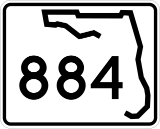
State Road 884, along with County Road 884, together create Lee County, Florida's primary east–west partially controlled access highway, linking Cape Coral in the western portion of the county to Lehigh Acres and Alva in the eastern portion. Currently, the highway consists of State Road 884, and two segments of County Road 884 on each end, and the entire highway is about 37.5 miles (60.4 km) long. The highway runs through the southern incorporated limits of the city of Fort Myers and through the mid part of Cape Coral, and has become a major commuter route.

<span class="mw-page-title-main">Atlantic Boulevard (Broward County)</span>

Atlantic Boulevard, consisting mostly of State Road 814, is a major commercial and commuter highway in northern Broward County, Florida. The 13-mile-long (21 km) divided highway extends from the Sawgrass Expressway in Coral Springs to State Road A1A in Pompano Beach. It serves as the latitudinal baseline for the street grid for the city of Pompano Beach. The portion of the boulevard west of U.S. Route 441 is locally maintained as County Road 814.

<span class="mw-page-title-main">Florida State Road 614</span> Highway in Florida

State Road 614 (SR 614), locally known as Indrio Road, is a 3.6-mile-long (5.8 km) east–west street serving a rural section of northern St. Lucie County, Florida, just south of Lakewood Park. The road has a 2.8 miles (4.5 km) eastern extension designated County Road 614 (CR 614).

<span class="mw-page-title-main">Florida State Road 865</span> State highway in Florida, United States

State Road 865 and County Road 865 are a series of roads serving Lee County, Florida. Originally a continuous state road extending from Bonita Springs to Tice by way of Fort Myers Beach and Fort Myers, SR 865 now consists of two segments connected by a part of CR 865, which also extends to the north and south of the state segments. Both the state and county controlled segments of the route combined stretch a distance of over 40 miles (64.37 km), making it the longest designation in Lee County.

<span class="mw-page-title-main">McGregor Boulevard</span>

State Road 867 and County Road 867 together create a 14.6-mile (23.5 km) long road known as McGregor Boulevard in Lee County, Florida, paralleling the Caloosahatchee River between Punta Rassa and Fort Myers. The entire road was formerly state-maintained.
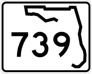
<span class="mw-page-title-main">Florida State Road 615</span> State highway in Florida, United States

State Road 615, locally known as 25th Street, is a 6.2-mile-long (10.0 km) north–south commuter road serving St. Lucie County, Florida. Its northern terminus is an intersection with U.S. Route 1 northeast of the St. Lucie County Airport in St. Lucie Village. SR 615 continues south along 25th Street, intersecting with Okeechobee Road and Virginia Avenue before the state road designation ends at its intersection with Edwards Road. County Road 615 (CR 615) begins here and extends 10.1 miles (16.3 km) south to Port St. Lucie. At Midway Road, the road changes names from 25th Street to St. James Drive. After winding its way through northern Port St. Lucie, St. James Drive ends at an intersection with Airoso Boulevard, with the CR 615 designation continuing south along Airoso Boulevard. After intersections with Prima Vista Boulevard and Crosstown Parkway, CR 615 and Airoso Blvd. finally reaches its southern terminus with Port St. Lucie Blvd., where Port St. Lucie's City Hall is located.

<span class="mw-page-title-main">U.S. Route 1 in Florida</span> Highway in Florida

U.S. Highway 1 (US 1) in Florida runs 545 miles (877 km) along the state's east coast from Key West to its crossing of the St. Marys River into Georgia north of Boulogne and south of Folkston. US 1 was designated through Florida when the U.S. Numbered Highway System was established in 1926. With the exception of Monroe County, the highway runs through the easternmost tier of counties in the state, connecting numerous towns and cities along its route, including nine county seats. The road is maintained by the Florida Department of Transportation (FDOT).

<span class="mw-page-title-main">U.S. Route 19 in Florida</span> Highway in Florida

U.S. Highway 19 (US 19) runs about 262 miles (422 km) along Florida's west coast from an interchange with US 41 in Memphis, south of Tampa, and continues to the Georgia border north of Monticello.

<span class="mw-page-title-main">U.S. Route 98 in Florida</span> Highway in Florida

U.S. Route 98 is a major east-west thoroughfare through the U.S. state of Florida. Spanning 670.959 miles (1,079.804 km), it connects Pensacola and the Alabama/Florida state line to the west with Palm Beach and the Atlantic coast in the east. It is the longest US road in Florida, as well as the longest US road in any state east of the Mississippi River.

References

  1. 1 2 3 4 FDOT straight line diagrams Archived March 6, 2014, at the Wayback Machine , accessed February 2014
  2. Google (February 2, 2014). "CR 78A" (Map). Google Maps . Google. Retrieved February 2, 2014.
  3. Google Maps distance
Template:Attached KML/Florida State Road 78
KML is from Wikidata