Port LaBelle, Florida

Last updated

Port LaBelle, Florida
Port LaBelle, Florida.jpg
Port LaBelle Marina
Hendry County Florida Incorporated and Unincorporated areas Port La Belle Highlighted.svg
Location in Hendry County and the state of Florida
USA Florida location map.svg
Red pog.svg
Port LaBelle, Florida
Usa edcp location map.svg
Red pog.svg
Port LaBelle, Florida
Coordinates: 26°44′52″N81°23′34″W / 26.74778°N 81.39278°W / 26.74778; -81.39278
Country Flag of the United States.svg  United States
State Flag of Florida.svg  Florida
Counties Hendry, Glades
Area
[1]
  Total10.92 sq mi (28.27 km2)
  Land10.74 sq mi (27.82 km2)
  Water0.17 sq mi (0.45 km2)
Elevation
10 ft (3 m)
Population
 (2020)
  Total5,450
  Density507.31/sq mi (195.87/km2)
Time zone UTC-5 (Eastern (EST))
  Summer (DST) UTC-4 (EDT)
ZIP code
33935 [2]
Area code 863
FIPS code 12-58420 [3]
GNIS feature ID1867192 [4]

Port LaBelle is a census-designated place (CDP) in Hendry and Glades counties, Florida, United States. The population was 3,530 at the 2010 census, [5] up from 3,050 at the 2000 census.

Contents

Geography

Port LaBelle is located in northern Hendry County and extends north into Glades County. It is bordered to the west by the city of LaBelle. Florida State Road 80 runs through the northern part of the community, leading east 30 miles (48 km) to Clewiston and west through LaBelle 32 miles (51 km) to Fort Myers.

According to the United States Census Bureau, the CDP has a total area of 8.2 square miles (21.2 km2), all land. [5]

Demographics

Historical population
CensusPop.Note
2020 5,450
U.S. Decennial Census [6]

As of the census [3] of 2000, there were 3,050 people, 879 households, and 700 families residing in the CDP. The population density was 354.0 inhabitants per square mile (136.7/km2). There were 973 housing units at an average density of 112.9 per square mile (43.6/km2). The racial makeup of the CDP was 70.33% White, 10.66% African American, 0.69% Native American, 0.66% Asian, 13.84% from other races, and 3.84% from two or more races. Hispanic or Latino of any race were 44.30% of the population.

There were 879 households, out of which 44.1% had children under the age of 18 living with them, 57.7% were married couples living together, 15.5% had a female householder with no husband present, and 20.3% were non-families. 15.0% of all households were made up of individuals, and 6.5% had someone living alone who was 65 years of age or older. The average household size was 3.20 and the average family size was 3.41.

In the CDP, the population was spread out, with 31.3% under the age of 18, 15.2% from 18 to 24, 28.2% from 25 to 44, 14.4% from 45 to 64, and 10.9% who were 65 years of age or older. The median age was 27 years. For every 100 females, there were 120.7 males. For every 100 females age 18 and over, there were 124.9 males.

The median income for a household in the CDP was $34,167, and the median income for a family was $36,974. Males had a median income of $25,104 versus $16,484 for females. The per capita income for the CDP was $13,704. About 13.8% of families and 22.5% of the population were below the poverty line, including 20.4% of those under age 18 and 16.0% of those age 65 or over.

Related Research Articles

<span class="mw-page-title-main">Glades County, Florida</span> County in Florida, United States

Glades County is a county located in the Florida Heartland region of the U.S. state of Florida. As of the 2020 census, the population was 12,126, making it the fourth-least populous county in Florida. Its county seat is Moore Haven.

<span class="mw-page-title-main">Hendry County, Florida</span> County in Florida, United States

Hendry County is a county in the Florida Heartland region of the U.S. state of Florida. As of the 2020 census, the population was 39,619, down from 42,022 at the 2010 census. Its county seat is LaBelle.

<span class="mw-page-title-main">Clewiston, Florida</span> City in Florida, United States

Clewiston is a city in Hendry County, Florida, United States. Its location is 80 miles (130 km) northwest of Fort Lauderdale on the Atlantic coastal plain. The population was 7,327 at the 2020 census, up from 7,155 at the 2010 census. The estimated population in 2018 was 7,985. The city is located on the south bank of Lake Okeechobee, and the Lake Okeechobee Scenic Trail (LOST) passes through the edge of the city. The city is home to Billie Swamp Safari, the Clewiston Museum and the Dixie Crystal Theatre. The area has been home to Seminole tribe members and sugar plantations, with the Ah-Tah-Thi-Ki Seminole Indian Museum located 32 miles (51 km) south of the city.

<span class="mw-page-title-main">Harlem, Florida</span> Census-designated place in Florida, United States

Harlem is a census-designated place (CDP) in Hendry County, Florida, United States. It was established in 1931. Its population is predominantly African American.

<span class="mw-page-title-main">Alva, Florida</span> Census-designated place in Florida, United States

Alva is an unincorporated community and census-designated place (CDP) in Lee County, Florida, United States, situated on the Caloosahatchee River. The population was 2,725 at the 2020 census, up from 2,596 at the 2010 census. It is part of the Cape Coral-Fort Myers, Florida Metropolitan Statistical Area.

<span class="mw-page-title-main">Charleston Park, Florida</span> Census-designated place in Florida, United States

Charleston Park is an unincorporated community and census-designated place (CDP) in Lee County, Florida, United States. The population was 235 at the 2020 census, up from 218 at the 2010 census. It is part of the Cape Coral-Fort Myers, Florida Metropolitan Statistical Area.

<span class="mw-page-title-main">Fort Myers Shores, Florida</span> Census-designated place in Florida, United States

Fort Myers Shores is an unincorporated community and census-designated place (CDP) in Lee County, Florida, United States. The population was 5,774 at the 2020 census. It is part of the Cape Coral-Fort Myers, Florida Metropolitan Statistical Area.

<span class="mw-page-title-main">North Fort Myers, Florida</span> Census-designated place in Florida, United States

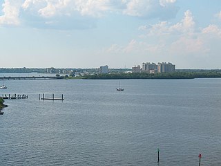
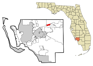
North Fort Myers is an unincorporated area and census-designated place (CDP) in Lee County, Florida, United States. The population was 42,719 at the 2020 census. It is part of the Cape Coral-Fort Myers, Florida Metropolitan Statistical Area.

<span class="mw-page-title-main">Olga, Florida</span> Census-designated place in Florida, United States

Olga is an unincorporated community and census-designated place (CDP) in Lee County, Florida, United States. The population was 1,952 at the 2010 census, up from 1,398 at the 2000 census. It is part of the Cape Coral-Fort Myers, Florida Metropolitan Statistical Area.

<span class="mw-page-title-main">Tice, Florida</span> Census-designated place in Florida, United States

Tice is an unincorporated community and census-designated place (CDP) in Lee County, Florida, United States. As of the 2020 census, the CDP population was 4,853. It is part of the Cape Coral-Fort Myers, Florida Metropolitan Statistical Area.

<span class="mw-page-title-main">Golden Glades, Florida</span> Census-designated place in Florida, United States

Golden Glades is a census-designated place (CDP) in Miami-Dade County, Florida, United States. The population was 32,499 at the 2020 census.

<span class="mw-page-title-main">Sunset, Florida</span> Census-designated place in Florida, United States

Sunset is a census-designated place (CDP) in Miami-Dade County, Florida, United States. The population was 15,912 at the 2020 census. The U.S. Postal Service uses the ZIP Codes of 33173 and 33183 for Sunset.

<span class="mw-page-title-main">Fairview Shores, Florida</span> Census-designated place in Florida, United States

Fairview Shores is a census-designated place and an unincorporated area in Orange County, Florida, United States. The population was 10,239 at the 2010 census. It is part of the Orlando–Kissimmee–Sanford, Florida Metropolitan Statistical Area.

<span class="mw-page-title-main">Belle Glade Camp, Florida</span> Unincorporated place in Florida, United States

Belle Glade Camp was a census-designated place (CDP) in Palm Beach County, Florida, United States. The population was 1,141 at the 2000 census.

<span class="mw-page-title-main">Canal Point, Florida</span> CDP in Florida, United States

Canal Point is a census-designated place (CDP) and unincorporated community in Palm Beach County, Florida, United States. Canal Point is located along the eastern shore of Lake Okeechobee, to the northeast of Pahokee and to the northwest of Bryant. The unincorporated community was originally inhabited by the Calusa tribe until almost 400 years ago. Whites began occupying the area in the 1900s decade, establishing an agrarian community. The completion of the West Palm Beach Canal in 1917 allowed crops to be shipped by boat to West Palm Beach and then to other areas of the country, while construction of Conners Highway in 1924 resulted in crops being transported by motor vehicle.

<span class="mw-page-title-main">Lake Harbor, Florida</span> CDP in Florida, United States

Lake Harbor is a census-designated place (CDP) in Palm Beach County, Florida, United States. The population was 49 at the 2020 census. It located along the southern banks of Lake Okeechobee, at the beginning of the Miami Canal. John Stretch Park is also located alongside the north end of Lake Harbor and the lake.

<span class="mw-page-title-main">Gulf Gate Estates, Florida</span> Census-designated place in Florida, United States

Gulf Gate Estates is a census-designated place (CDP) in Sarasota County, Florida, United States. The population was 10,911 at the 2010 census. It is part of the North Port–Sarasota–Bradenton Metropolitan Statistical Area.

<span class="mw-page-title-main">North Eagle Butte, South Dakota</span> Census-designated place in South Dakota, United States

North Eagle Butte is a census-designated place (CDP) in Dewey County, South Dakota, United States, along the 45th parallel. The population was 1,879 at the 2020 census.

Fairfield Glade is a resort, retirement community and census-designated place (CDP) in Cumberland County, Tennessee, United States. The population was 9,152 at the 2020 census, up over 3,000 from the 2010 census.

<span class="mw-page-title-main">LaBelle, Florida</span> City in Florida, United States

LaBelle is a city in and the county seat of Hendry County, Florida, United States. The population was 4,640 at the 2010 census, up from 4,210 at the 2000 census. It was named for Laura June Hendry and Carrie Belle Hendry, daughters of pioneer cattleman Francis Asbury Hendry.

References

  1. "2020 U.S. Gazetteer Files". United States Census Bureau. Retrieved October 31, 2021.
  2. "Port LaBelle FL ZIP Code". zipdatamaps.com. 2023. Retrieved January 26, 2023.
  3. 1 2 "U.S. Census website". United States Census Bureau . Retrieved January 31, 2008.
  4. "US Board on Geographic Names". United States Geological Survey. October 25, 2007. Retrieved January 31, 2008.
  5. 1 2 "Geographic Identifiers: 2010 Demographic Profile Data (G001): Port LaBelle CDP, Florida". American Factfinder. U.S. Census Bureau. Retrieved April 26, 2017.[ dead link ]
  6. "Census of Population and Housing". Census.gov. Retrieved June 4, 2016.