Otú Airport

Last updated
Otú Airport

Alberto Jaramillo Sanchez Airport
Summary
Airport typePublic
Owner Aerocivil
Serves Remedios, Colombia
Location Otú
Elevation  AMSL 2,060 ft / 628 m
Coordinates 7°00′37″N74°42′55″W / 7.01028°N 74.71528°W / 7.01028; -74.71528 Coordinates: 7°00′37″N74°42′55″W / 7.01028°N 74.71528°W / 7.01028; -74.71528
Map
Colombia location map.svg
Airplane silhouette.svg
OTU
Location of the airport in Colombia
Runways
Direction LengthSurface
mft
17/359463,104Asphalt
Source: WAD [1] GCM [2] HERE Maps [3]

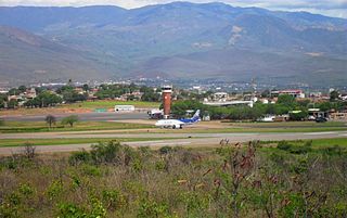
Otú Airport (Spanish : Aeropuerto de Otú) ( IATA : OTU, ICAO : SKOT) is an airport located in the village of Otú and serving the town of Remedios, a municipality of the Antioquia Department in Colombia. It is also known as Alberto Jaramillo Sanchez Airport.

Spanish language Romance language

Spanish or Castilian is a Romance language that originated in the Castile region of Spain and today has hundreds of millions of native speakers in the Americas and Spain. It is a global language and the world's second-most spoken native language, after Mandarin Chinese.

An IATA airport code, also known as an IATA location identifier, IATA station code or simply a location identifier, is a three-letter code designating many airports around the world, defined by the International Air Transport Association (IATA). The characters prominently displayed on baggage tags attached at airport check-in desks are an example of a way these codes are used.

ICAO airport code four-letter code designating many airports around the world

The ICAOairport code or location indicator is a four-letter code designating aerodromes around the world. These codes, as defined by the International Civil Aviation Organization and published in ICAO Document 7910: Location Indicators, are used by air traffic control and airline operations such as flight planning.

Contents

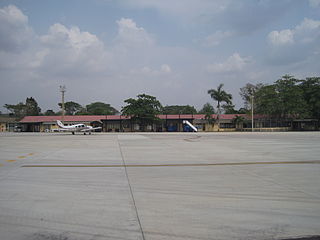
Currently only Aerolínea de Antioquia operates from this airport, with two daily flights on Twin Otter aircraft to Enrique Olaya Herrera Airport in Medellín. Previously, the airline ACES flew between this airport and Medellin several times per day on aircraft including the Let L-410 Turbolet, Cessna 206 and Twin Otter. The airport's runway is also used as a small military base for the Air Force and National Police.

ADA S.A., operating as Aerolínea de Antioquia (ADA), was a regional airline headquartered at the Olaya Herrera Airport in Medellín, Colombia. It started operations in 1987. It ceased operations on March 29, 2019 The airline operates scheduled domestic services from Medellín to over 20 destinations. Its main base is Olaya Herrera Airport.

Medellín Municipality in Aburrá Valley, Colombia

Medellín, officially the Municipality of Medellín, is the second-largest city in Colombia, after Bogota, and the capital of the department of Antioquia. It is located in the Aburrá Valley, a central region of the Andes Mountains in South America. According to the National Administrative Department of Statistics, the city has an estimated population of 2.5 million as of 2017. With its surrounding area that includes nine other cities, the metropolitan area of Medellín is the second-largest urban agglomeration in Colombia in terms of population and economy, with more than 3.7 million people.

ACES Colombia airline

ACES was an airline with its headquarters in the Edificio del Cafe in Medellín, Colombia and founded on August 30, 1971, by a group of 13 Colombian entrepreneurs, amongst them, most notably Orlando Botero Escobar and German Peñaloza Arias from Manizales and Luis H. Coulson, Jorge Coulson R., Alberto Jaramillo and Hernán Zuluaga from Medellín.

The Otu VOR-DME (Ident: OTU) is located on the field. [4]

See also

Related Research Articles

Alfonso Bonilla Aragón International Airport airport in Palmira, Colombia

Alfonso Bonilla Aragón International Airport formerly known as Palmaseca International Airport is located between Palmira and Cali, the capital of Valle del Cauca Department, Colombia. It is Colombia's 4th busiest airport in passenger volume, with 5,600,000 people using the airport in 2016. It is the third largest airport in Colombia in terms of area and construction. The airport often serves as the alternate airport for Bogotá - El Dorado Int'l Airport and other Colombian airports.

Olaya Herrera Airport commercial airport in Colombia serving regional, domestic, and general aviation traffic

Enrique Olaya Herrera Airport is an airport located in Medellín, Colombia, which serves regional and domestic flights. Additionally, the airport is used by general aviation and features several hangars for charters. Olaya Herrera is the second busiest airport in Colombia by number of flights.

José María Córdova International Airport commercial airport in Medellin, Colombia

José María Córdova International Airport is the second largest airport in Colombia after El Dorado International Airport of Bogotá in terms of infrastructure and passenger service. It is located in the city of Rionegro, 20 kilometres (12 mi) south-east of Medellín.

El Edén International Airport airport in La Tebaida, Quindío, Colombia

El Edén International Airport is an international airport serving Armenia, the capital of the Quindío Department of Colombia. The airport is 13 kilometres (8.1 mi) southwest of Armenia, near the town of La Tebaida. It handles domestic flights to Bogotá and Medellín and international flights to Panama City and Fort Lauderdale, Florida.

Camilo Daza International Airport airport in Colombia

Camilo Daza International Airport is a civil airport located in Cúcuta, Colombia. The airport serves the Norte de Santander Department. It is named after Colombian aviation pioneer Camilo Daza.

Gustavo Rojas Pinilla International Airport airport in the archipelago of San Andrés, Providencia and Santa Catalina

Gustavo Rojas Pinilla International Airport is the main airport in the archipelago of San Andrés, Providencia and Santa Catalina, one of the departments of Colombia. It is able to receive large aircraft and to accommodate seasonal and charter flights from different parts of the Americas and Europe.

Antonio Nariño Airport colombian airport

Antonio Nariño Airport is located in the town of Chachagüí and serves the city of Pasto in the Nariño Department of Colombia. The airport is 35 kilometres (22 mi) north of Pasto. It handles only domestic flights in addition to military operations and private charters. A new terminal, administrative and tower control are being built, also new navigation equipment is being set up due to the increasing number of passengers and cargo flights.

Antonio Roldán Betancourt Airport airport in Colombia

Antonio Roldán Betancourt Airport is an airport serving Apartadó, a town in the Antioquia Department of Colombia. The airport is in the countryside 12 kilometres (7.5 mi) southwest of Apartadó.

Las Brujas Airport (Colombia) Colombian domestic airport

The Las Brujas Airport is a domestic airport located in the town of Corozal, Sucre in Colombia. The airport is located 10 minutes from the capital of the department, the city of Sincelejo. In emergency situations, it serves as the alternate airport of the city of Montería. It has regional and national operations. Las Brujas operates regional and domestic flights to Barranquilla, Bogota and Medellin.

Germán Olano Airport airport

Germán Olano Airport is an airport serving Puerto Carreño, the capital of Vichada Department in Colombia. It is also known as Puerto Carreño Airport. The airport is 1.5 kilometres (0.93 mi) west of and parallels the Orinoco River, locally Colombia's border with Venezuela.

Eduardo Falla Solano Airport airport in Meta, Colombia

Eduardo Falla Solano Airport in Spanish: Aeropuerto Eduardo Falla Solano is a domestic airport serving the municipality of San Vicente del Caguán in the Caquetá Department of Colombia.

Útila Airport Airport in Honduras

Útila Airport is an airport serving Útila, Islas de la Bahía, Honduras. It handles regional and international air traffic for the town of Útila. The airport is served by several airlines on a daily schedule, as well as numerous private and charter flights.

LaMia Flight 2933 commercial airline flight

LaMia Flight 2933 was a charter flight of an Avro RJ85, operated by LaMia, that on 28 November 2016 crashed near Medellín, Colombia, killing 71 of the 77 people on board. The aircraft was transporting the Brazilian Chapecoense football squad and their entourage from Santa Cruz de la Sierra, Bolivia, to Medellín, where the team was scheduled to play at the 2016 Copa Sudamericana Finals. One of the four crew members, three of the players, and two other passengers survived with injuries.

Urrao Airport airport in Colombia

Urrao Airport is an airport serving Urrao, a town in the Antioquia Department of Colombia. The runway and town are in an elevated mountain valley, on the eastern bank of the small Penderisco River, an eventual tributary of the Atrato River.

Jaime Ortiz Betancur Airport airport in Colombia

Jaime Ortiz Betancur Airport is an airport serving the town of Chigorodó in the Antioquia Department of Colombia.

Amalfi Airport (Colombia) airport in Colombia

Amalfi Airport is an airport serving the town of Amalfi, in the Antioquia Department of Colombia.

Otú Norte Fault

The Otú Norte or Otú-Pericos Fault is an inactive sinistral oblique strike-slip fault in the department of Antioquia in northern Colombia. The fault has a total length of 144.4 kilometres (89.7 mi) and runs along an average north-northwest to south-southeast strike of 346.4 ± 8, cross-cutting the northern part of the Central Ranges of the Colombian Andes. Together with the parallel Bagre Norte Fault the fault separates the Central Ranges from its northeasternmost continuation, the Serranía de San Lucas.

Hacienda Napoles Airstrip

Hacienda Nápoles Airstrip is an airstrip on Hacienda Nápoles, a large estate in the Antioquia Department of Colombia.

References

The Aviation Safety Network (ASN) is a website that keeps track of aviation accidents, incidents, and hijackings. Their database contains details of over 10,700 reports. The ASN includes an aviation database with aviation investigations, news, photos, and statistics.